After last week's wild weather, another cool system moved through over the weekend. High temperatures were only in the 40s Sunday, with bursts of snow in the lower elevations and several inches piling up in the mountains.
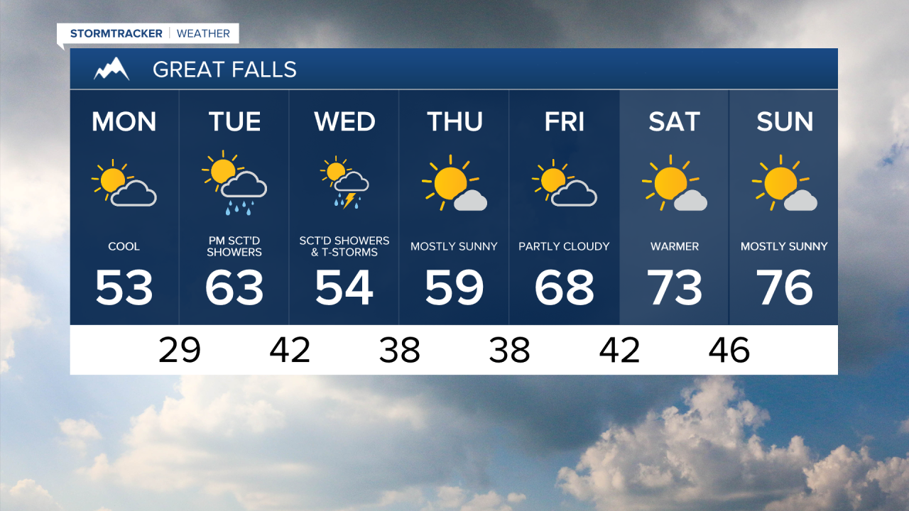
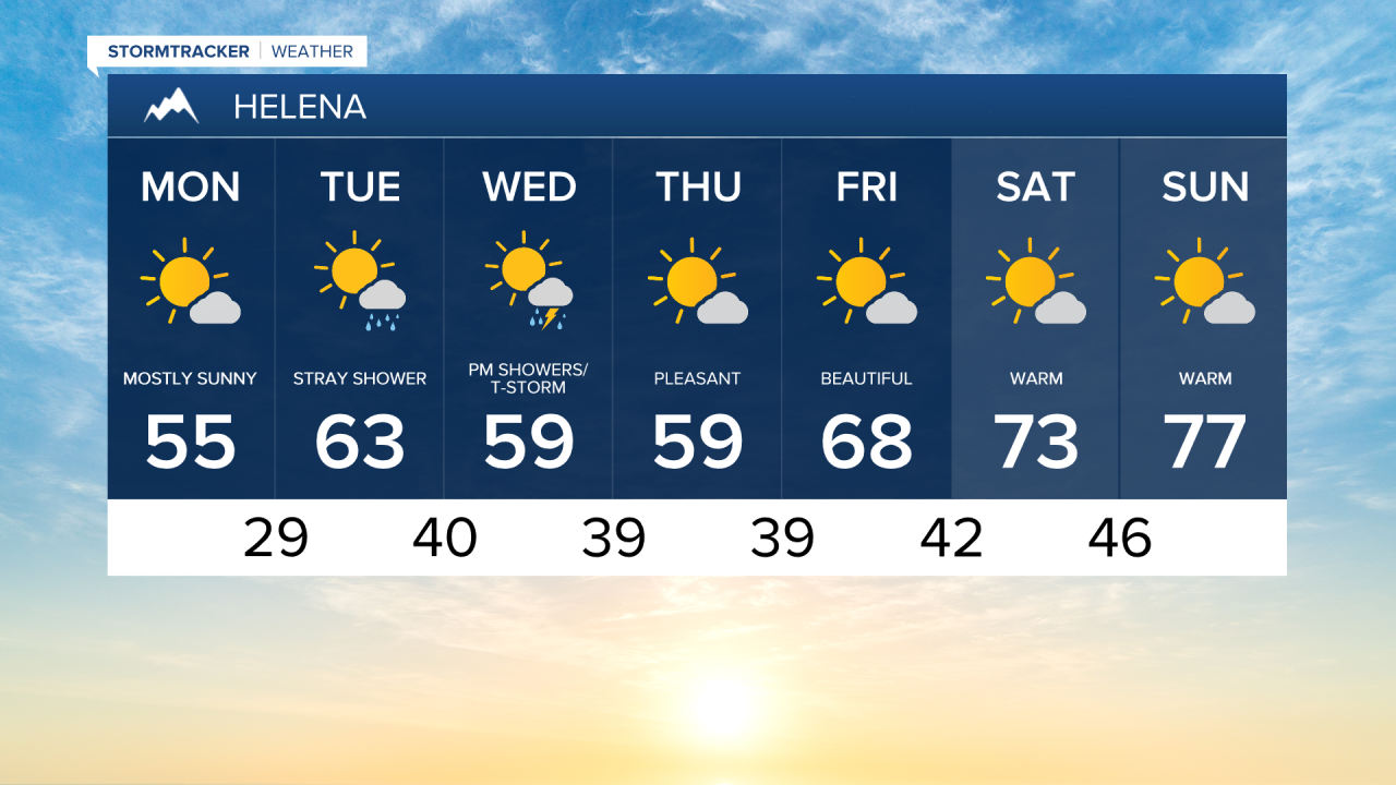
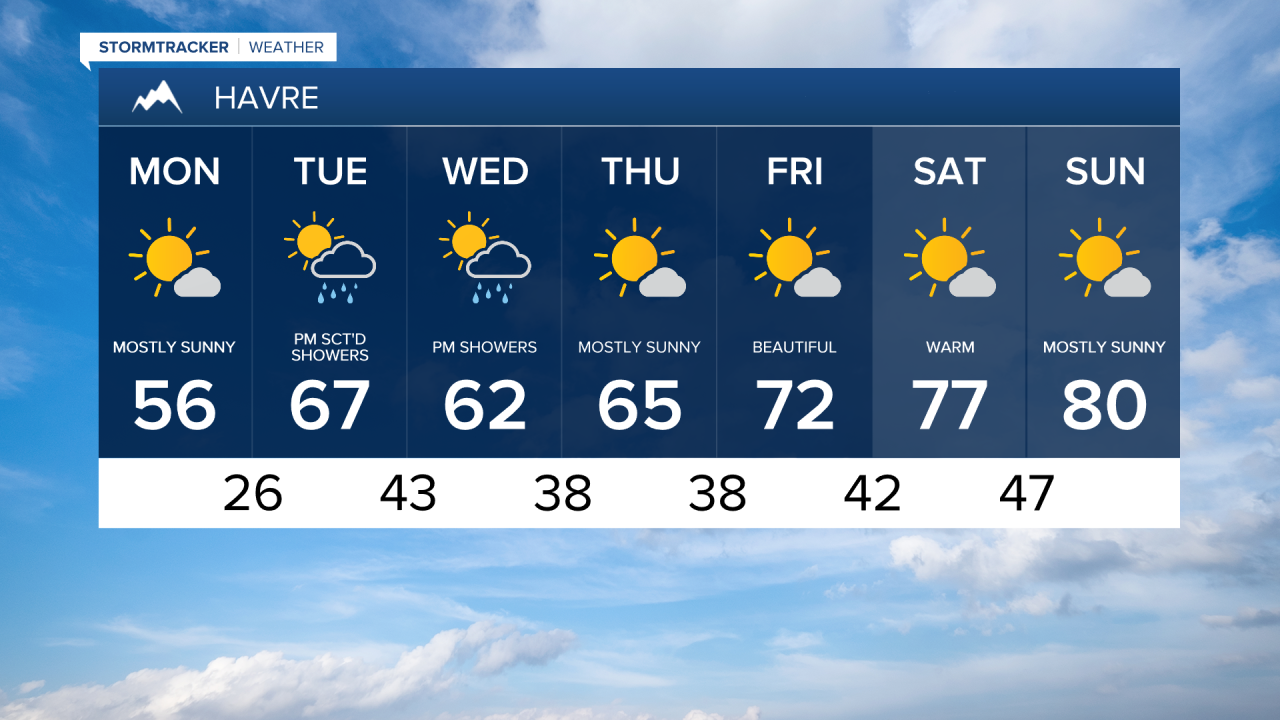
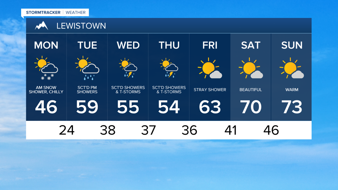
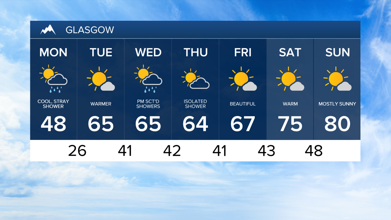
Monday Morning Forecast:
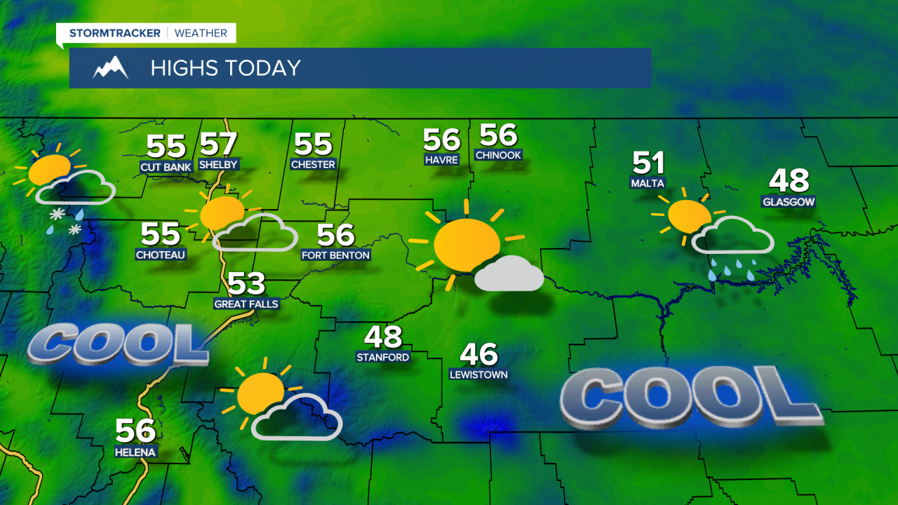
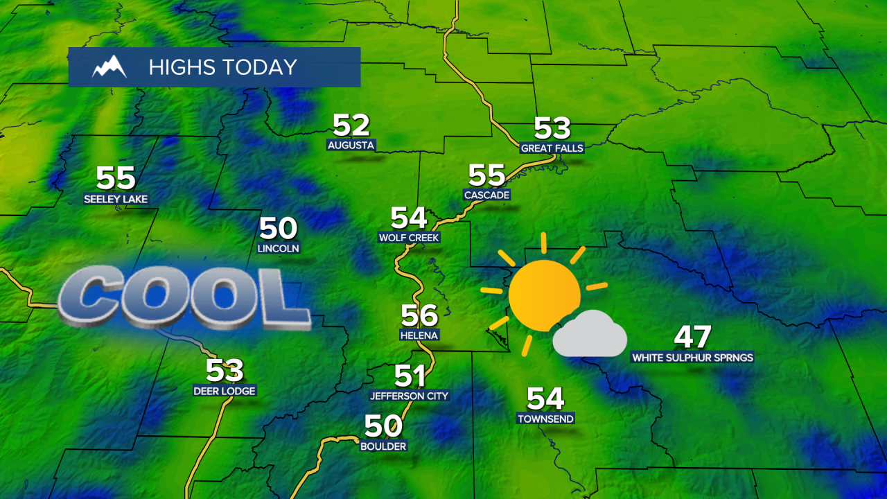
As the main system pushes east, shower chances will diminish throughout the morning, with more pop-up rain and mountain snow showers developing late this afternoon. Today will be another cool one, with highs in the upper 40s and 50s.
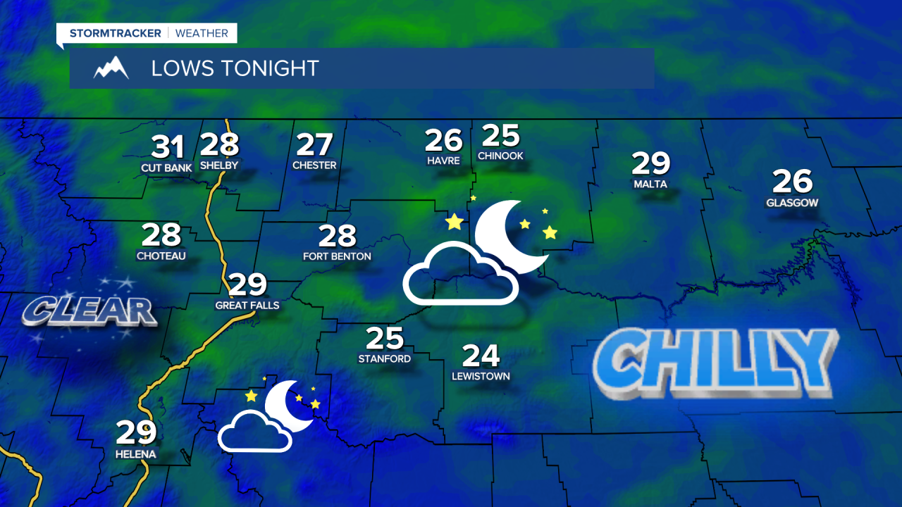
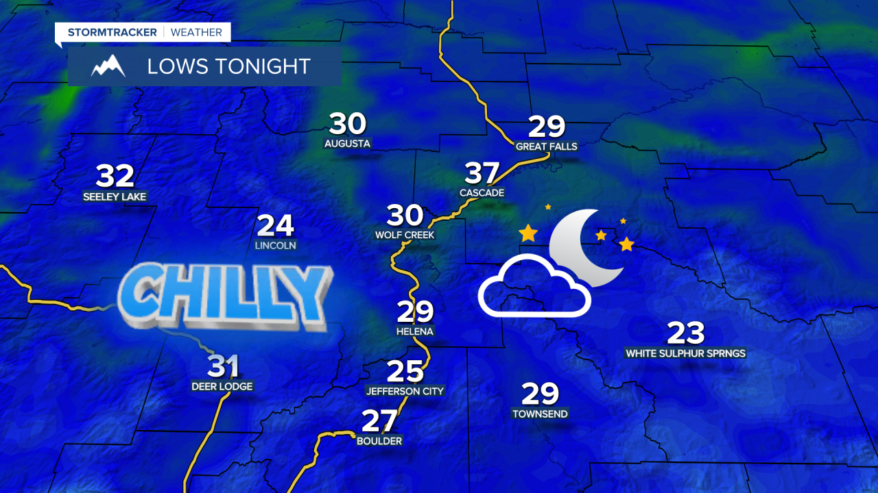
With a cool air mass in place and clearing skies overhead, temperatures are expected to fall into the 20s tonight, bringing another widespread freeze and even a hard freeze for some towns. The cold temperatures could damage sensitive vegetation and early-season crops, so make sure to protect any freeze-sensitive plants before heading to bed Monday night.
Afternoon showers will be possible again Tuesday as a weak disturbance moves through, followed by a stronger system bringing more widespread showers and thunderstorms Wednesday into Thursday morning. High temperatures will warm into the 60s Tuesday, then cool back down into the 50s across central Montana while eastern Montana stays in the 60s.
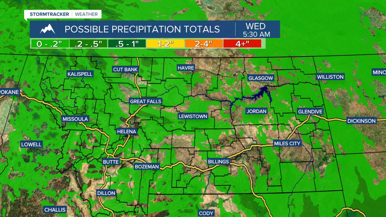
Most lower elevations will still pick up very little moisture this week, generally less than a couple tenths of an inch, while the mountains could see around a quarter to half an inch. Still, we'll take what we can get.
Sunshine and pleasant spring weather look to return heading into Memorial Day weekend. Temperatures will climb day by day, with highs warming back above average into the 70s and 80s. If you're planning to do any boating or swimming, keep in mind that winds may pick up Sunday into Monday and the water will remain very cold due to snowmelt.