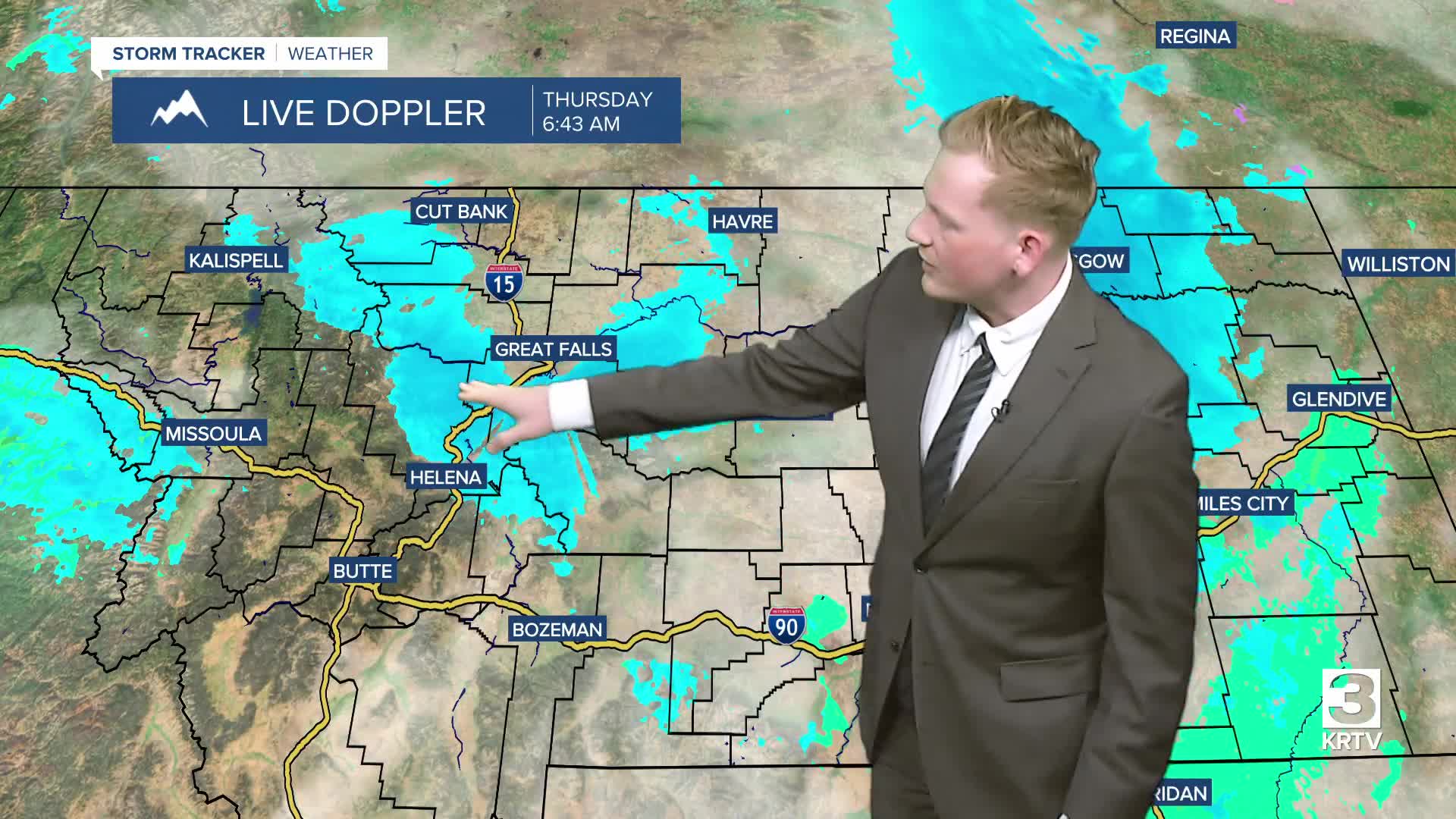


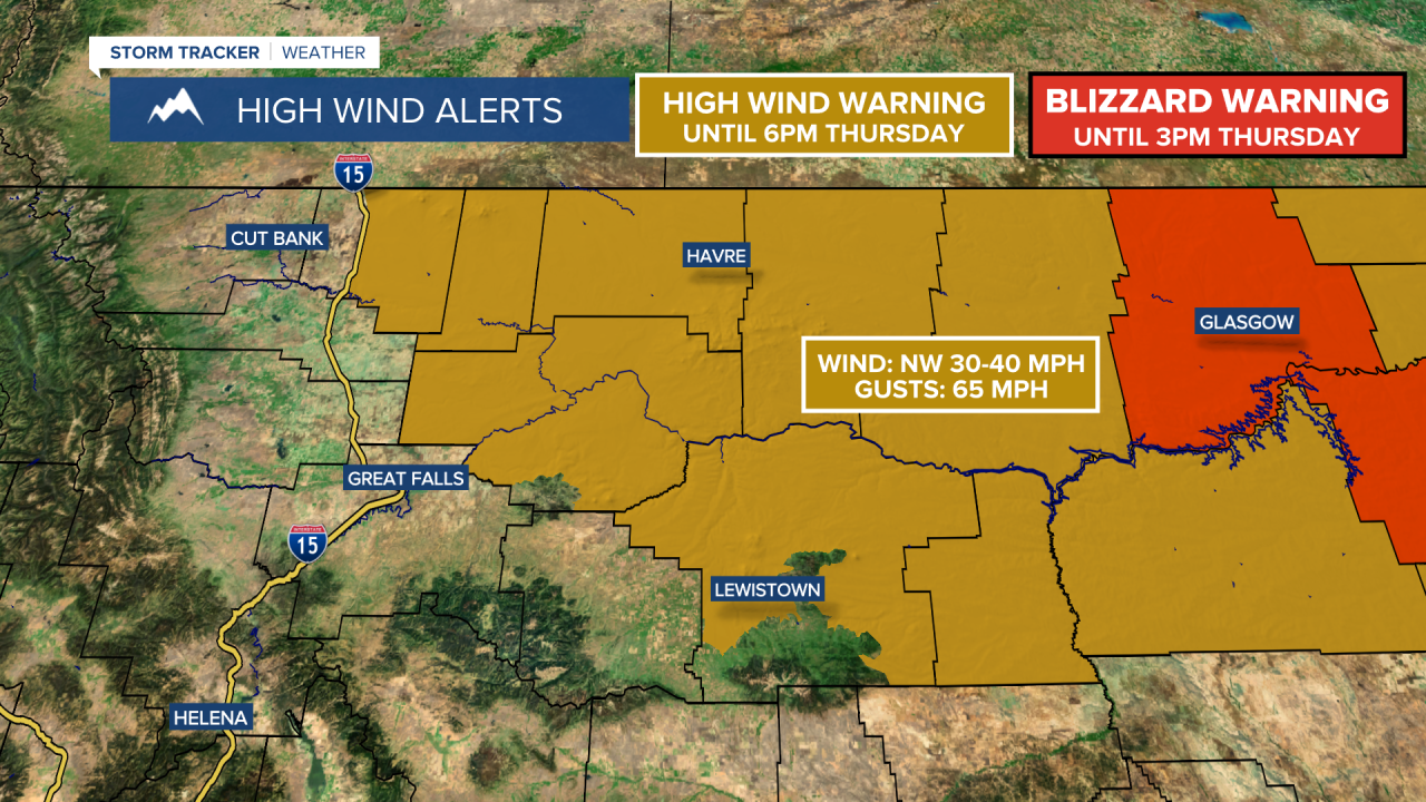
The heavier band of snow has moved out of northeast Montana and the Blizzard Warning has expired early. Conditions will improve this afternoon and evening. The mountain passes are snow-covered and slick, especially Rogers and MacDonald Pass. Take it slow and leave a lot of time to reach your destination if you're traveling in these areas!
As expected, this storm definitely had its winners and losers. It’s not done just yet either, we’ll keep some on-and-off rain and snow showers through the weekend as this system is very slow to move out. The heaviest precipitation is behind us. Here's some totals:


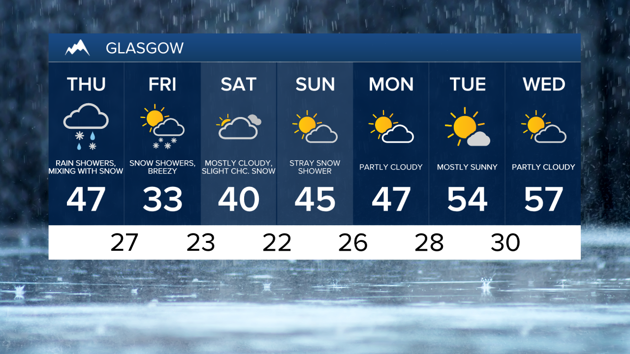
Over 1.5" of moisture (combined rain and melted snow) fell overnight and this morning in Glasgow. This is now our 2nd-wettest April day on record and the wettest day in nearly 6 years. So much water in this storm for the Glasgow area and we're not done!
Thursday Morning Forecast:
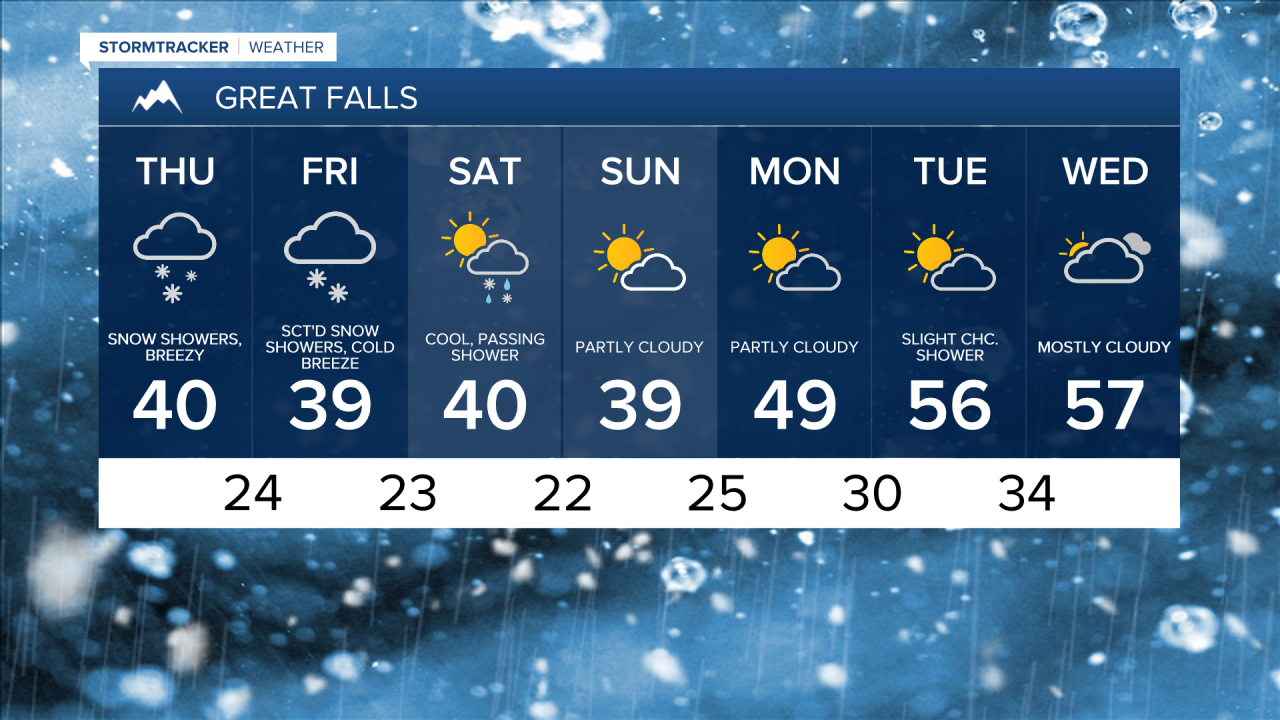
Thursday will be cold and blustery with high temperatures in the 30s and low 40s, but gusty northwest winds will make it feel like the 20s. Scattered snow showers will continue throughout the day, especially in the mountains. A High Wind Warning is in effect through 6pm.


Overnight lows dip down into the 20s and 30s, with areas of snow continuing into Friday. High temperatures once again only reach the 30s and lower 40s with a brisk northwest breeze gusting to 30-40 mph at times. The storm system responsible for the precipitation will move out very slowly, so scattered snow showers will linger through most of Friday and into the upcoming weekend.
High temperatures will only hit the 30s and 40s on Saturday and Sunday, but the wind will be a bit lighter. Mixed rain and snow showers continue through the entire weekend, but significant travel impacts are not expected at this time.
The cool, stormy weather pattern will persist into next week, but high temperatures should rebound to near average by next Tuesday and Wednesday.