


A snowstorm impacted Montana from Thursday through Saturday, with that snowstorm becoming a blizzard in some areas on Saturday as gusty winds led to whiteout conditions.
During the day on Saturday, sustained wind speeds were between 10 and 30 mph, and wind gusts were over 40 mph in a lot of locations. This wind caused there to be a lot of blowing and drifting snow.
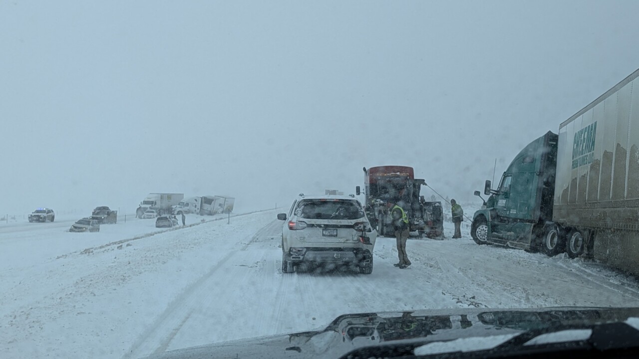
Whiteout conditions were reported throughout portions of central and north-central Montana from late Saturday morning through early Saturday night as visibility was at or below a quarter mile.
The whiteout conditions combined with poor road conditions led to numerous collisions, slide-offs, and road closures.
The largest incident happened on Saturday afternoon north of Helena on I-15 near Gates of the Mountains. Several vehicles were involved and this caused I-15 to be shut down for a brief period of time. At the time of the incident, whiteout conditions were occurring.
This was the best snowstorm of the winter for many in central Montana.
Several locations in Judith Basin County and Fergus County received more than two feet of snow!
With it being a wet and heavy snow, there was some damage though, including a caved in roof on a private indoor arena in Lewistown.

Great Falls has received 10.4" of snow as of 6pm Saturday evening, making this the biggest snowstorm of the winter. This storm also almost doubled the amount of snow that has been received so far this snow season.
Scattered snow showers will continue Saturday night, but will gradually taper off as the night goes on. Roads will remain slick/snow-packed for the remainder of the weekend, so use extreme caution when driving. Most of this snow will quickly melt away next week as temperatures warm up into the 60s and 70s.
FULL FORECAST - WATCH THE VIDEO:
A little minor flooding is possible next week, but at this point, flooding does not look to be a big issue.
