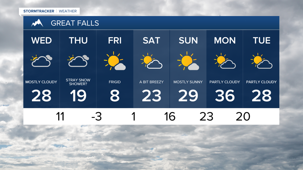
After a mostly dry and chilly Wednesday, a brief blast of Arctic air moves in for the rest of the week. This will bring some of the coldest temperatures and wind chills of this winter season to central and eastern Montana.
Today's Forecast:
As the colder air slowly advances today and Thursday, there will be a few flurries and light snow showers. Daytime highs will drop from the 20s and lower 30s on Wednesday to the 0s and 10s on Thursday.
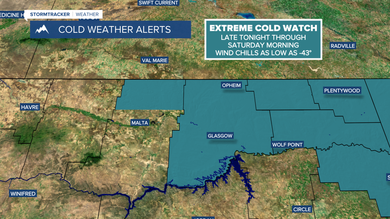
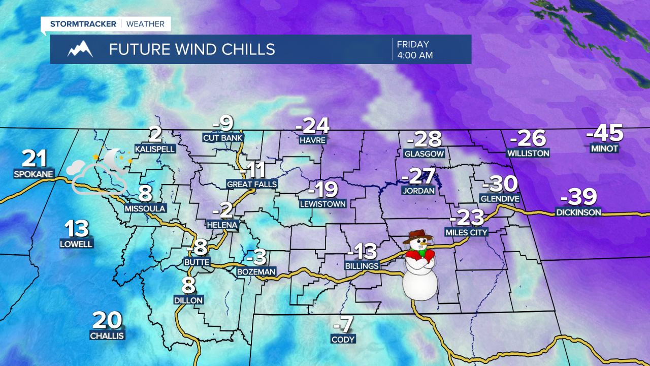
On Friday, the Arctic air really settles in. Most areas east of the Divide will fall below zero by Friday morning. Wind chills could dip to the -10s and -20s in central Montana, and as low as -40 in northeast Montana. It will be mostly sunny and frigid during the afternoon, with high temperatures in the 0s and -10s, and some in the -0s in northeast Montana.
Another cold front will move through on Saturday with mostly cloudy skies and light snow showers. High temperatures will remain in the 0s across northeast Montana and in the 10s and 20s in central Montana.
A chinook wind will help warm temperatures back up into early next week, but overall colder conditions and more typical weather for this time of year will take over as we head into February.