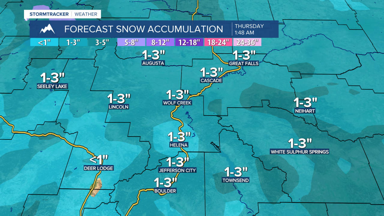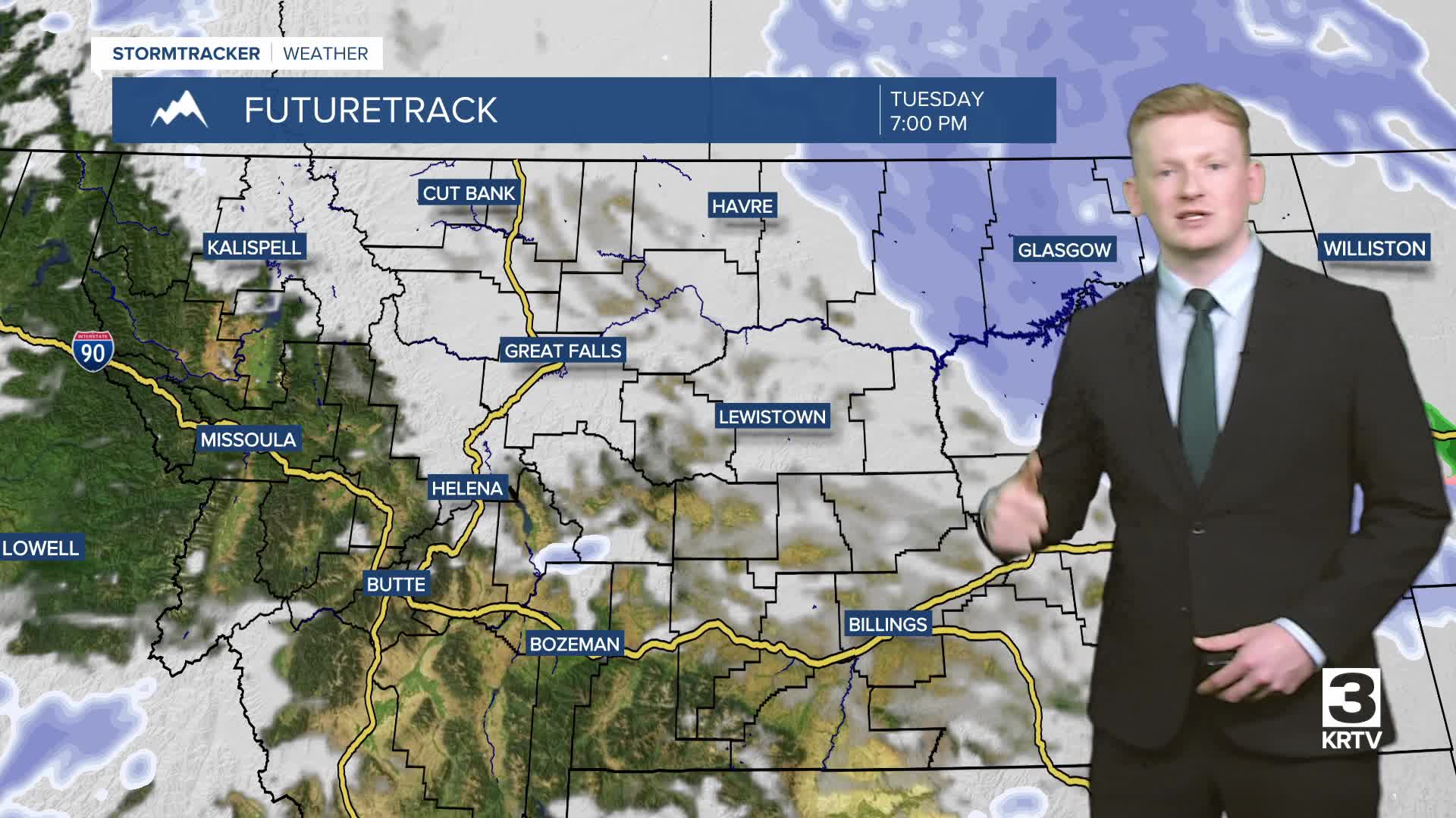


A band of snow is starting to move across central Montana this morning. Expect lowered visibility, quickly changing road conditions, and gusty winds as it passes through. Most areas will see generally light snow accumulation, but enough to create slick roads. Temperatures will also fall throughout the day, reaching the 0s and 10s by this evening, which will make roads icy and slick.


Today's Forecast:
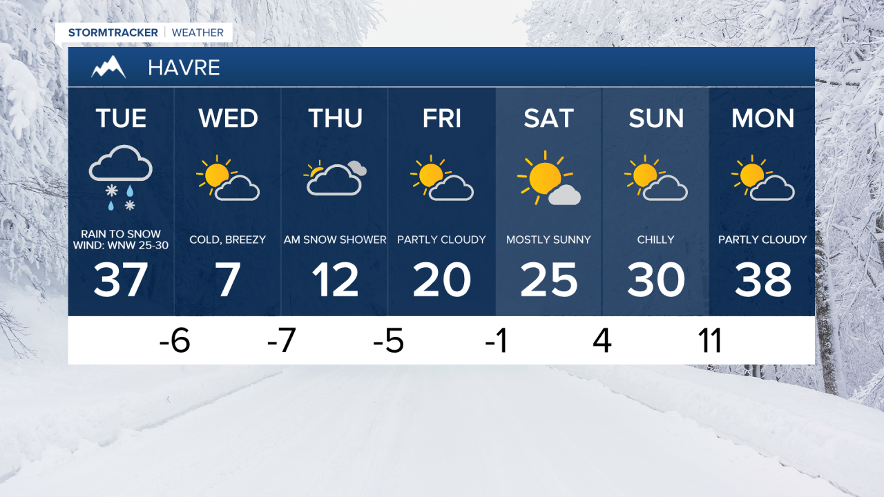
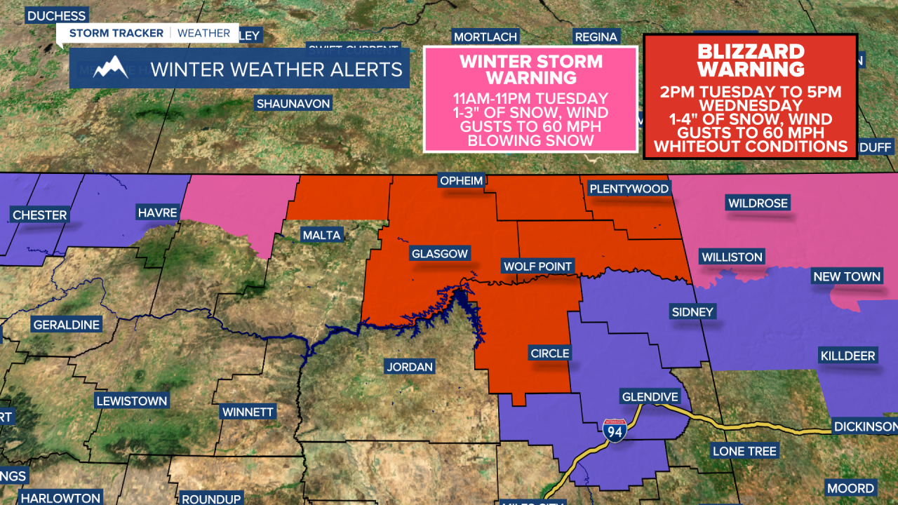
As the storm pushes east and intensifies, bands of snow will move across northeast Montana starting this afternoon. Wind gusts could reach 50-60 mph in these areas, causing whiteout conditions on Highway 2 east of Havre and throughout northeast Montana. A BLIZZARD WARNING is in effect for northern Phillips County, Valley County, and all of northeast Montana from this afternoon through Wednesday evening.
- Road Conditions: click here
- MDT Webcams: click here
- MTN Cameras: click here
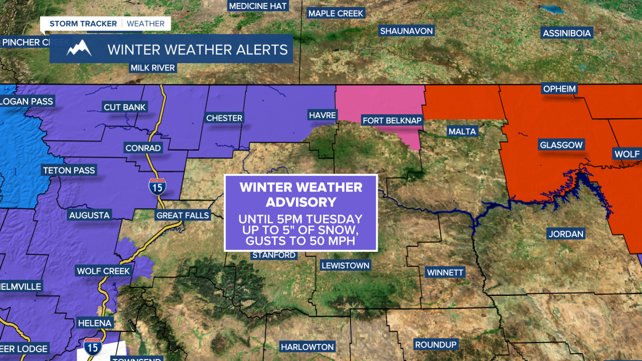
Strong northwest winds will develop on the backside of the storm system, with blowing and drifting snow likely across north-central Montana. A HIGH WIND WARNING is in effect for parts of the area, with wind gusts exceeding 60 mph.

Colder air will settle in tonight, with temperatures dropping below zero across central Montana and wind chills as low as -15 to -30 by Wednesday morning. Another wave of light snow will move through Wednesday into Wednesday night, with an additional dusting up to a couple of inches of snowfall expected.

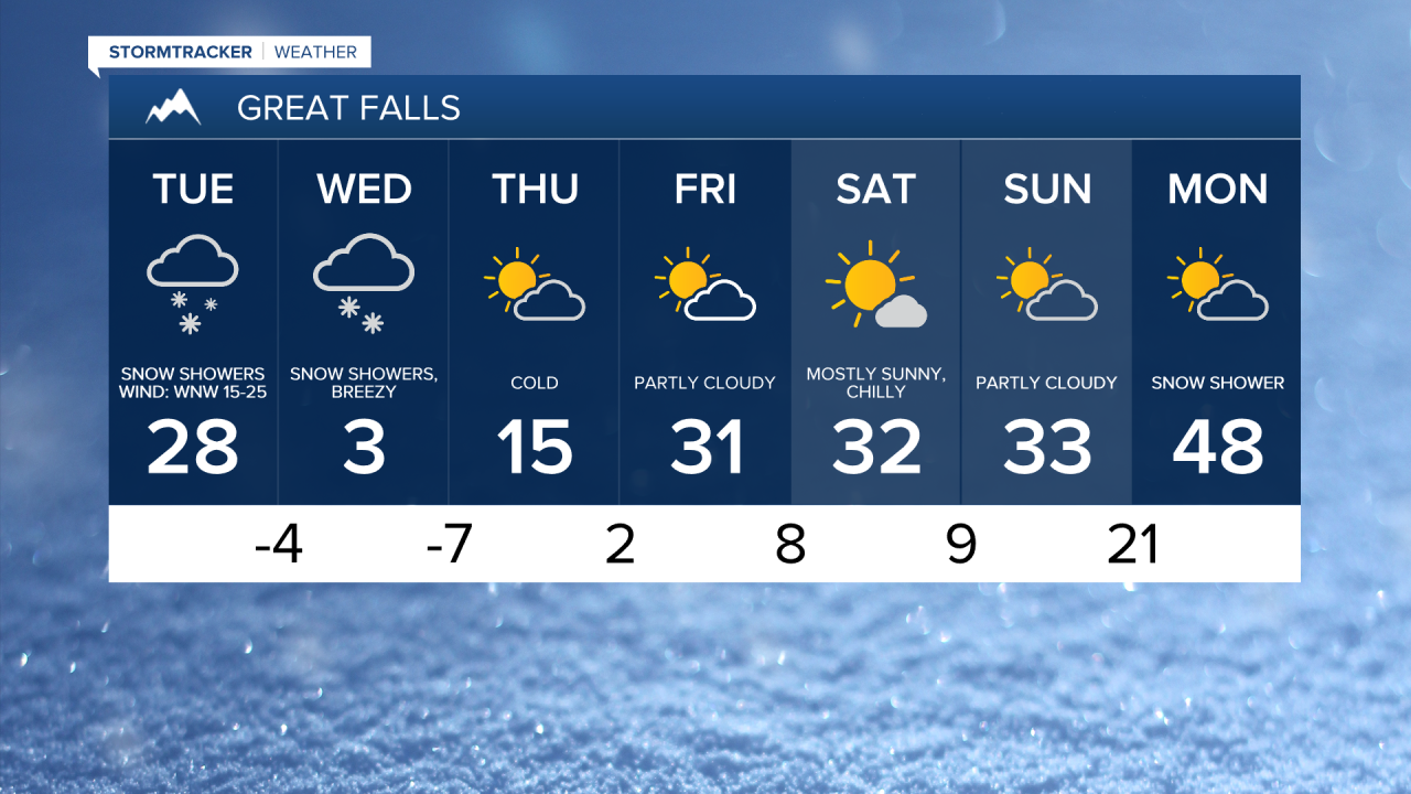
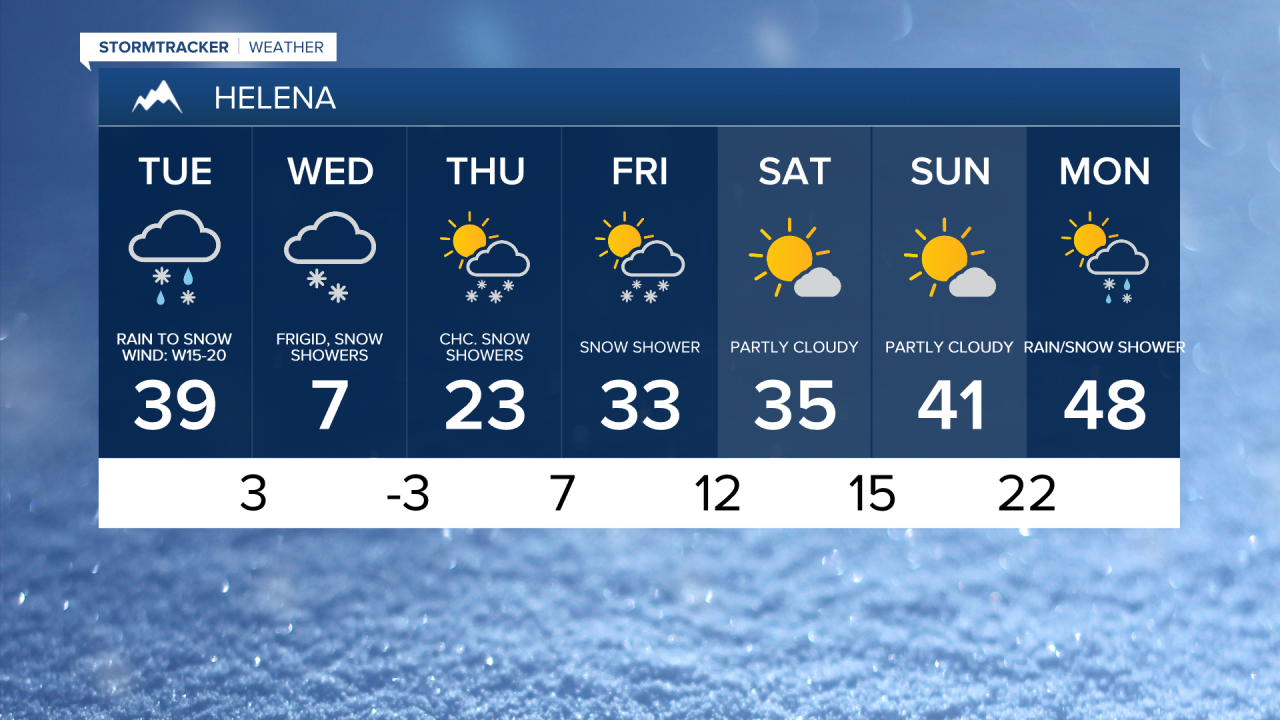
A high pressure ridge redevelops over the region by the weekend, bringing gradually moderating temperatures and dry conditions. Daytime highs will return to the 20s and 30s, but nights will remain cold, with lows down into the 0s and even below zero in some areas.