


After an incredibly active couple of days, the storm system responsible for the severe weather and wind is moving out, but it will quickly be replaced by another cool and unsettled system this weekend.


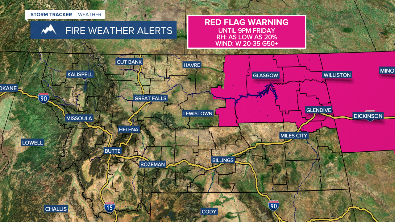
Today will be mostly sunny to partly cloudy with highs in the upper 50s and 60s. Winds will gradually continue to ease, though it will still be breezy at times with speeds of 10–25 mph and gusts up to 40–50 mph. Widespread blowing dust is not expected, but there could still be some patchy blowing dust and localized reductions in visibility on roads and highways.
Friday Morning Forecast:
Isolated rain and mountain snow showers will continue along the Continental Divide and on the Hi-Line today, with scattered rain and mountain snow showers developing overnight into Saturday. Highs Saturday will range from the 30s and 40s in the mountains to the 50s in central Montana and 60s in eastern Montana.
Everyone cools down Sunday with rain mixing with snow, even in some lower elevations. Daytime highs will only reach the upper 30s and 40s. Little accumulation is expected in the lower elevations, but several inches of snow will pile up in the mountains.
Next week starts off frosty with temperatures dipping into the 20s and 30s by Monday morning. Active weather looks to continue through much of next week, though temperatures should slowly rebound into the 60s and 70s by the middle to end of the week.


