


Temperatures fell from 80° Tuesday afternoon to the upper teens (18°) this morning as a cold April storm system moved into the state. The chilly air, strong wind, and snow showers will continue as the main area of low pressure keeps cool air flowing in from the northwest throughout the weekend.

Friday Morning Forecast:
Friday will be mostly cloudy with areas of snow and northwest winds gusting to 30–40 mph. High temperatures will only reach the 30s to around 40°, while the mountains stay in the 20s. Steadier snow will return to the mountains during the morning, with on-and-off snow in the lower elevations.


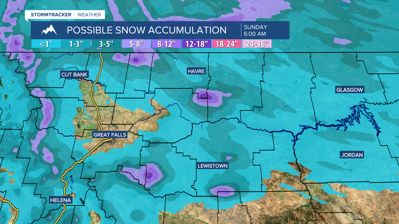
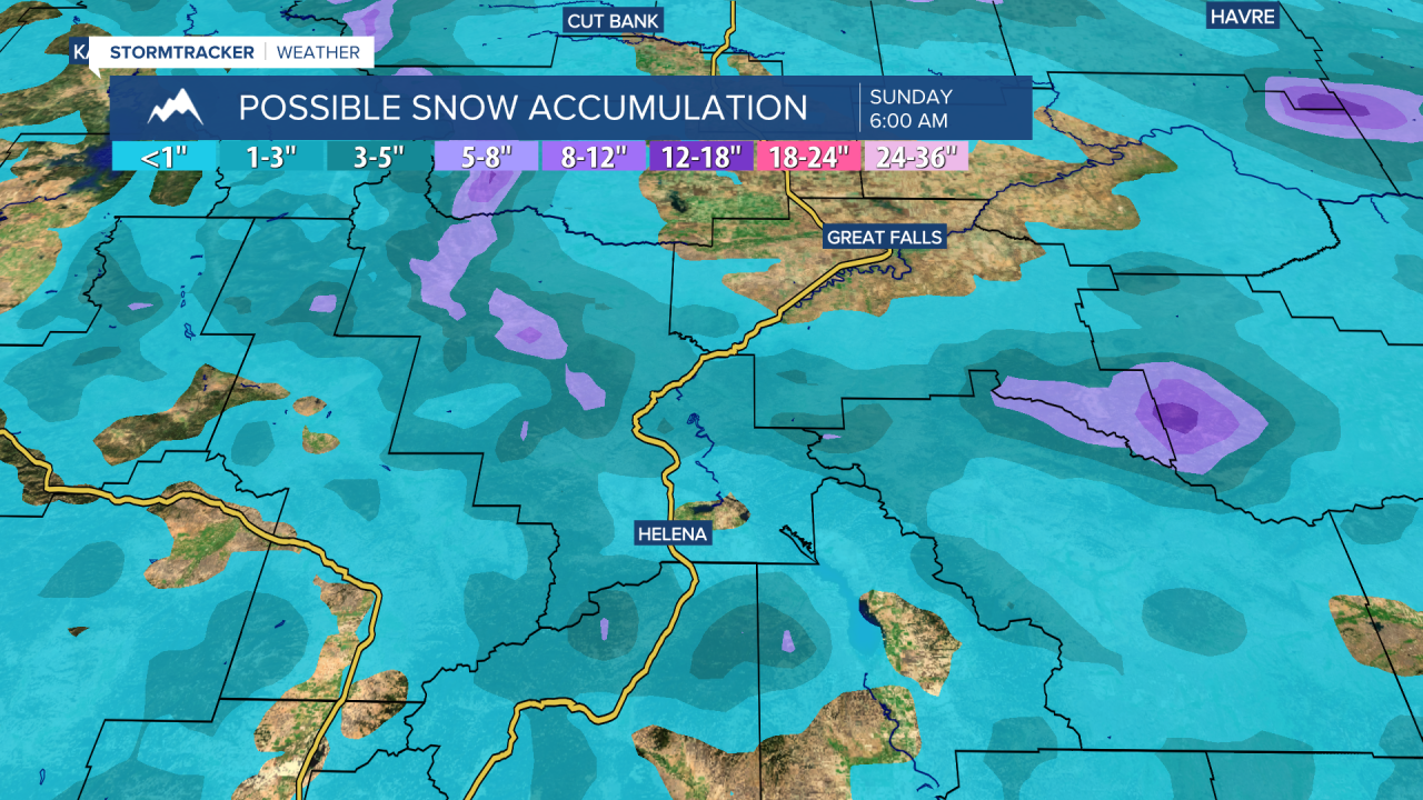
Both days this weekend will only reach the 30s and lower 40s with scattered snow showers and breezy northerly winds. The mountains could still pick up several inches of snow. A Winter Storm Warning has been issued for the Bear Paws through noon Saturday for 4–10 inches of snow.
The cool, stormy weather pattern will persist into next week for the mountains, while the lower elevations will just see mixed rain and snow showers at times. Temperatures should rebound to near average by next Wednesday and Thursday.


