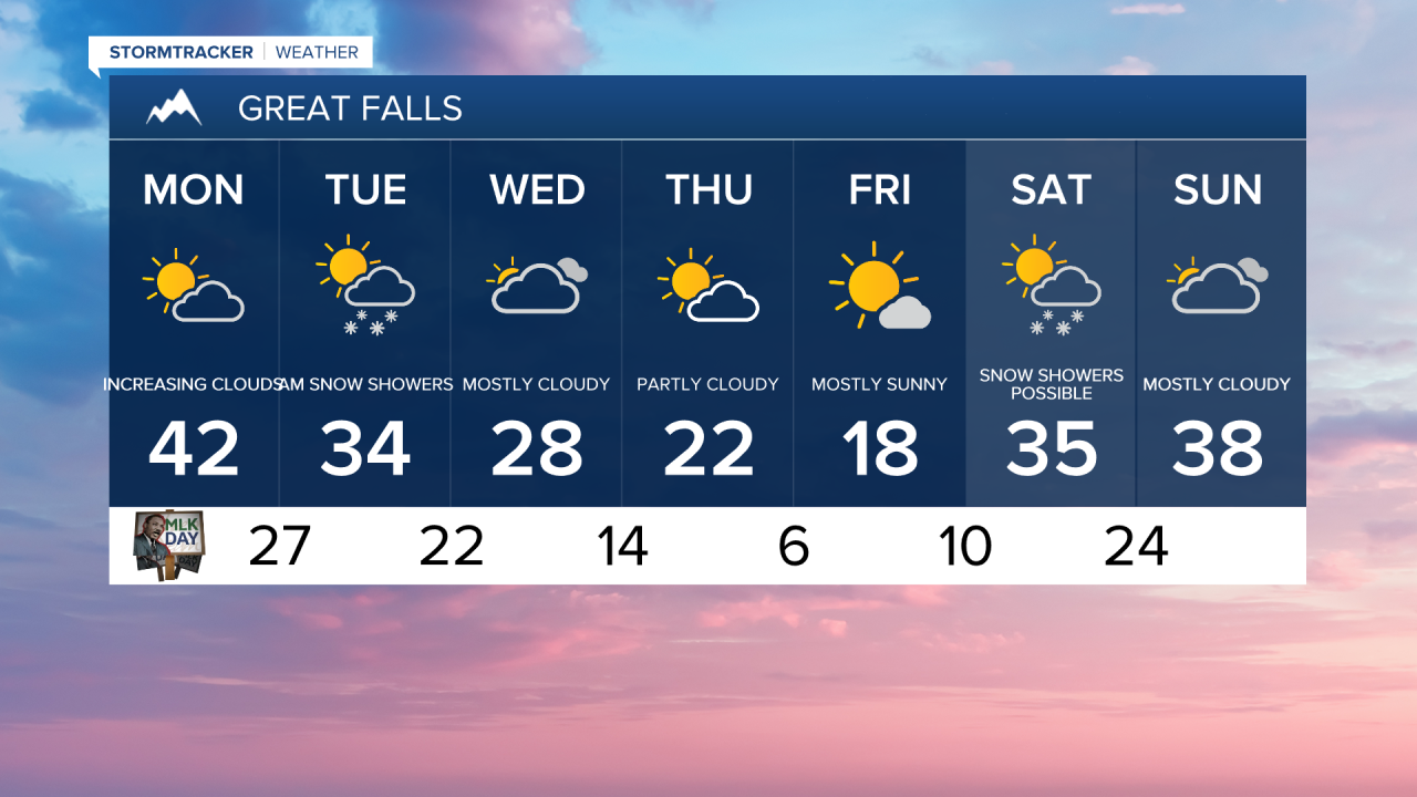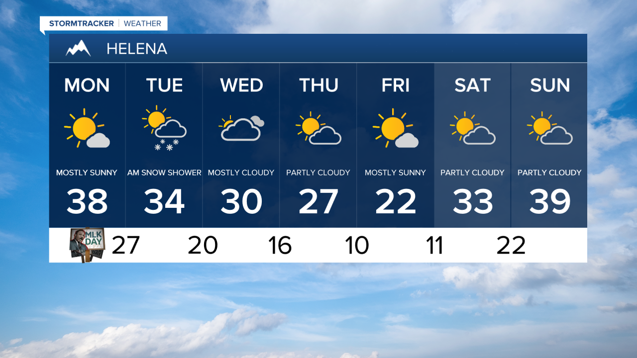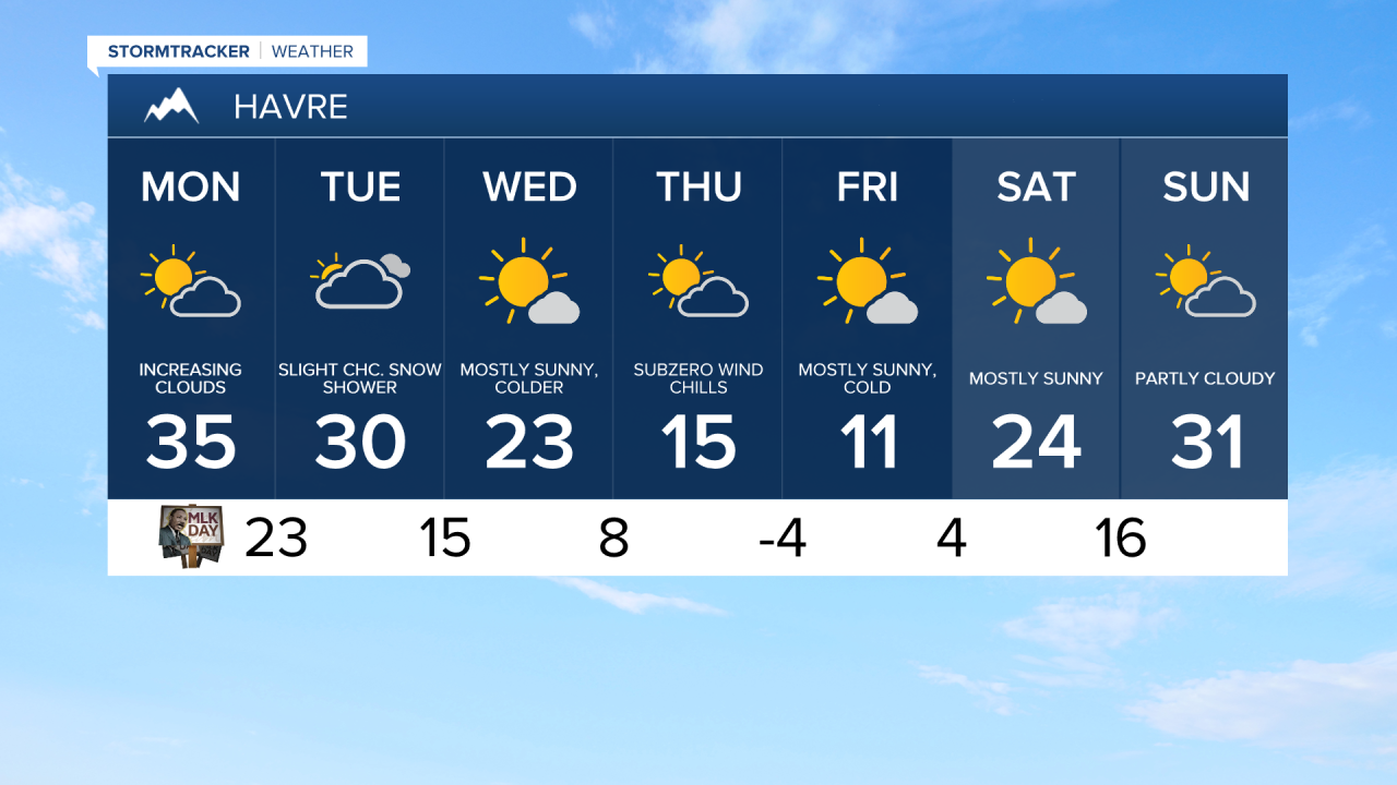


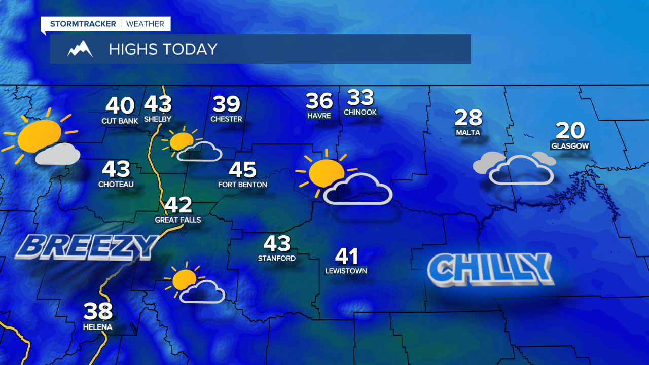
It's a frigid start to MLK Day in central and eastern Montana, with temperatures in the 0s and 10s. Expect increasing clouds ahead of a cold front that will move south across the area overnight into Tuesday morning.

Today's Forecast:
Once the front passes, winds shift to the north-northwest and strengthen to 10-25 mph across central and eastern Montana, with gusts between 30-45 mph. Daytime highs will be in the low to mid 20s in northeast Montana and in the low to mid 30s in central Montana.

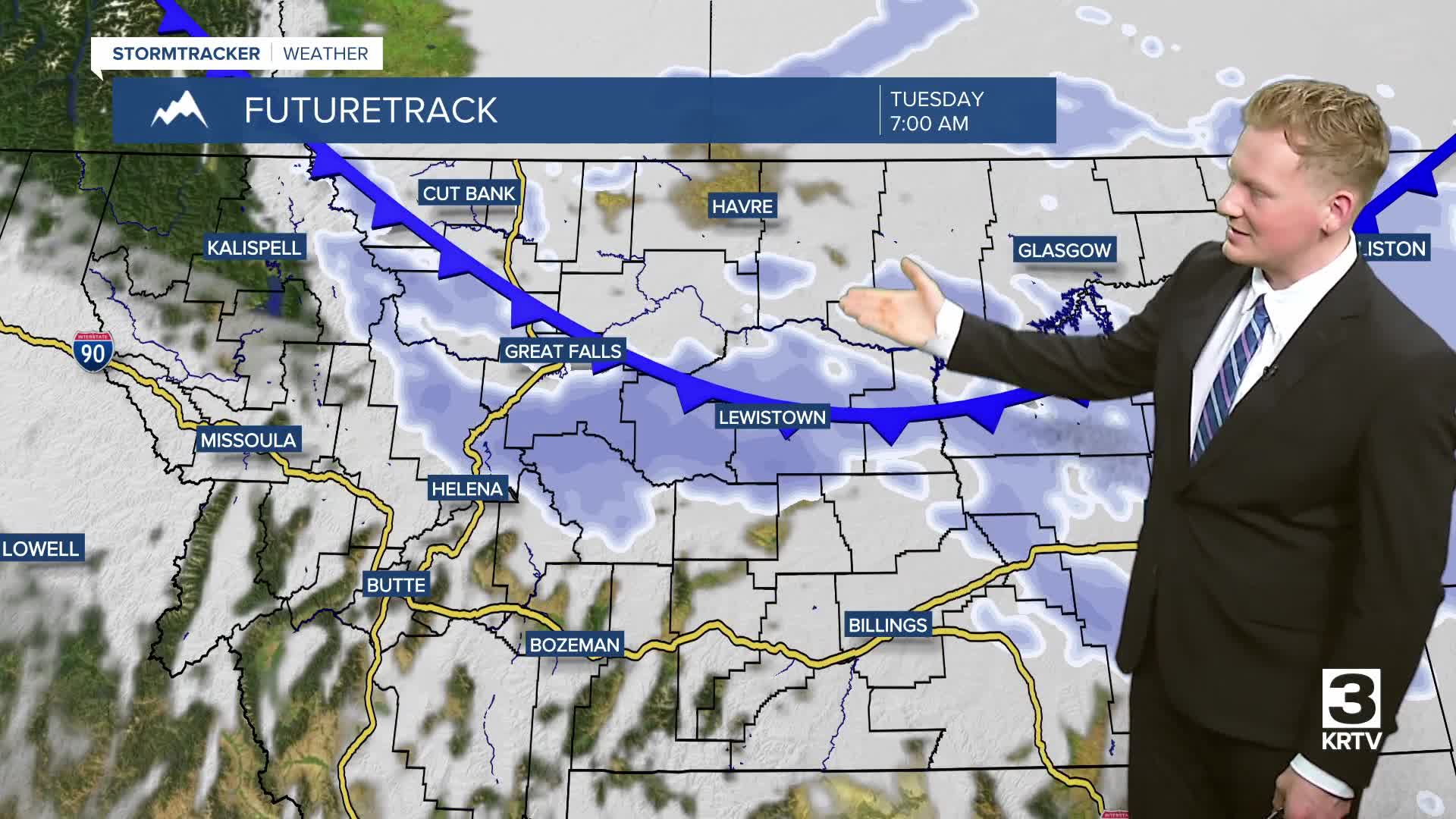
Scattered snow showers will develop on the Hi-Line late Monday night and spread further south across central Montana into Tuesday morning. Snow accumulation will be very light in the lower elevations, generally a trace to half an inch. Areas between Great Falls and Lewistown could see up to one or two inches of snow. The mountains are expected to receive 3 to 8 inches of snowfall.
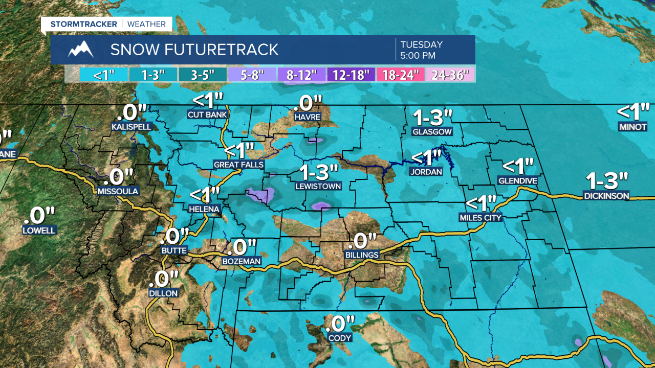
A second system will clip eastern Montana, bringing some light snow showers mainly to the mountains in central Montana.
Temperatures progressively get colder throughout the week. Highs reach the upper 20s and 30s on Tuesday, then only the upper 10s and 20s on Wednesday.
Much colder air will arrive late in the week, with high temperatures in the 0s and 10s on the Hi-Line and in the 10s and 20s in central Montana on Thursday and Friday. The likelihood of widespread snow has decreased, but some light snow is expected Friday night into Saturday.