


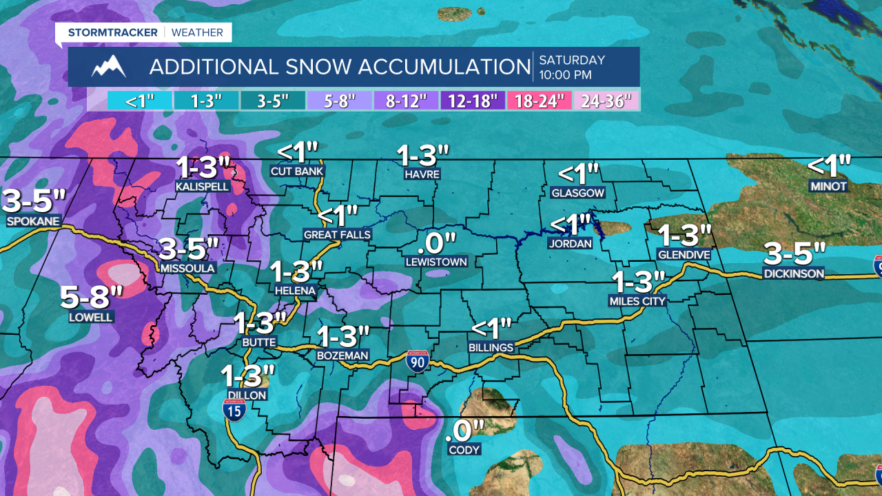
Smooth sailing for travel between now and Christmas throughout central Montana. There will be a cold front that moves through around dinnertime on Thursday bringing with it snow showers and gusty winds. These will be brief, once the cold front moves through cold air settles in behind it. The only concern as far as travel is concerned is western Montana. Snow will pile up in the mountains, so be prepared for snow-covered roads over mountain passes.
Thursday: Another mild and mostly sunny day. Temperatures will reach the low to mid 40s. A Canadian cold drops south with a line of rain and snow showers, there could be a quick burst of snow as it moves through. The winds will also briefly increase with gusts up to 45mph possible. Snowfall accumulations will be limited to a dusting to an inch, with any accumulations occurring in the Helena area. Temperatures crash into the low to mid teens overnight with decreasing cloud cover by daybreak.
Christmas Eve: Partly sunny to mostly cloudy skies. Much chillier with high temperatures in the mid 20s to around 30 degrees. A few, light snow showers are possible as temperatures fall into the single digits at night.
Christmas: Waking up to subzero wind chills for much of the area. Otherwise, mostly cloudy skies with some light snow showers possible. Higher likelihood of snow showers in Helena. Temperatures will rise to the mid to upper teens. The chance for snow showers continues overnight, with the Hi-Line having the greatest chance for snow showers. A dusting to an inch may accumulate. Temperatures crash overnight, with lows ranging from -5 to -15 throughout central Montana.

Sunday: Mostly cloudy skies. A few snow showers possible in Helena and in the Rockies. Temperatures climb to -5 to 5 degrees across central Montana. Subzero wind chills are expected throughout the day. Overnight lows -10 to 20 degrees with the continued chance for light snow showers.
Monday: Frigid temperatures. Highs will fail to reach 0 degrees in many locations. Partly to mostly cloudy skies. Temperatures overnight fall to -20 to -30 degrees with wind chills as low as -40 possible for the Hi-Line.
Tuesday: Even colder. Dangerous wind chills, especially overnight and during the early morning hours. High temperatures will reach -5 to -10 degrees under partly cloudy skies. Overnight lows will be -20 to -35 degrees, with wind chills as low as -45 degrees for the Hi-Line.
Wednesday: Dangerously cold temperatures. Mostly cloudy skies. High temperatures will be well below zero in most cases. Highs will be -15 to -5 degrees throughout central Montana. Overnight lows once again falling to -15 to -25 degrees.
