


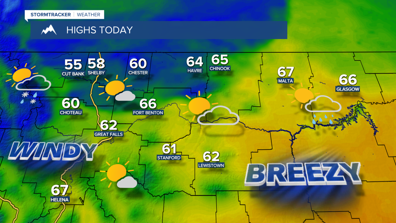
Winds are picking up ahead of a cold front, with gusts up to 60–80 mph in Glacier County. Those strong wind gusts will spread east across the plains of central Montana throughout the morning and afternoon. Gusts could reach 50–70 mph at times, with isolated gusts of 70–80+ mph near the Rocky Mountain Front. The strongest gusts are expected during the late morning and early afternoon before winds gradually ease through the evening.
Tuesday Morning Forecast:

Daytime highs reach the 50s and 60s before falling into the 30s and 40s behind the front. Clouds roll in as the front passes through, bringing widely scattered rain and snow showers, with areas west of I-15 seeing the greatest chance for precipitation.


Winds will stay gusty in eastern Montana through Wednesday morning, but most areas will have lighter wind. Temperatures start out chilly in the 20s and 30s and only warm into the 40s and lower 50s in central Montana, with lower 60s near Helena.
Another weak front will pass through early Thursday morning with a few scattered rain and snow showers. Partly cloudy skies and cool temperatures will continue, with highs in the 40s and 50s.
Friday looks gorgeous, with highs in the 60s to near 70 under mostly sunny skies. Saturday starts out beautiful with sunshine and warm temperatures, but a few showers and isolated thunderstorms will develop in southwest Montana and push into central Montana during the afternoon and evening.
Sunday will be cloudy with widespread showers and some high-elevation snow. Showers will continue on and off through the day and into Monday. This could bring another round of beneficial moisture to the state.


