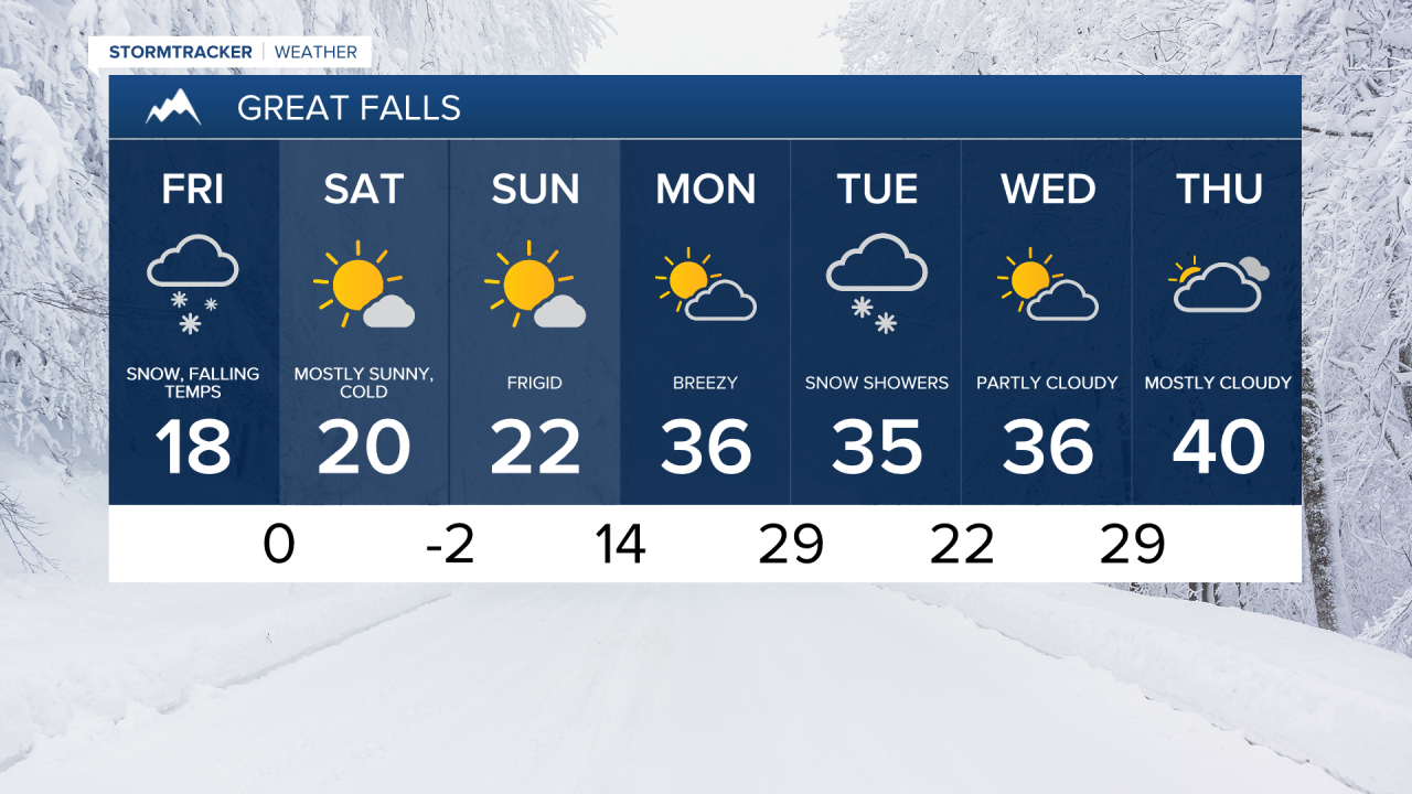
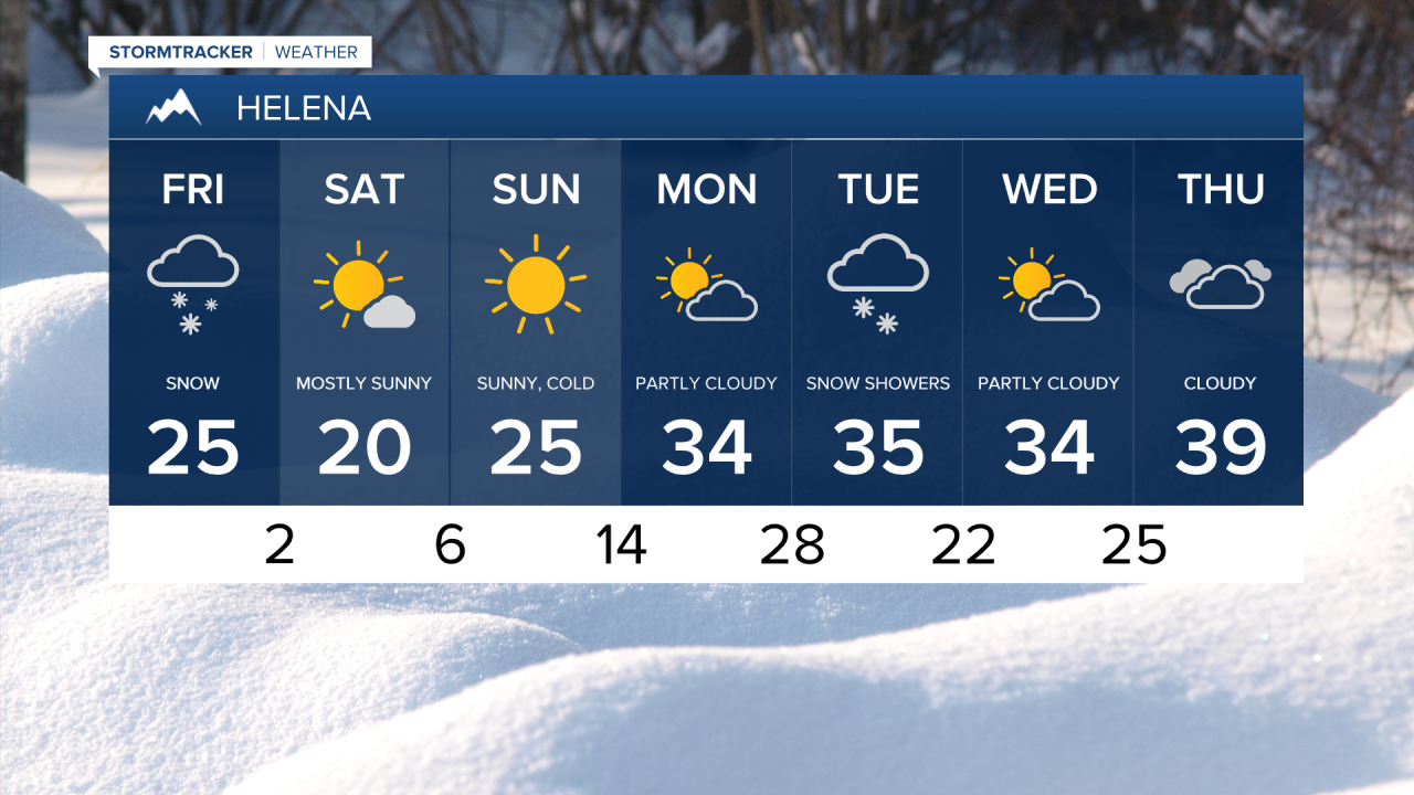
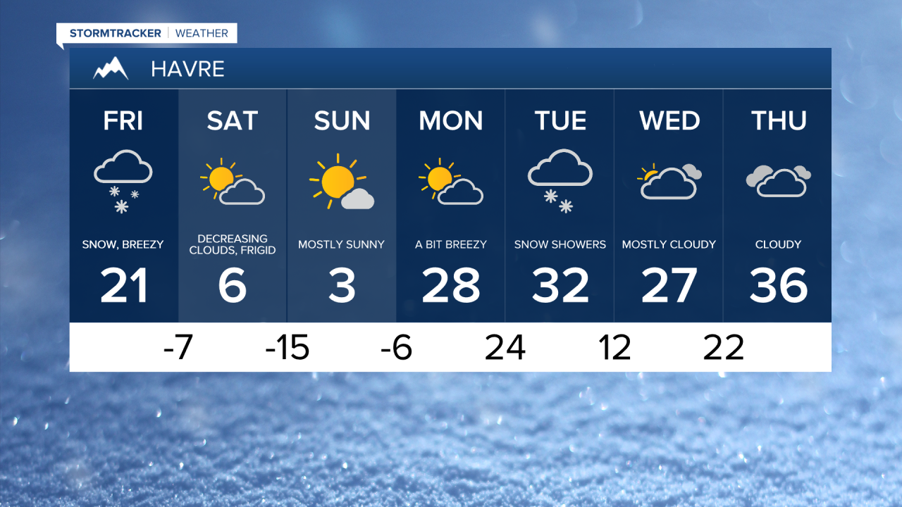
Widespread snow is overspreading central Montana as the main storm system swings through later this morning into the afternoon. Steady snow tapers to scattered snow showers late afternoon into the evening. An additional 1 to 3 inches is likely, with a few locations receiving up to 5 inches of additional snow.
Today's forecast:
Highs will be in the 10s and 20s, but falling into the 0s and 10s by dinnertime. A brisk northerly breeze sustained at 10-20 mph will make it feel frigid and gusts of 30-40 mph could cause some blowing snow and reduced visibility.
- Road Conditions: click here
- MDT Webcams: click here
- MTN Cameras: click here
Snow showers end overnight, and skies gradually clear out allowing temperatures to plummet. Overnight lows dip down to the -10s and -0s for the Hi-Line and -0s and 0s for central Montana.

The coldest air of the season surges in tonight and for the weekend. Although, mostly sunny skies are expected for Saturday and Sunday. Highs will be in the 0s for the Hi-Line and 10s and lower 20s across central Montana. Frigid overnight lows in the -10s and -0s.
Temperatures warm up next week as highs return to the 20s and 30s Monday and then 30s and 40s for the remainder of the week. Breezy conditions accompany the milder temperatures by Monday. Some rain and snow showers are possible on Tuesday.