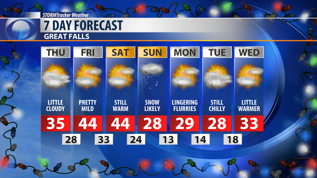
A passing cold front has caused temperatures to drop significantly overnight, making for a much cooler day Thursday.
Some freezing drizzle and light snow is not out of the question early in the day as this front passes.
The main impacts on Thursday will be cooler temperatures and mostly cloudy skies.
On Friday we'll see a nice boost in temperatures with most of the state once again reaching the 40s.
The driving force behind the temperatures boost is strong high pressure ridge.
This ridge is expected to last through the first half of the weekend before our next snow maker moves in on Sunday.
Much colder temperature and another round of snow are expected with this system.
Early forecast models are hinting at 3 to 5 inches throughout Central Montana.
These anticipations will likely change before the weekend.
Colder air from this system will last through the first portion of next week.