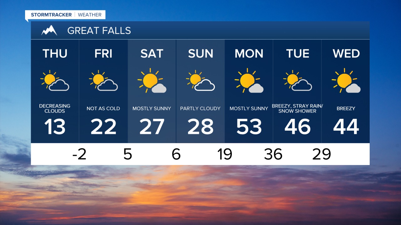
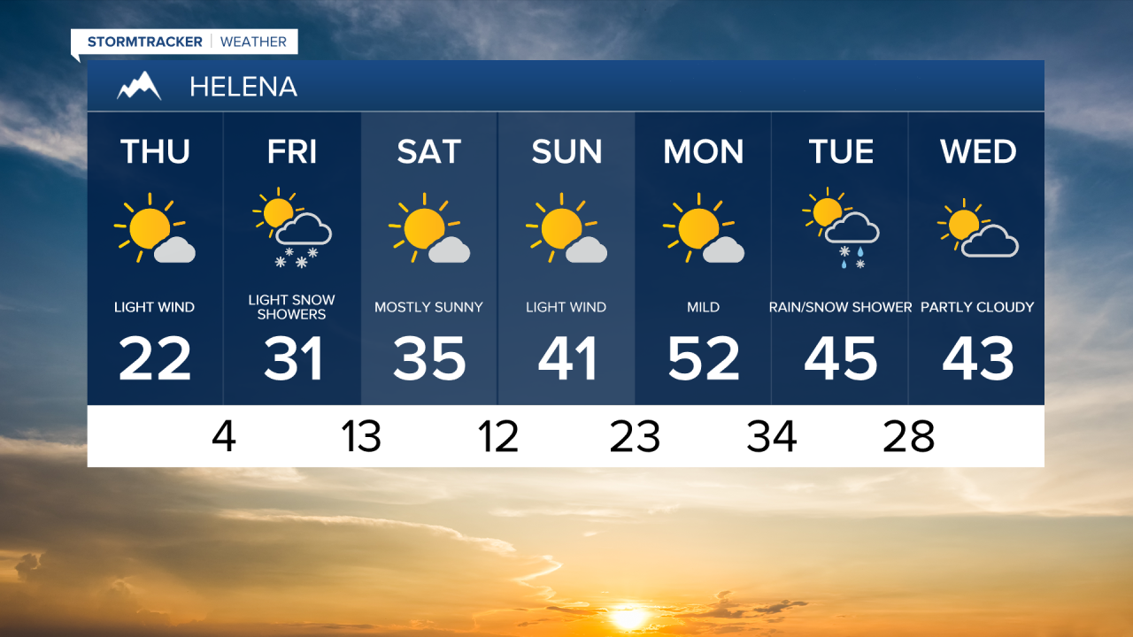
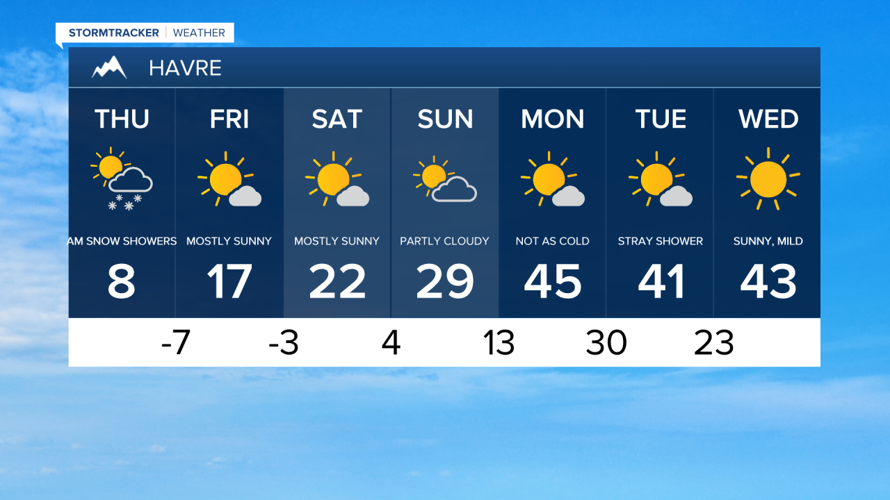
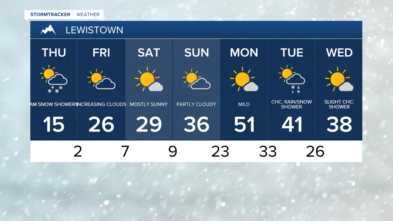
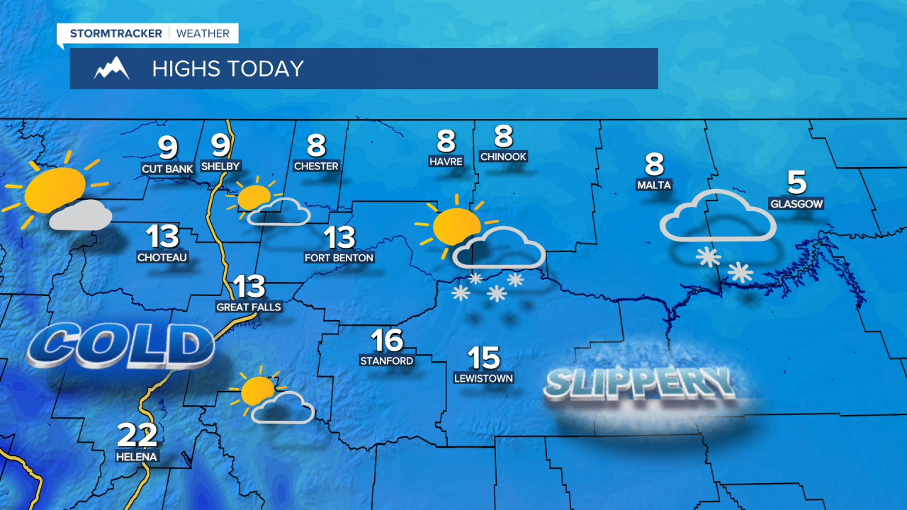
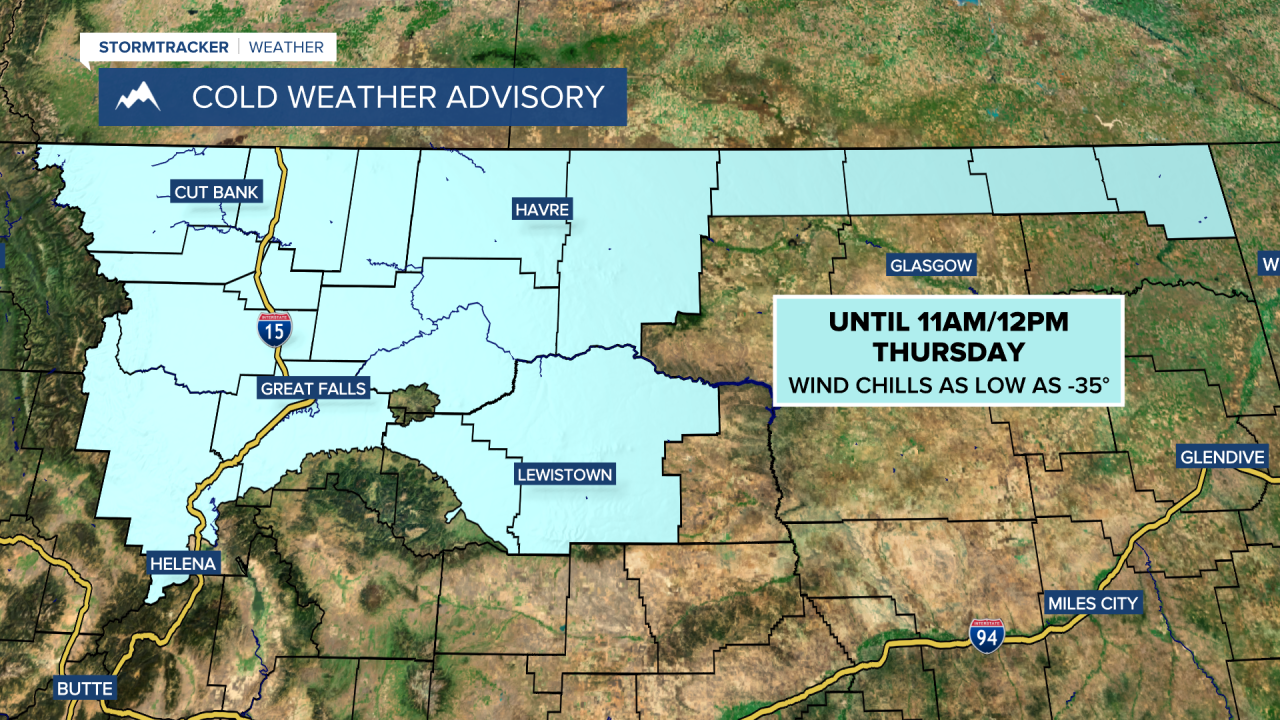
This morning was the coldest since this date in 2025, with temperatures dipping down to -17. A Cold Weather Advisory continues through midday Thursday, with wind chills as low as -35. Light snow showers are ongoing on the Hi-Line east of Havre, but the system is pulling away, and clouds will clear from west to east throughout the morning. This afternoon, it will be mostly sunny, with high temperatures reaching the 0s and 10s across central Montana and the 20s near Helena. However, light snow will continue in eastern Montana, with highs in the 0s.
Today's Forecast:
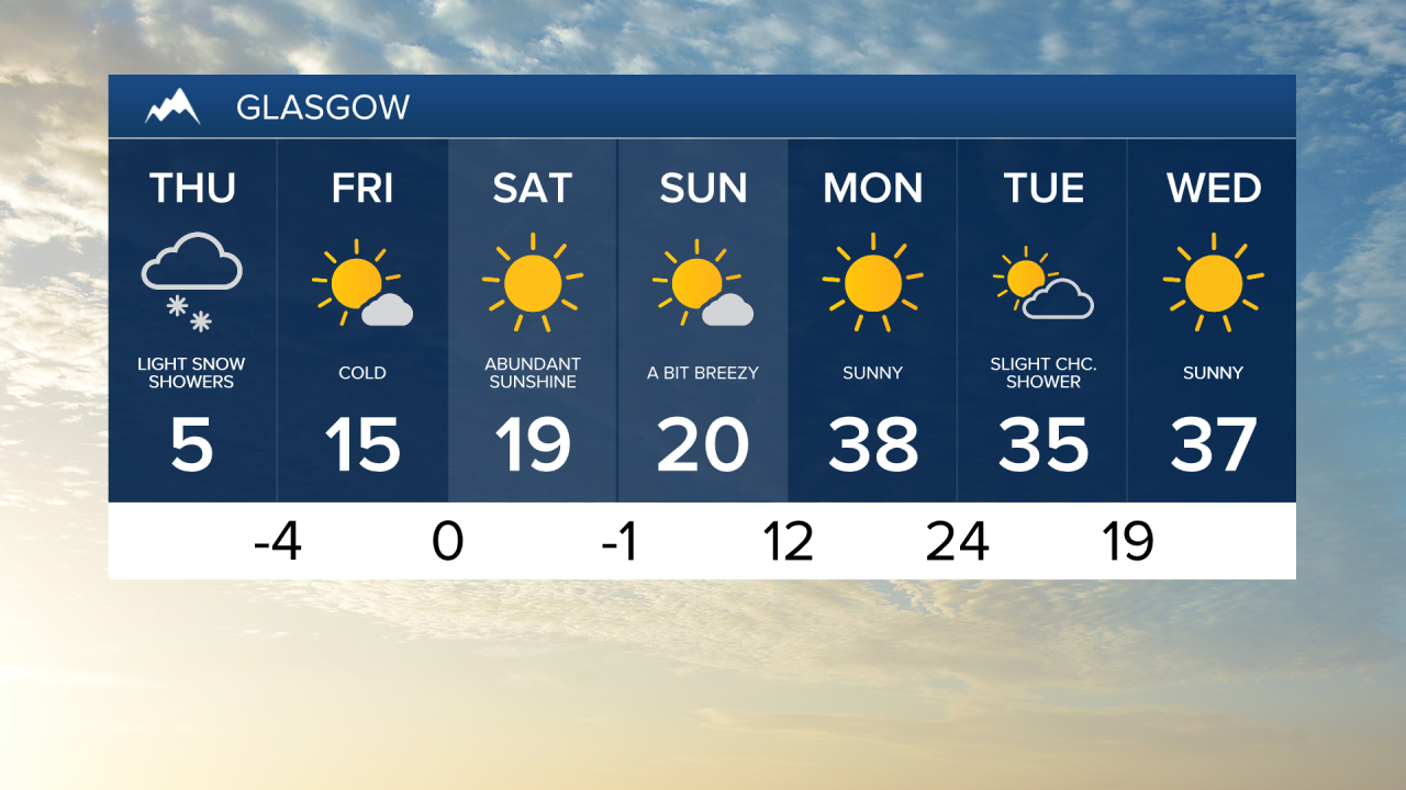
Friday will bring more clouds, along with some flurries and light snow showers. High temperatures will be in the 10s and 20s in central and eastern Montana, with lower 30s near Helena.
High pressure moves in for the weekend, bringing drier conditions and some sunshine. Temperatures will range from the 10s in northeast Montana to the 20s and 30s across central Montana.
A chinook wind warms temperatures quickly on Monday and pushes out the Arctic air. Highs will be in the 40s and lower 50s, with gusts up to 40 mph.