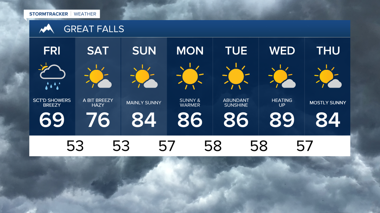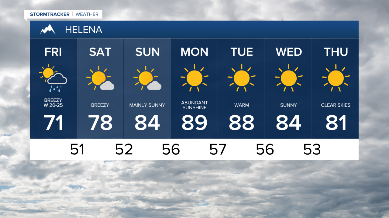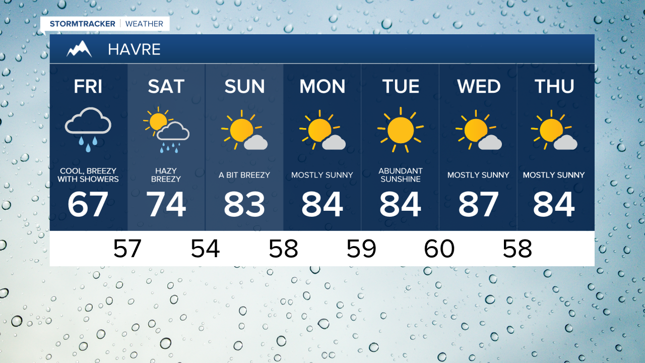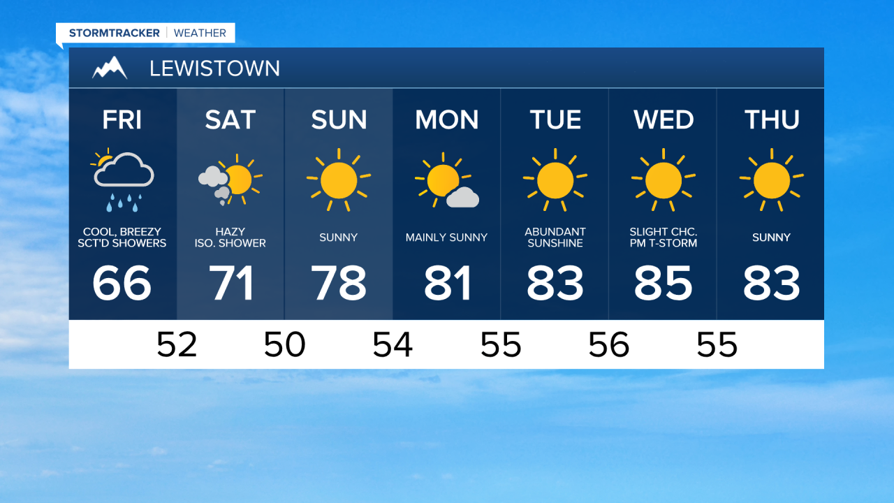


Happy Friday! This morning it was cold enough for some light snow to fall in the higher peaks of the Big Belts and the Little Belts as a cool low pressure system makes its way across the area. Temperatures are starting out in the upper 40s and low 50s and we're on track to stay in the 60s for most towns on our Friday.

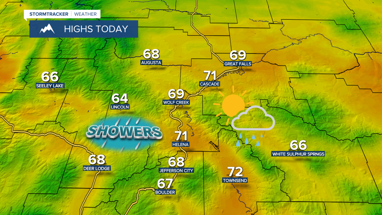
Overcast skies and scattered showers are expected to continue through most of the day. A gusty westerly breeze will be with us throughout the day with gusts of 30 to 40 mph possible.

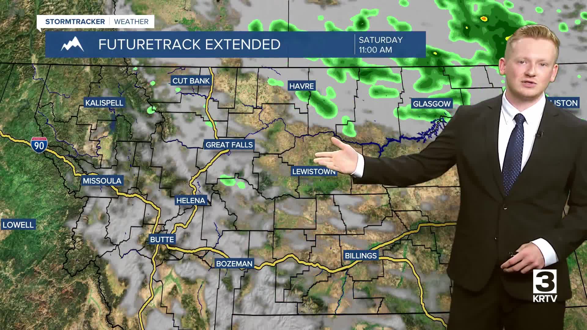
The weather will improve gradually this weekend as we could still have a few isolated showers and thunderstorms around on Saturday and a gusty breeze at around 10 to 20 mph will continue in central Montana. A stronger wind at around 15 to 30 mph is expected across eastern Montana, and a few gusts could reach 50 mph. A Lake Wind Advisory is in effect for Fort Peck Lake through Saturday at 9:00 PM as wave heights could reach 3 to 5 feet.

Temperatures warm nicely into the mid and upper 70s on Saturday, and then more sunshine is anticipated on Sunday as temperatures climb into the low to mid 80s.
Canadian wildfire smoke will also return to central and eastern Montana on Saturday, and this smoke may cause the air quality to be unhealthy for sensitive groups or unhealthy for everyone at times.

High pressure builds in providing a quiet, dry and warm stretch of weather. Daytime highs will get into the mid to upper 80s and lower 90s for the first part of next week.