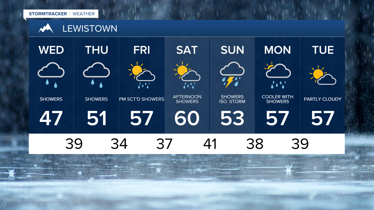
We're stuck in a cool, cloudy, and at times showery weather pattern for at least the next 7 days in central and eastern Montana. In fact, I have a non-zero chance of rain showers for the next 10 days. For most of us, this will just mean nuisance clouds and showers that don't add up to a whole lot.
A steady rain this morning across portions of central Montana will turn more showery this afternoon. Scattered showers will continue into Thursday, before tapering off Thursday evening. Precipitation amounts will vary significantly over the next few days. The heaviest precipitation will stay south of MT-200 and east of I-15.
From Wednesday through Friday, temperatures will range from the upper 40s to 50s in central Montana and from the mid to upper 50s and lower 60s on the Hi-Line. Temperatures warm into the 60s on Saturday, which also has the chance of a few isolated showers and thunderstorms during the afternoon. Overall, Saturday is going to be the most pleasant day of the week, with a good mix of sunshine and clouds.
A stronger, more organized area of low pressure will impact Montana by the end of the weekend and early next week. This will bring higher odds for rain and mountain snow. Snow levels could drop quite low with this system, so we will need to monitor it closely for potential travel impacts. In any case, next week remains cool, with highs generally in the 50s and 60s.