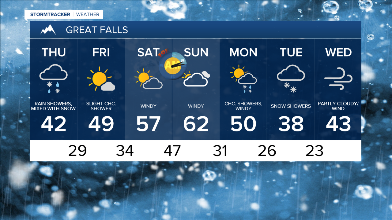
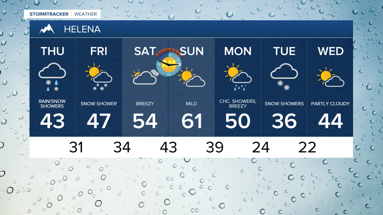
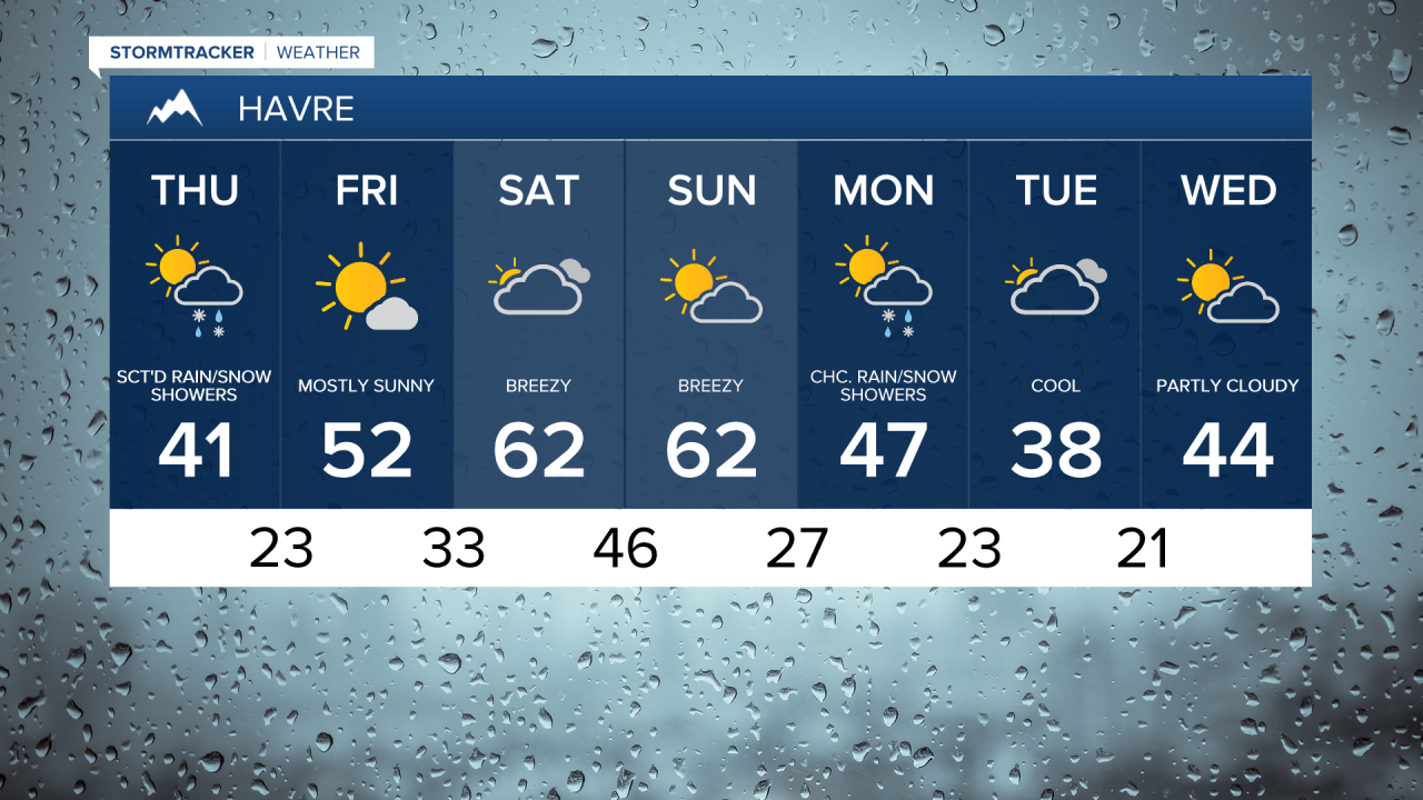
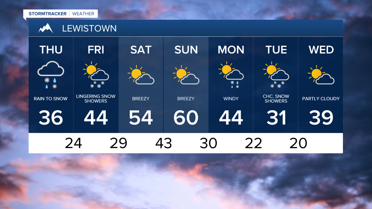
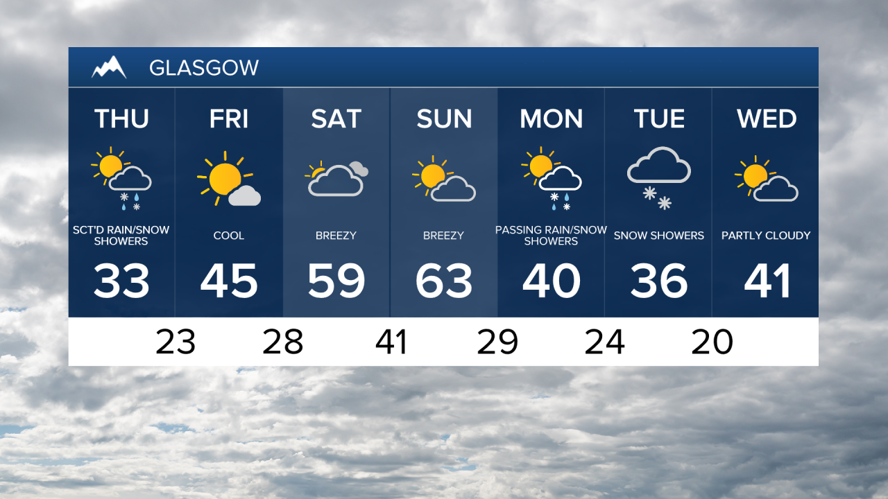
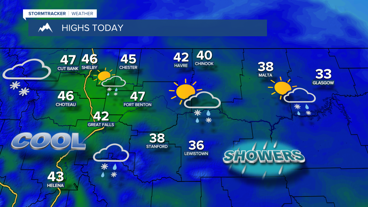
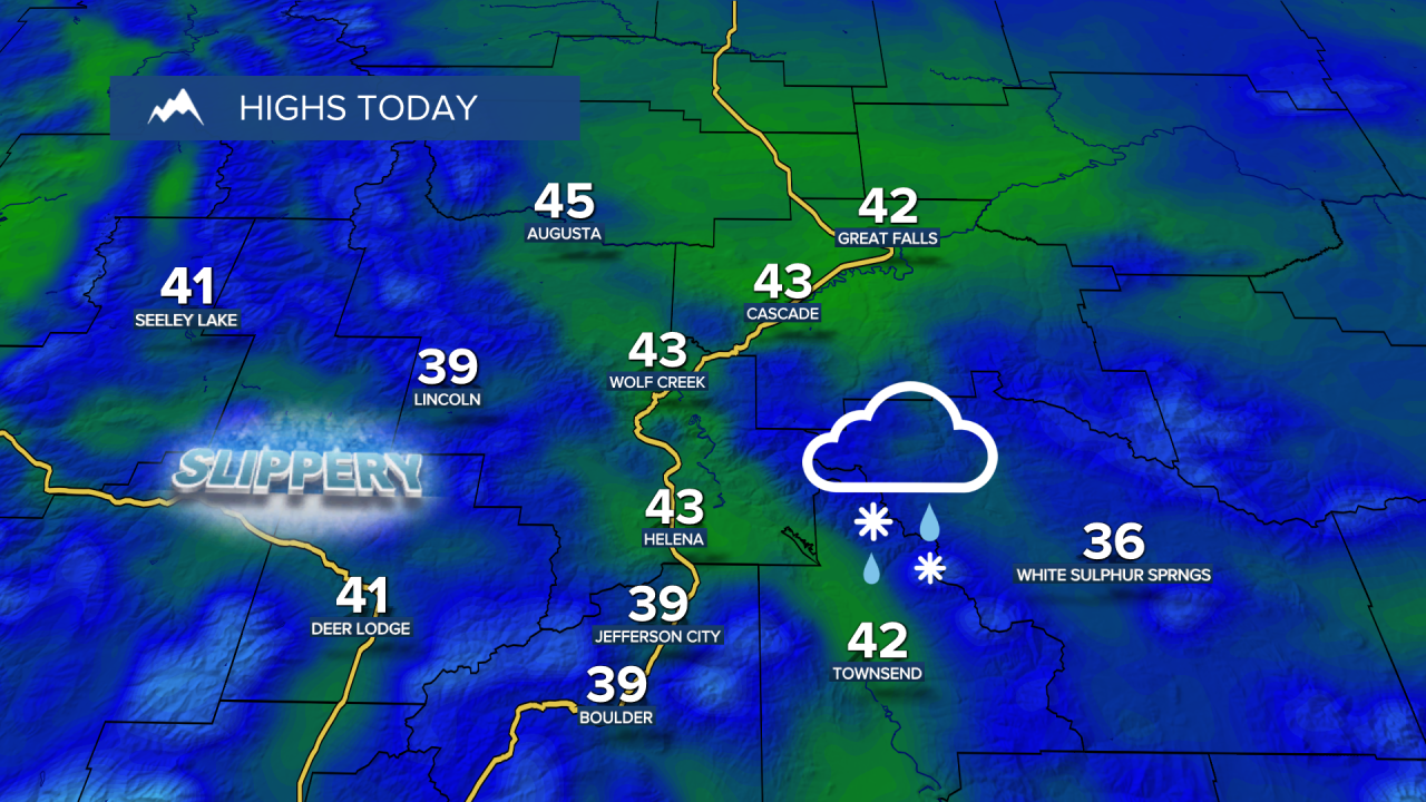
An area of rain and snow in the lower elevations, along with steady snow in the mountains, will continue throughout the morning. This will gradually break up into scattered rain and snow showers in the afternoon and evening as a northwest flow brings in additional moisture. Highs will be in the 30s and 40s.
This system moves away on Friday, with a few leftover snow showers in the mountains early Friday morning. It will be partly cloudy, with highs in the 40s to 50s.
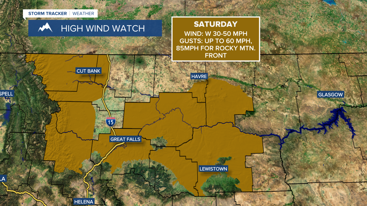
The weekend is going to be mild and windy, with high temperatures in the 50s and 60s. A High Wind Watch has already been issued for the Rocky Mountain Front and the plains from Friday night into Saturday. Wind gusts could reach up to 60 mph across the plains and exceed 80 mph along the Rocky Mountain Front. Skies will be partly to mostly cloudy throughout the weekend.
Don't forget to set your clocks forward an hour as Daylight Saving Time begins Sunday at 2 a.m. Sunsets will be after 7 p.m. starting Sunday.
A cooler, wetter weather pattern is expected to develop next week after a strong cold front passes through on Monday. High temperatures will drop to the 30s and 40s for the rest of the week, with chances of snow even in lower elevation areas.