


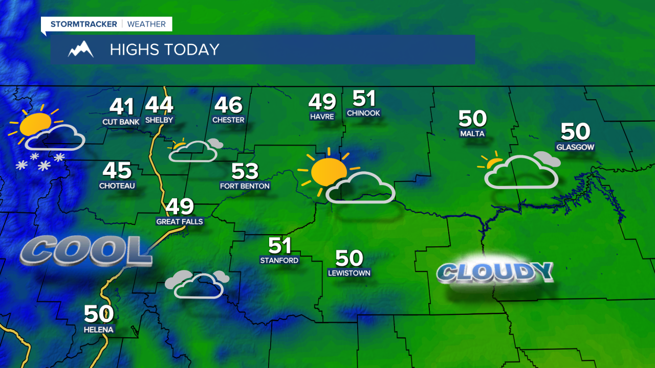
Saturday saw a record high temperature of 73 degrees in Great Falls and Helena. Widespread winds gusting to 40-50 mph were around throughout the weekend. Clouds will be around on Monday, but mostly dry conditions and lighter winds can be expected to start the week. Highs will be much cooler, but near normal, in the upper 40s and lower 50s.

Here's the detailed forecast:
Some Pacific moisture moves into the state today into Tuesday, bringing valley rain and mountain snow along and west of the Continental Divide. A few inches of snow are possible over Marias Pass. Light rain and mountain snow showers will move east of the Divide tonight into Tuesday morning, but accumulation should be minimal. Daytime highs will be in the mid to upper 40s and low 50s.
Temperatures will moderate toward the middle of the week. Highs are set to reach the upper 40s and lower 50s on the Hi-Line and mid to upper 50s in central Montana. We'll continue to have lots of clouds around but generally dry conditons.

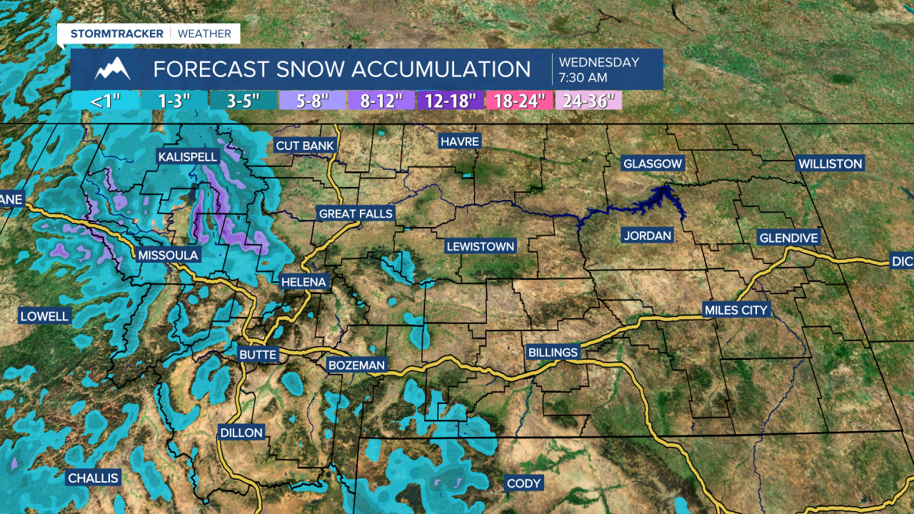
Seasonably mild temperatures Thursday and Friday, but another Pacific system moves in Friday night into Saturday. The warmer Pacific air will likely keep snow levels at mountain pass level across the area, with another round of rain showers and mountain snow. This system will also bring gustier winds to the region.


