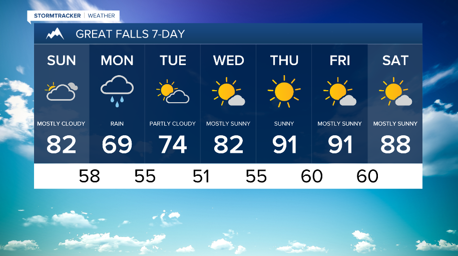
Sunday will see initial dry conditions during the morning/afternoon before shower and thunderstorm chances increase through the afternoon and evening hours.
Best coverage of showers and storms during the day on Sunday looks to occur southeast of a Helena to Lewistown line, and then along and eastern portion of the state.
High temperatures on Sunday will fall back below normal in wake of today`s cold front, with most locations ranging from the mid-70s to 80s.

This troughing pattern continues into next week cooling temperatures down at the top of the week and increasing chances for widespread showers and storms.
A weather system will bring the next chances for widespread rain across North-Central MT Monday and Tuesday. Temperatures dip down into the upper-60s and low-70s.
This pattern looks to stay through mid-week with temperatures look to trend back above average by the end of next week.