There are a few, slow-moving thunderstorms impacting parts of central Montana this afternoon. A nearly stationery thunderstorm over the Little Snowies in southeast Fergus county has dumped over 2 inches of rain. Flash flooding is going to be a big concern in any thunderstorms that develop this afternoon. The good news is most of the stronger thunderstorms will stay to the south of central Montana this afternoon and evening.
It is very muggy outside by Montana standards, dew points are in the upper 50s and lower 60s across a lot of central and eastern Montana. This will be fuel for heavy rainfall in thunderstorms in the next few days and a big concern for flash floods.

Severe Thunderstorm Watch now in effect for south-central Montana, including Billings and Bozeman, until 9:00pm tonight. The storms will be capable of producing very large hail up to 2.5 inches in diameter and up to 80 mph wind gusts. Storms could get very intense in the areas shaded in pink, please have a way to receive weather alerts!
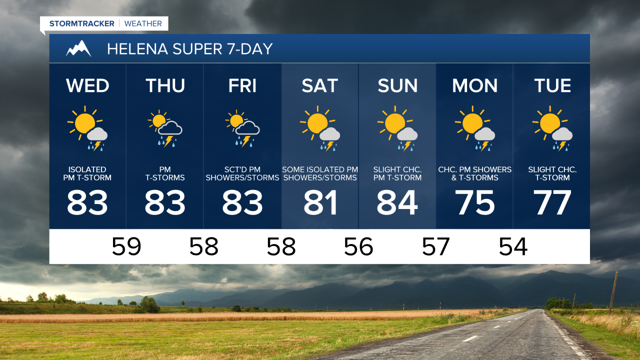
Some thunderstorms will develop on Wednesday, but they'll be fairly isolated in nature. Thursday is going to be a bigger concern not for severe weather, but for more slow-moving thunderstorms leading to flash flooding on an already saturated ground.
While there will continue to be scattered showers and thunderstorms with very heavy rainfall through Saturday, this is not expected to be a widespread flooding event in central and eastern Montana.