A wild week of weather is ahead for Montana featuring damaging wind gusts, blizzard conditions, rain, and heavy snowfall. A long-duration atmospheric river event will kick off on Wednesday, bringing significant moisture to the state.
Watch - full forecast video:
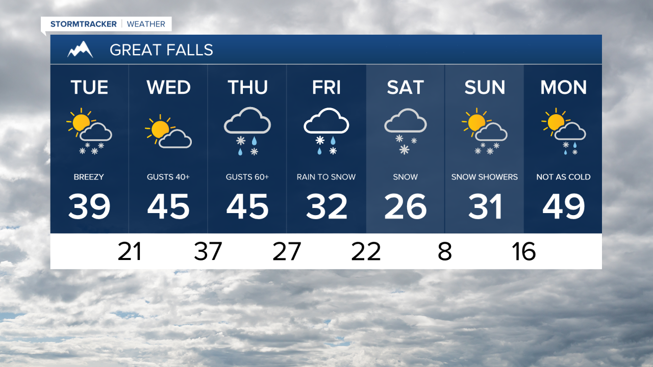
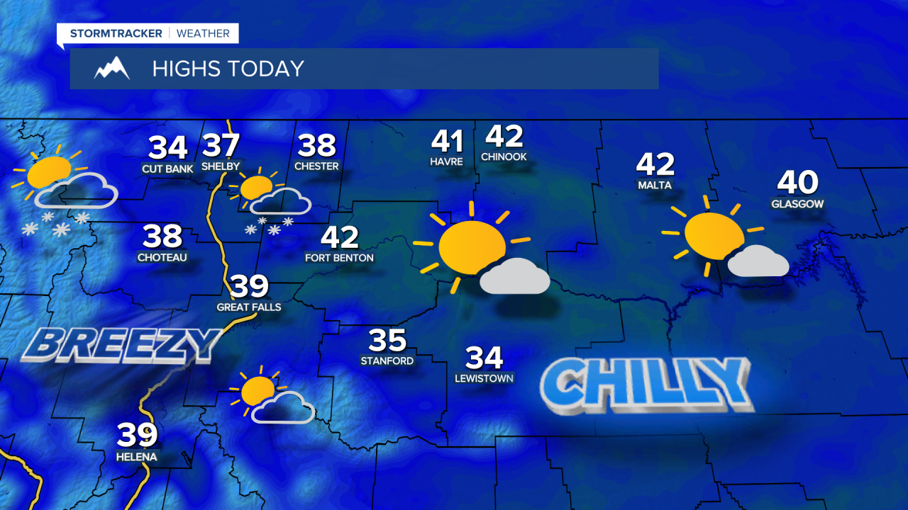
A westerly flow will bring some passing, nuisance snow showers on Tuesday. It will be partly to mostly cloudy with high temperatures in the 30s to around 40. Breezy westerly winds continue with gusts up to 40 mph.
The atmospheric river will start moving in on Wednesday, with heavy snow developing in the mountains and along the Rocky Mountain Front. Downslope winds will keep areas east of the Continental Divide mostly dry on Wednesday. It will be mostly cloudy and warmer with high temperatures in the 40s. The wind will pick up into the afternoon with widespread gusts of 40-50 mph.

A strong low pressure system moves into northern Montana late Wednesday into Thursday, bringing heavy snow to the Continental Divide and damaging winds east of the Divide. A High Wind Watch begins Wednesday evening through Thursday afternoon for sustained southwest winds of 35 to 55 mph gusting as high as 70 mph, with isolated gusts of 80-90+ mph for the Rocky Mountain Front. The combination of heavy snow and high winds will likely create whiteout conditions near the Rocky Mountain Front.
Temperatures will warm to the 40s to near 50 across central Montana and remain in the 30s towards the Hi-Line on Thursday. A cold front will head southward throughout the day with rain showers switching over to bursts of snow as temperatures fall. The mountains will continue to pick up heavy snowfall.
The front stalls right over central Montana Thursday night into Friday, with a wide range of temperatures from north to south. Areas along the front will see moderate to heavy snow, with rain mixing in south of the front. The cold front will finally push south through the state late Friday into Saturday, bringing snow to all areas.

Saturday will be cold with snow slowly wrapping up and high temperatures only in the 10s and 20s. Some blowing snow could reduce visibility. Parts of north-central Montana could see over 6 inches of snow. The location of the front will determine who receives the heaviest snowfall in the lower elevations. Meanwhile, in the mountains, several feet of snow will pile up - providing a long-awaited boost to the snowpack. A Winter Storm Watch goes into effect Wednesday evening through Saturday morning, with 1 to 3 *feet* of snowfall in the mountains. Visibility may be near zero at times.


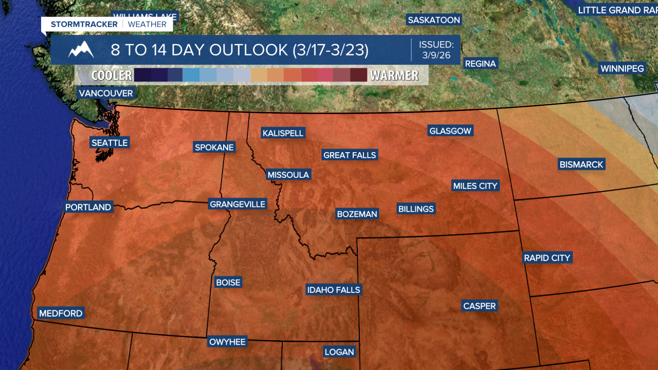
Next week, a strong ridge of high pressure builds in over the western United States. Temperatures will be well-above average in the 60s and possibly 70s.