


A major wind and snow storm is now unfolding around Montana.

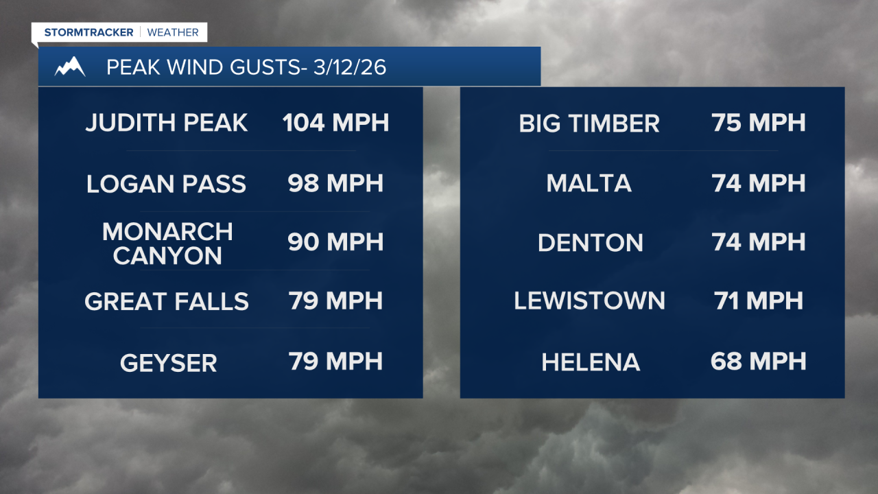
Strong westerly winds picked up overnight and will peak this morning through early this afternoon. The peak wind gusts as of 10:00 am in Great Falls was 79 mph and a 90 mph wind gust was recorded near Monarch.
A cold front is moving south through the Hi-Line accompanied by rain showers switching to bursts of snow as temperatures fall into the 20s and 30s. As the front drops further south, the wind will die down.
Eventually, this front stalls out right over central Montana later on this evening. Areas of light to moderate snow will break out across central Montana overnight as temperatures dip into the 20s.
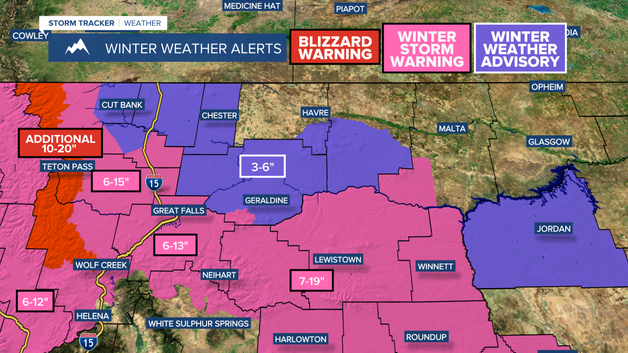
The snow will fall on-and-off Friday into Saturday, with the focus of the heaviest snowfall along the U.S. 87 corridor from Armington Junction to Lewistown and in the mountains. High temperatures will only reach the 20s and 30s.
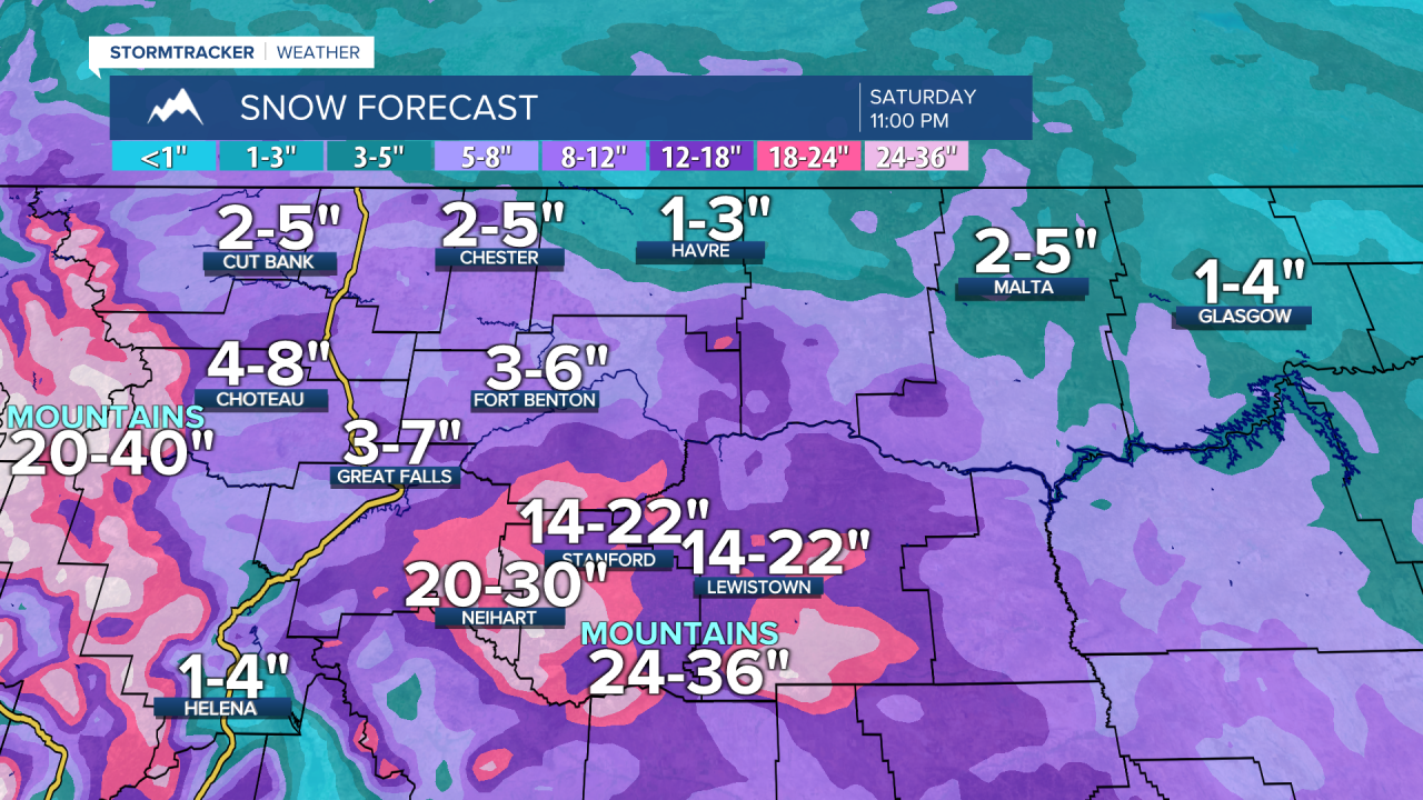
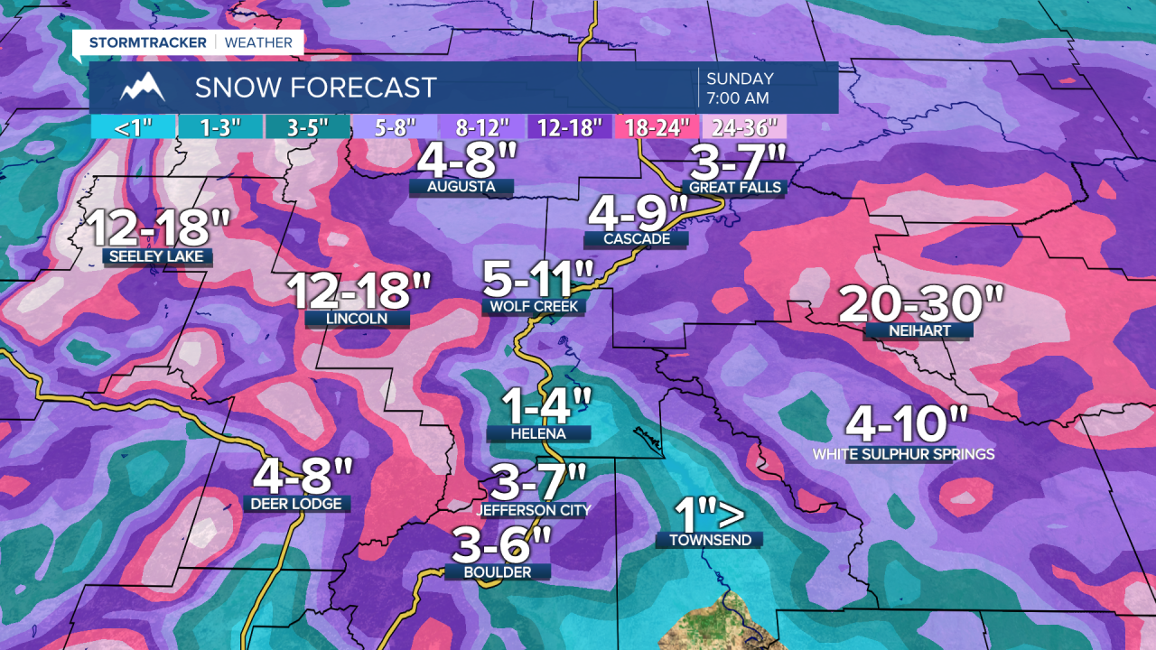
The mountain ranges in central Montana will pick up 1 to 3 feet of snow! The Little Belt, Highwood, Judith and Snowy mountains will receive the highest amounts.
Forecast snow totals through Sunday morning:
Outside of this area, there will still be accumulating snowfall, but it will be generally lighter and less impactful. Roads could still be very slick.
A major warmup is on the way next week as a strong high pressure ridge builds into the western United States. By St. Patrick’s Day, highs will be into the 60s and then several days in the 60s and 70s after that. Record highs will be challenged.


