


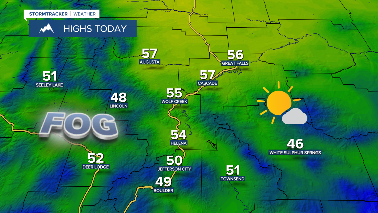
Happy Thursday! Today will be the nicest day of the week weather-wise. Most of the area will see decreasing clouds; however, the clouds will linger longer in Fergus County and areas east of Havre on the Hi-Line. It will warm up nicely into the 50s and low 60s, but it will be cooler in Fergus County and northeast Montana, with high temperatures only reaching the upper 40s and lower 50s.

Check out the forecast:
Winds will start to pick up tonight along the Rocky Mountain Front, and widespread gusty winds will develop across central and eastern Montana on Friday. Wind speeds will be between 15 and 35 mph, gusting over 50 mph along the Rocky Mountain Front, and between 10 and 30 mph, gusting over 40 mph elsewhere.

Friday is going to start off with sunshine, but clouds will roll in during the afternoon and evening, with scattered rain and mountain snow showers developing across the area. A coating to 3 inches of snow could pile up Friday evening through Saturday morning in the mountains. There may also be some brief bursts of heavier snow in the mountains.
The system will clear out quickly Saturday morning, making way for mostly sunny skies, dry conditions, and pleasant temperatures. Highs will be in the mid to upper 50s. Breezy southwest winds will blow between 10 and 25 mph.
Another storm system will move in on Sunday into Monday, bringing increasing clouds and more rain and mountain snow showers. Another round of gusty winds is also expected on Sunday, with sustained wind speeds between 10 and 30 mph and gusts over 40 mph. Temperatures will be mild on Sunday, with highs in the mid to upper 50s and low to mid 60s. It will stay breezy and cooler into Monday, with highs in the upper 40s and lower 50s.
A warming trend will then develop for the rest of next week, with temperatures rising into the 50s and 60s. Expect nice weather with mainly sunny skies, mostly dry conditions, and pleasant temperatures.


