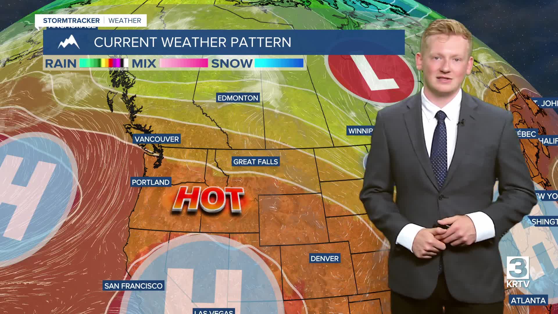


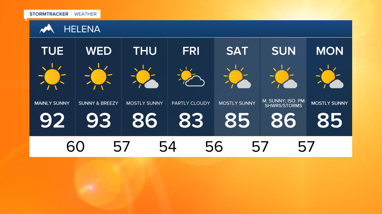
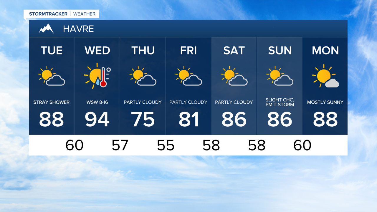
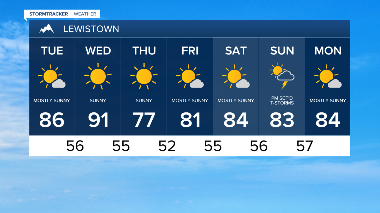
It's been two and a half weeks since we hit the 90s in Great Falls, but we'll back to the sizzling heat today and on Wednesday. A high pressure ridge to our south will expand into Montana, and that'll also generally keep us on the dry side. However, there could be an isolated shower or thunderstorm in northeast Montana later tonight.


Today will get a little breezy towards the Rocky Mountain Front, then the wind gets stronger for everyone on Wednesday as a front approaches from the west. This will elevate the fire danger, especially in southwest Montana, where a Fire Weather Watch is in effect from noon to midnight Wednesday. Gusts could reach 40 mph west of I-15!


By Thursday and Friday, we'll drop those temperatures a bit behind a cold front that'll move through Wednesday night. Highs will be back in the upper 70s and lower 80s. A stray shower or thunderstorm is not out of the question, but a mostly dry rest of the week is expected for the region.
This weekend is trending warmer, with highs mostly in the mid to upper 80s. It does look like we'll bring in some scattered shower and thunderstorm chances Sunday evening.

Here's something to cool you off as we deal with sizzling temperatures the next couple of days:

