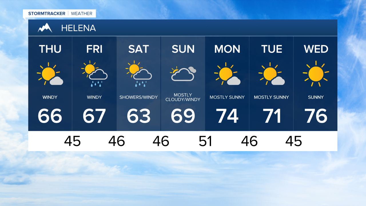
Brace yourself... Even stronger wind is on tap on Thursday as a cold front moves through the state.
The strongest wind is expected just north of Great Falls extending to the high line.
Wind gusts near 80 mph are very possible in this region.
The strong wind, low humidity, and dry vegetation has warranted The National Weather Service to issue a Fire Weather Warning for this afternoon.
A few scattered showers can't be ruled out with the passage of today's front, however the best chances for moisture remain over the mountains.
This passing cold front will keep daytime high temperatures a bit cooler on Thursday, with highs expected in the upper 60s.
Temperatures will trend still cooler on Friday following the passage of Thursdays cold front.
The wind is also expected to remain strong as we near the weekend.
On Friday and Saturday we'll have a better chance of picking up a few showers in Central Montana.
Temperatures will begin to regain some strength on Sunday as a ridge of high pressure begins to build off the Pacific Coast.
This pressure system will have the potential to drive temperature well above average by Wednesday of next week.