A band of moderate snow has formed from the Cut Bank area, extending southeast across Chouteau, Fergus, and Judith Basin Counties. Be alert for low visibility and slick road conditions. Icy conditions continue in Lewis & Clark and Broadwater counties, where snow fell on top of ice after some freezing rain overnight. Up to a 1/4" of ice has been reported on cars and sidewalks. Freezing rain may mix in again this morning as milder air begins to move back in.
Today's Forecast:
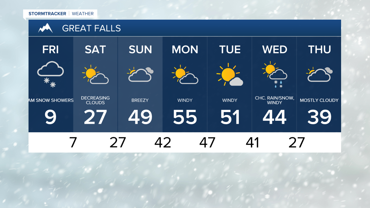
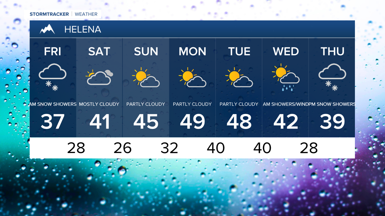
It will be a frigid today, with high temperatures in the 0s and lower 10s across central and eastern Montana, and mid to upper 30s in Helena.
The snow band will continue throughout the day, bringing several inches of snow to areas east of I-15. The band of snow will gradually push east tonight, impacting Blaine, Phillips, and Valley counties overnight. Snow showers taper off by Saturday morning.

- Road Conditions: click here
- MDT Webcams: click here
- MTN Cameras: click here

Expect difficult driving conditions through Saturday morning, especially east of I-15 and into the mountains.
Arctic air slowly retreats north on Saturday. Temperatures start off in the -10s to near 0 on the Hi-Line and in the 0s for central Montana, then climb to the 0s and 10s for the Hi-Line and 10s to 20s in central Montana by Saturday evening.
Meanwhile, it will be a pleasant weekend in Helena with temperatures in the low 40s. A gusty breeze develops on Sunday, as temperatures warm nicely into the low to mid 40s in central Montana and into the 30s in northeast Montana.
Looking ahead to next week, mild and windy conditions kick off the workweek, followed by active weather returning midweek.