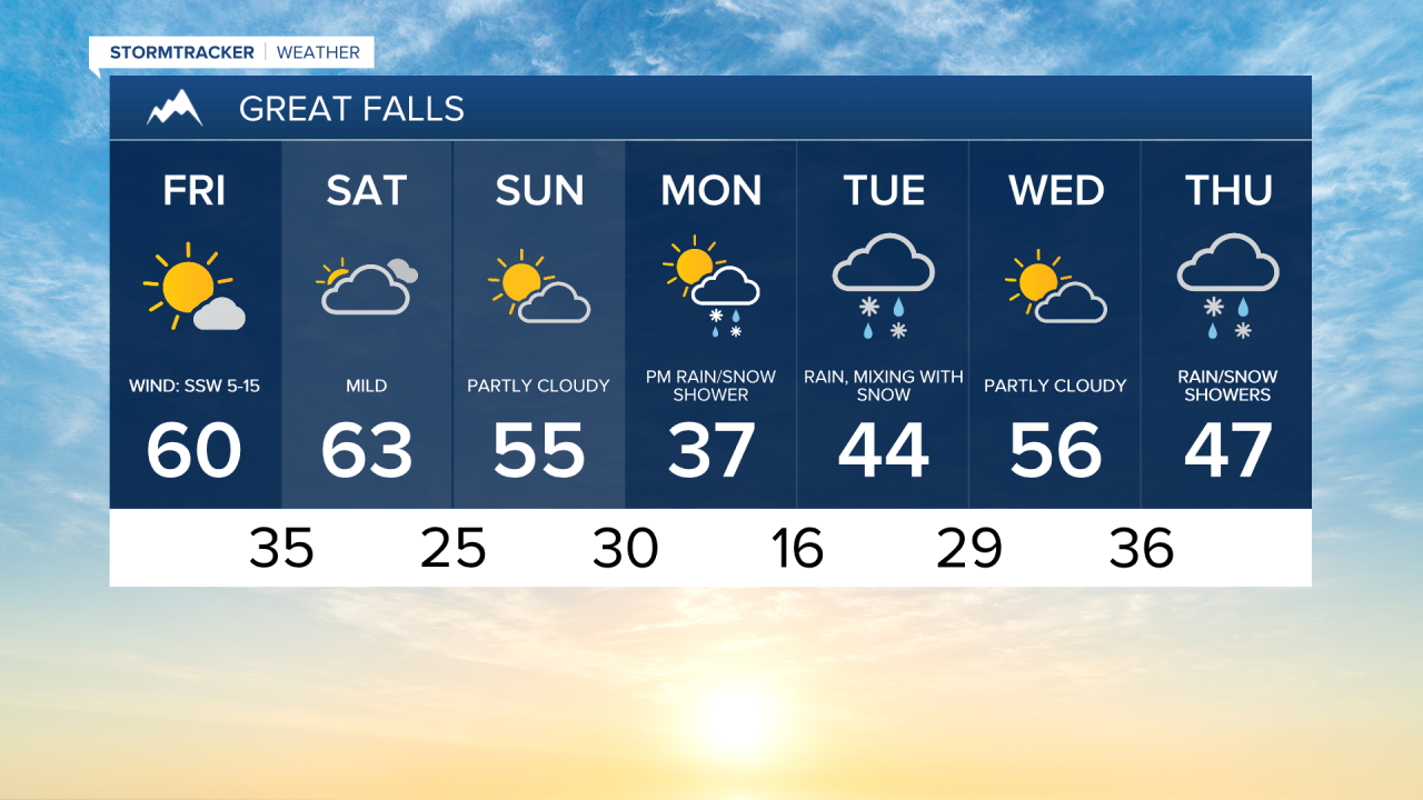
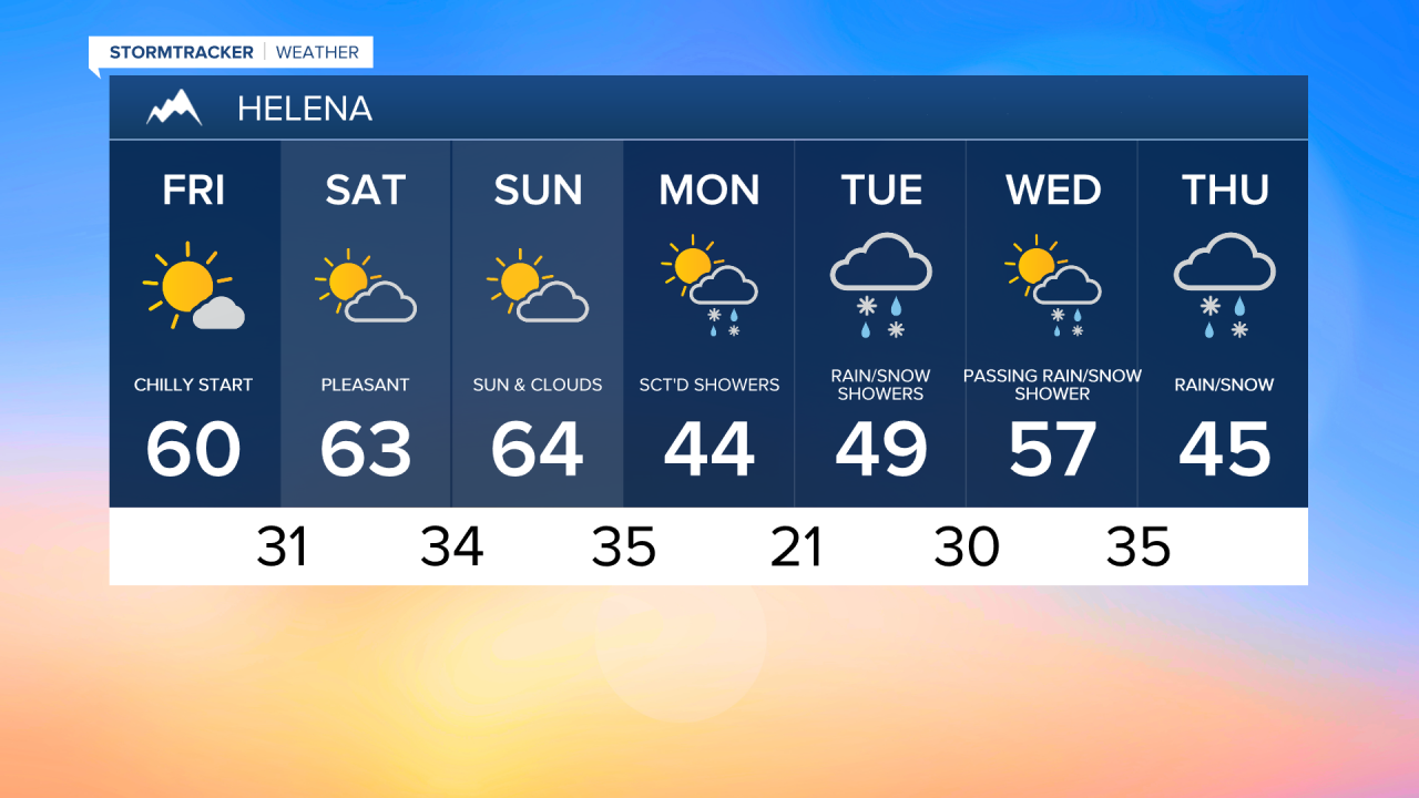
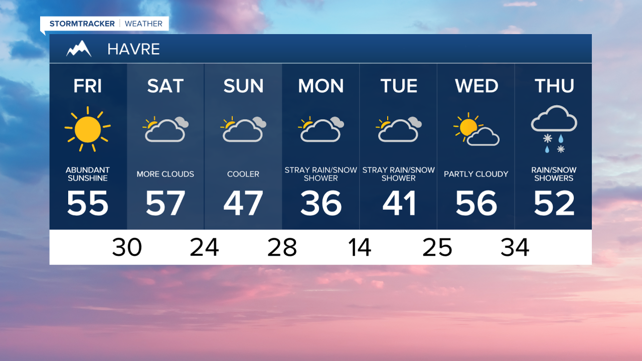
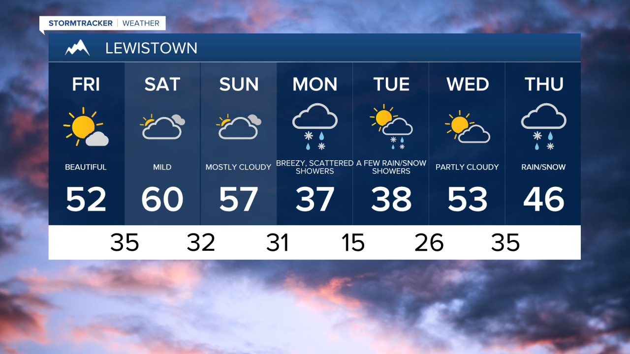
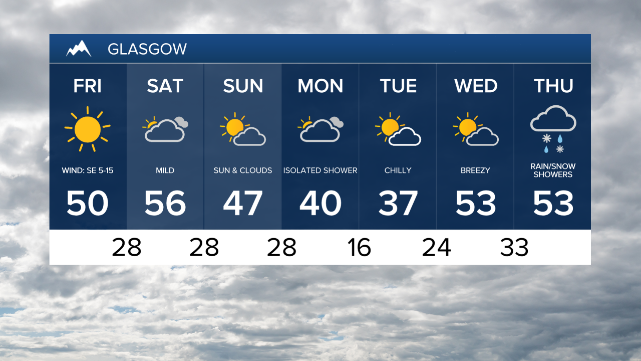
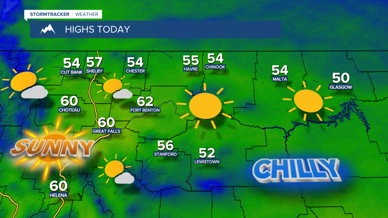
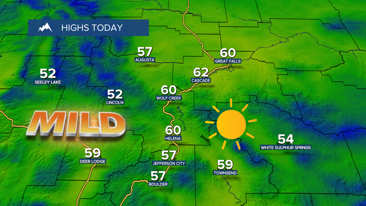
Happy Friday! Clear skies and lighter winds Thursday night allowed temperatures to plummet into the 0s and 10s early Friday morning. That chilly start won't last long as temperatures rebound to the 50s and low 60s under abundant sunshine.
Friday Morning Forecast:
This quiet weather sticks around throughout the weekend, though we’ll see more clouds. High temperatures will be back up into the 50s and lower 60s.
On Sunday, a surface cold front will move south into northern Montana, causing a wide range of temperatures. Highs will be in the 40s along the Hi-Line, 50s in central Montana, and 60s in the Helena area.
Big changes are on the horizon! By Monday, gusty winds develop ahead of another, stronger cold front. A sudden drop in temperatures from the 50s to the 30s, with rain showers switching over to snow. Scattered rain and snow showers will continue into Tuesday, with high temperatures only reaching the upper 30s and 40s.
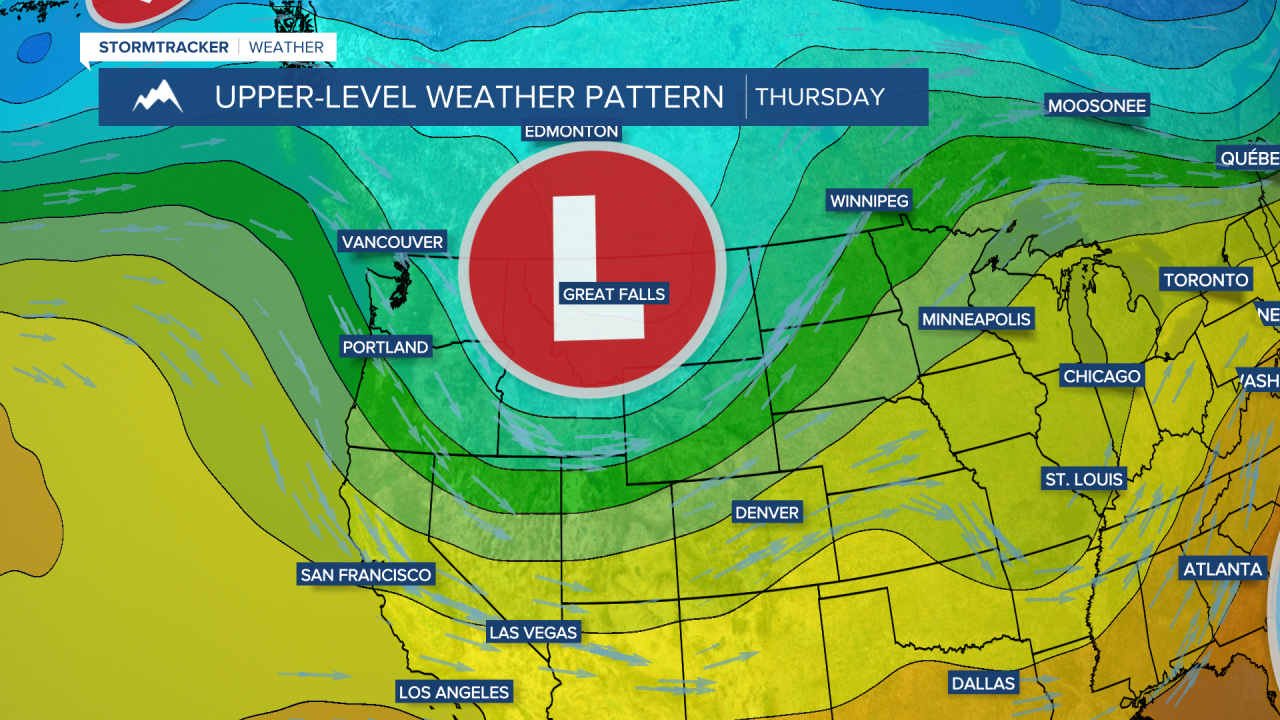
Meanwhile, a larger and more powerful storm system will develop along the Pacific Northwest coast. As it moves inland midweek, expect wet, cooler weather to persist. The mountains could receive significant snowfall, with accumulations of over a foot possible. There may also be some snow in lower elevations at times next week, especially overnight, as temperatures dip below freezing.