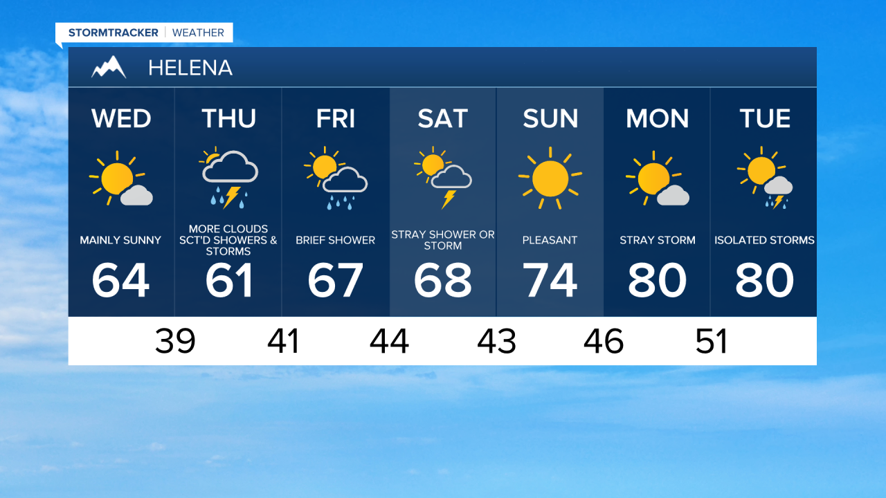
We've got another cool morning, with temperatures into the low to mid 30s in some areas. Keep an eye on your gardens and raised beds—you may want to cover any sensitive vegetation again tonight, as Thursday morning is expected to be another cooler one.
After some sunshine in the morning, clouds will increase and we'll see another chance for an isolated shower or thunderstorm, especially for the Hi-Line. The wind will be pesky again, with sustained wind speeds between 10 and 20 mph and gusts as high as 35 mph, particularly during the first part of the day. Temperatures will reach the upper 50s to low or mid 60s in the afternoon.

Our next system of note moves in on Thursday as a trough moves over the area. This will lead to increasing clouds and eventually scattered showers and a few thunderstorms during the afternoon and evening. The system will continue to slowly move through on Friday, so a few showers are possible again Friday afternoon. Temperatures will be near or slightly below average, with highs in the 60s to low 70s.


A high pressure ridge will amplify over the Mountain West on Sunday and into Memorial Day. This means temperatures will heat up and storm chances will diminish just in time for Memorial Day. Most areas are expected to reach the 70s on Sunday and Monday, with a few spots even hitting the low 80s on Memorial Day. A stray shower or thunderstorm is possible, but most areas are going to remain mostly dry.