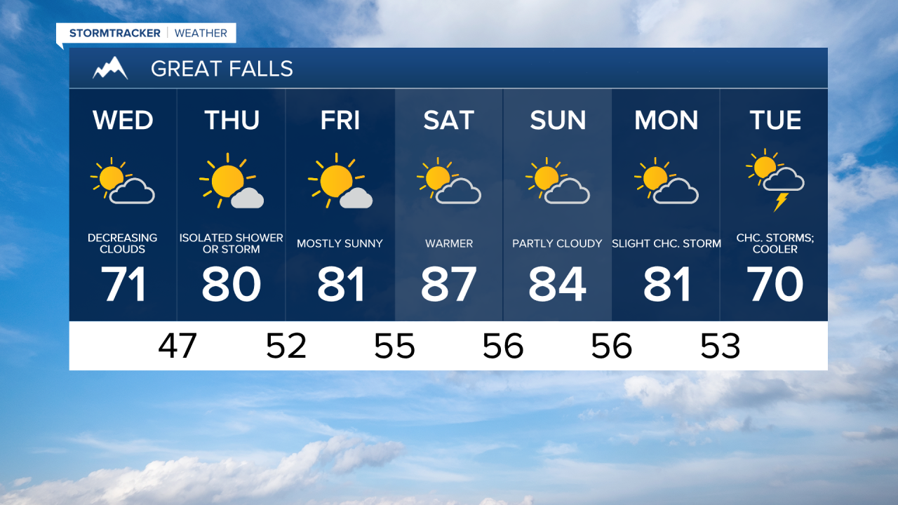
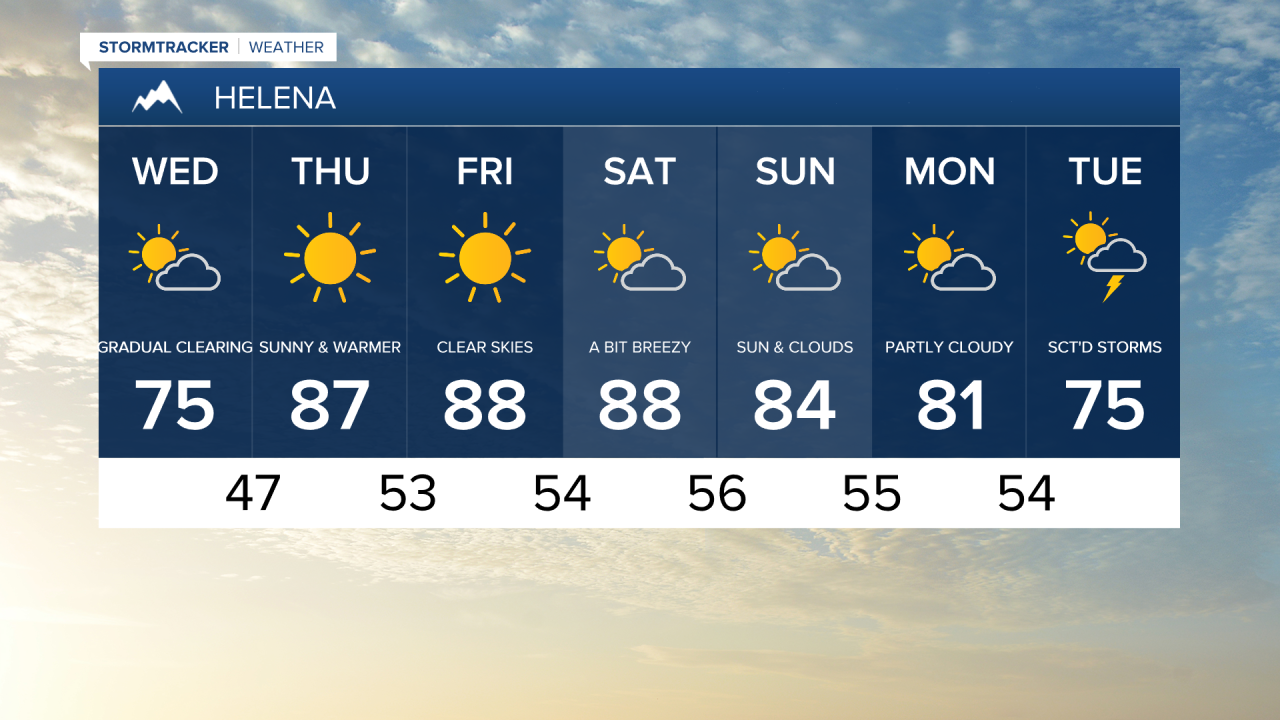
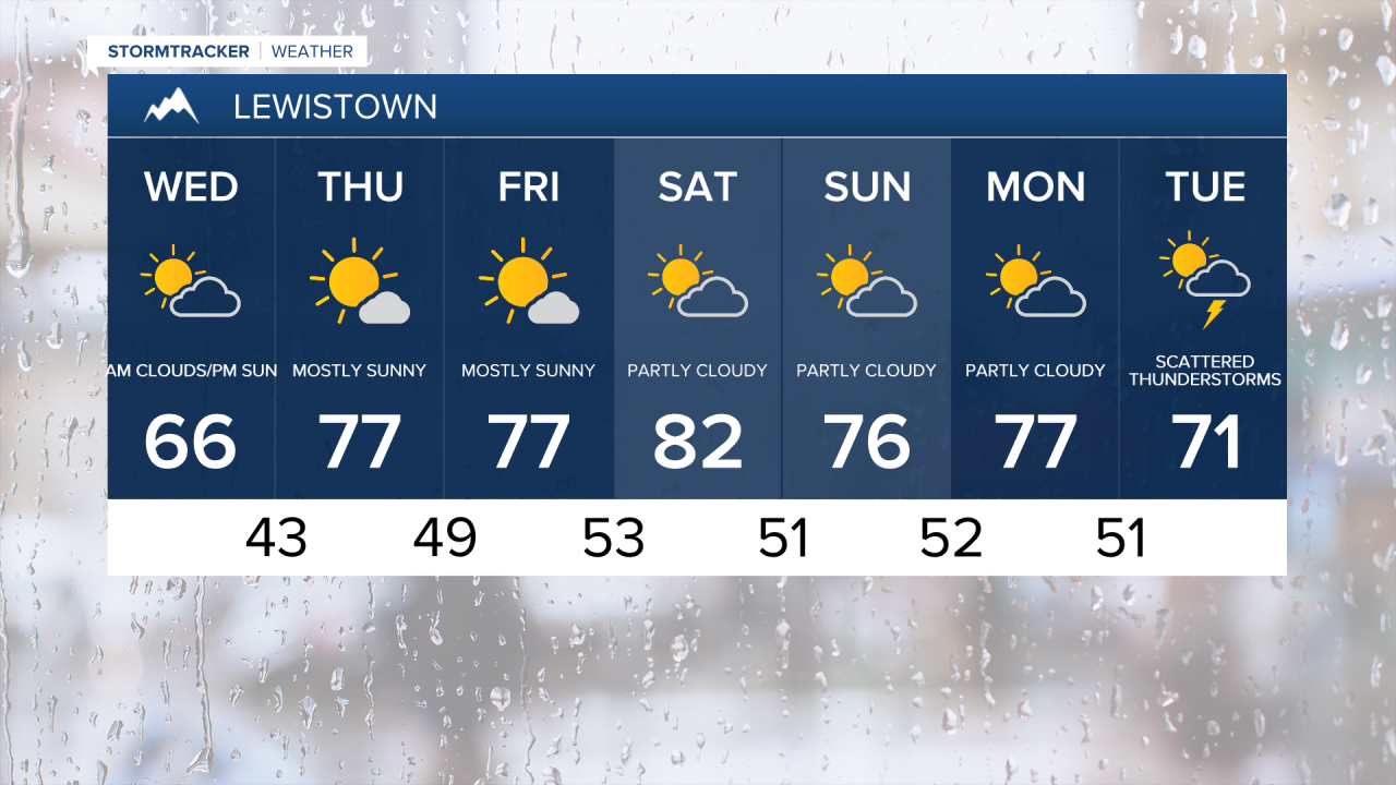
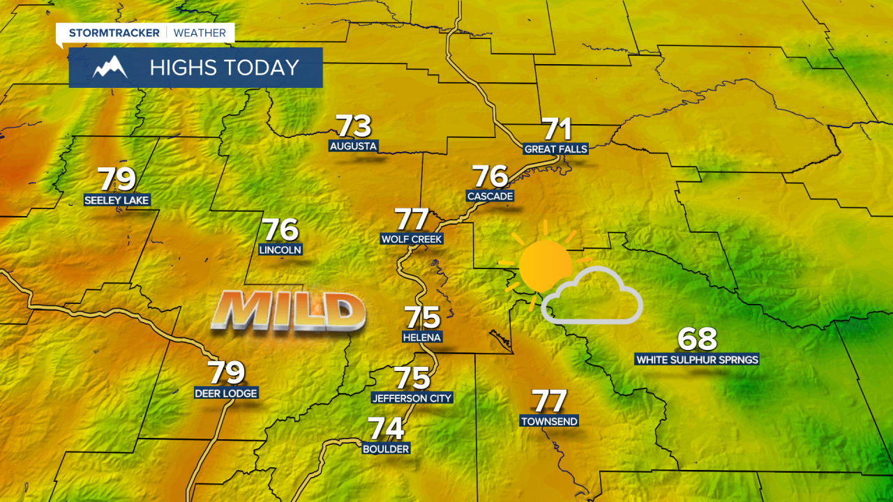
Wednesday will feature patchy fog and low clouds in the morning, and gradual clearing to sunshine for the evening. After waking up to smoke and poor air quality due to some Canadian wildfire smoke yesterday, a wind shift will clear us out for today. It will be warmer than yesterday, but still well below average with high temperatures in the upper 60s and low 70s.

A weak system passes through the Hi-Line on Thursday bringing another chance for showers and thunderstorms. Temperatures continue to warm with highs in the 70s and low 80s.
Sunny, warm and pleasant weather to close out the week. Then, we'll see a few more clouds and some isolated showers and thunderstorms for the upcoming weekend. A return to more typical July temperatures with high temperatures in the 80s.
A cooldown and scattered thunderstorms are likely next Tuesday as another system impacts the state. High temperatures will fall into the 60s and 70s.