Good morning! Strong, gusty winds have returned this morning and will peak early this afternoon, with gusts of 50-70 mph across the plains and 60-80+ mph along the Rocky Mountain Front.
Today's Forecast:

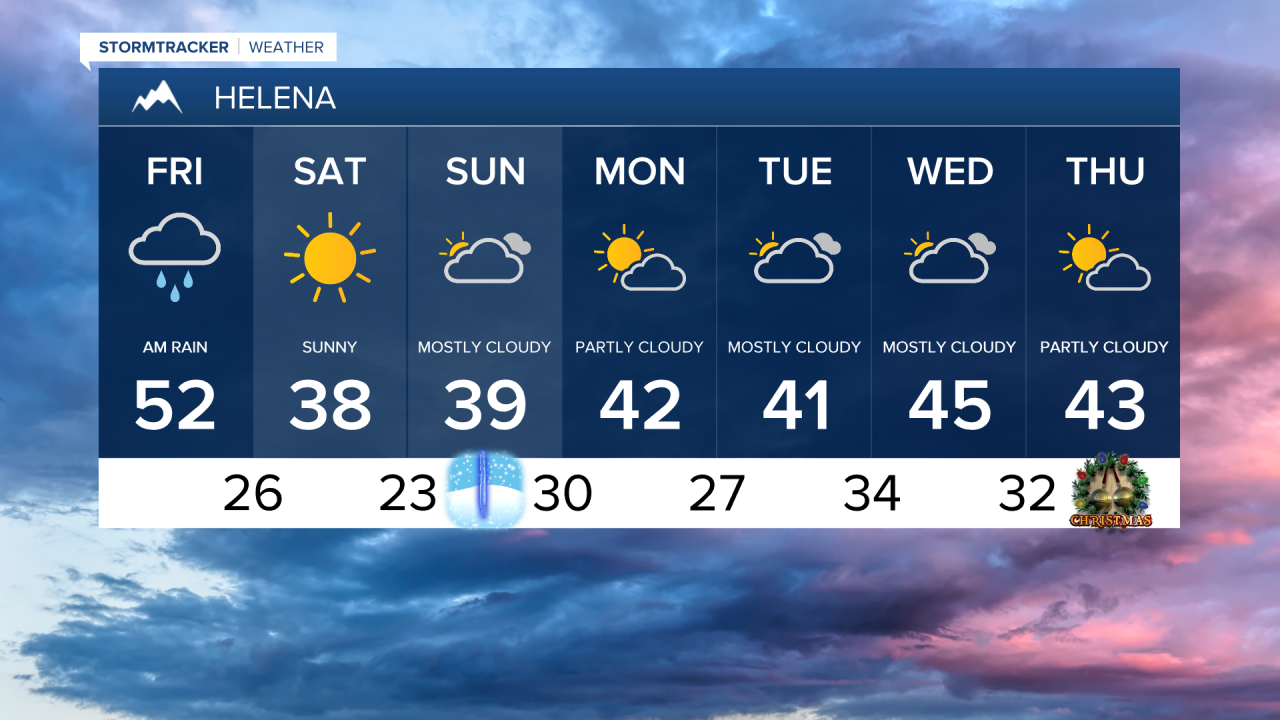
The strongest winds will last during the day on Friday, with winds gradually calming down after sunset on Friday night.


Temperatures are sitting in the 30s, 40s and 50s around central and eastern Montana. But, a cold front will drop south across the area this afternoon, causing temperatures to fall into the 10s and 20s by this evening.

Rain and mountain snow showers are falling along the Continental Divide for the next few hours, then clearing out overnight as a high pressure ridge builds in. Several inches of snow will accumulate in the mountains along the Continental Divide. Highway 2 is snow-covered from East Glacier to Essex.

Highs will be cooler in the 30s and lower 40s heading into the weekend, with more sunshine and continued breezy conditions. However, high winds are not expected.
A weak system could bring a few rain or snow showers to Helena early next week. High temperatures will range from the 20s and 30s on the Hi-Line to the upper 30s and 40s south of the Hi-Line.
Christmas Eve and Christmas Day will be partly cloudy, with high temperatures in the upper 20s and lower 30s on the Hi-Line and upper 30s to 40s south of the Hi-Line. We may see a few rain or snow showers on Christmas Eve, but Christmas Day looks to be dry.