


A beautiful day is in store for central and eastern Montana. More sunshine and highs set to climb to the upper 60s and low to mid 70s.


Staying dry through the end of the week as high pressure is over the region. Temperatures will be above average in the upper 60s and 70s Thursday and Friday.
Check out the forecast:
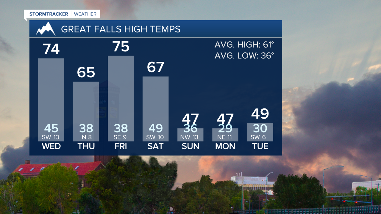
A Pacific cold front will move across the area on Saturday, bringing the next chance for showers and even a few thunderstorms during the afternoon and evening. The most significant impact will be widespread gusty winds on Saturday, with gusts exceeding 40 mph across the plains, and possibly over 50 mph along the Rocky Mountain Front.

A secondary cold front drops south from Canada on Sunday. Snow levels will fall behind this front, potentially dropping as low as 4,000 feet. Mountain snow will continue Saturday night into Sunday, which could lead to slippery travel, especially over Marias Pass. Scattered rain and snow showers are possible in the lower elevations on Sunday. It will be cold, with high temperatures in the 30s in the mountains and in the 40s in the lower elevations.


The low pressure system will remain over the region into early next week, maintaining the chance of unsettled weather on Monday and Tuesday. It will stay chilly into next week, with high temperatures in the 40s and low 50s.


