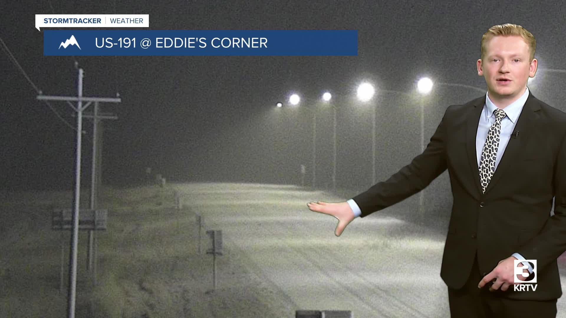


Snow is coming down at a good clip for much of central Montana and portions of the Hi-Line early this Tuesday morning. It's a heavy, wet snow with temperatures near or slightly above freezing, so roads will be very slushy. Please leave extra time and take it slow on your morning commute.
Today's Forecast:
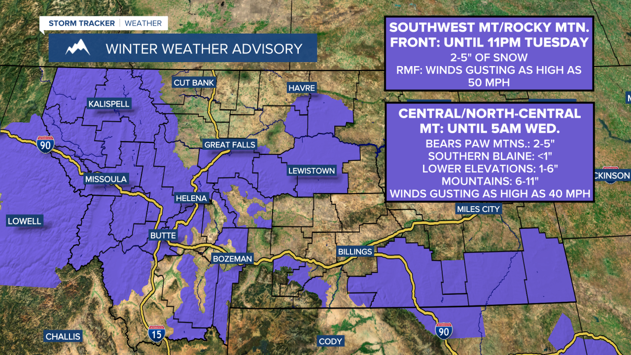
There's a Winter Weather Advisory in effect through late tonight or early tomorrow morning for the purple-shaded areas. Generally, lower elevations will receive 1-4 inches of snowfall and the mountains will receive 4-10 inches of snowfall. Areas like Lewistown and between Belt and Geyser along Highway 87 could pick up 4-7 inches of snowfall.
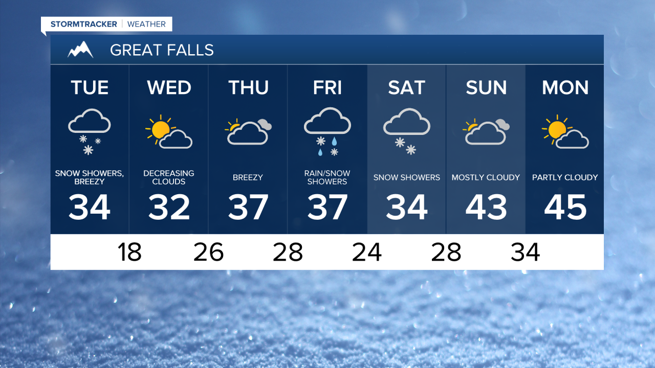
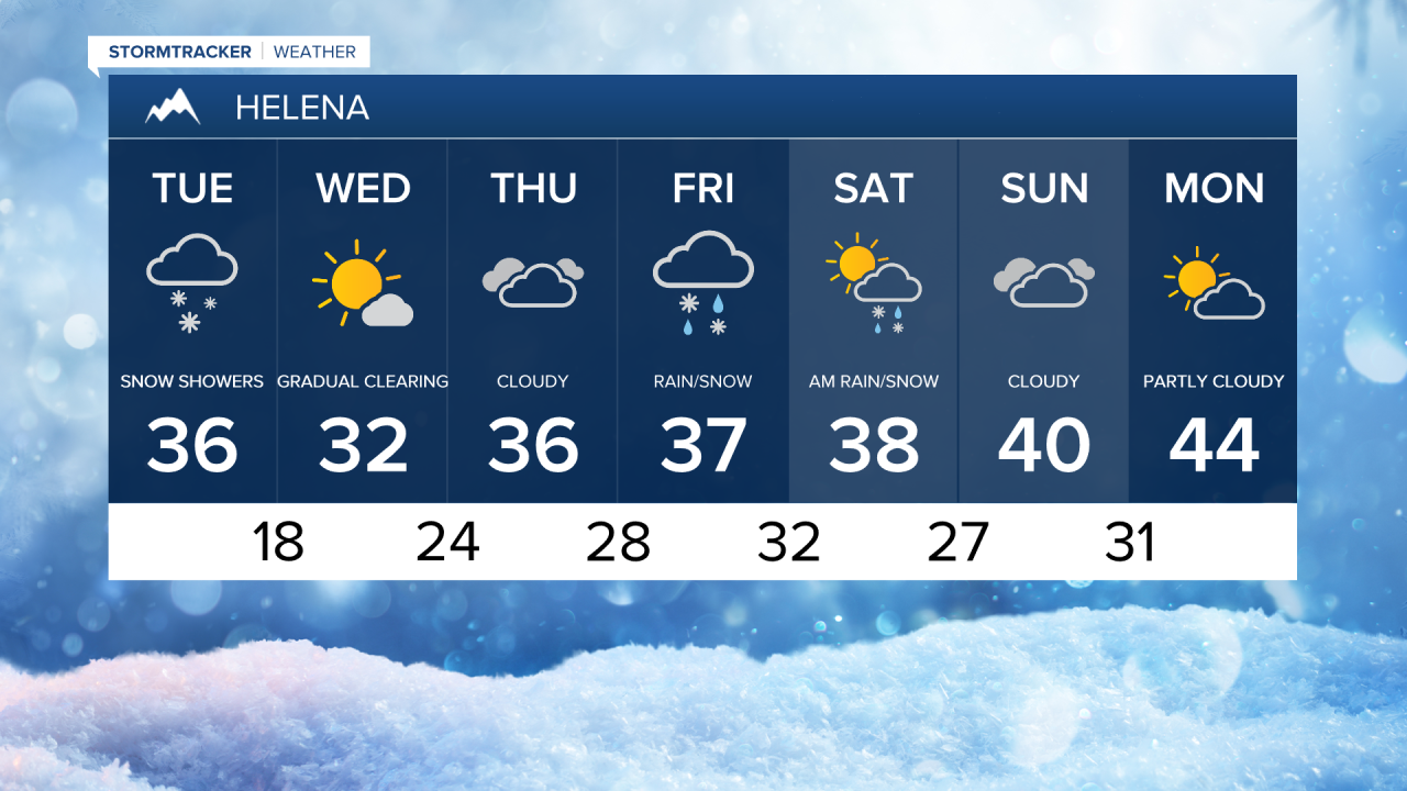
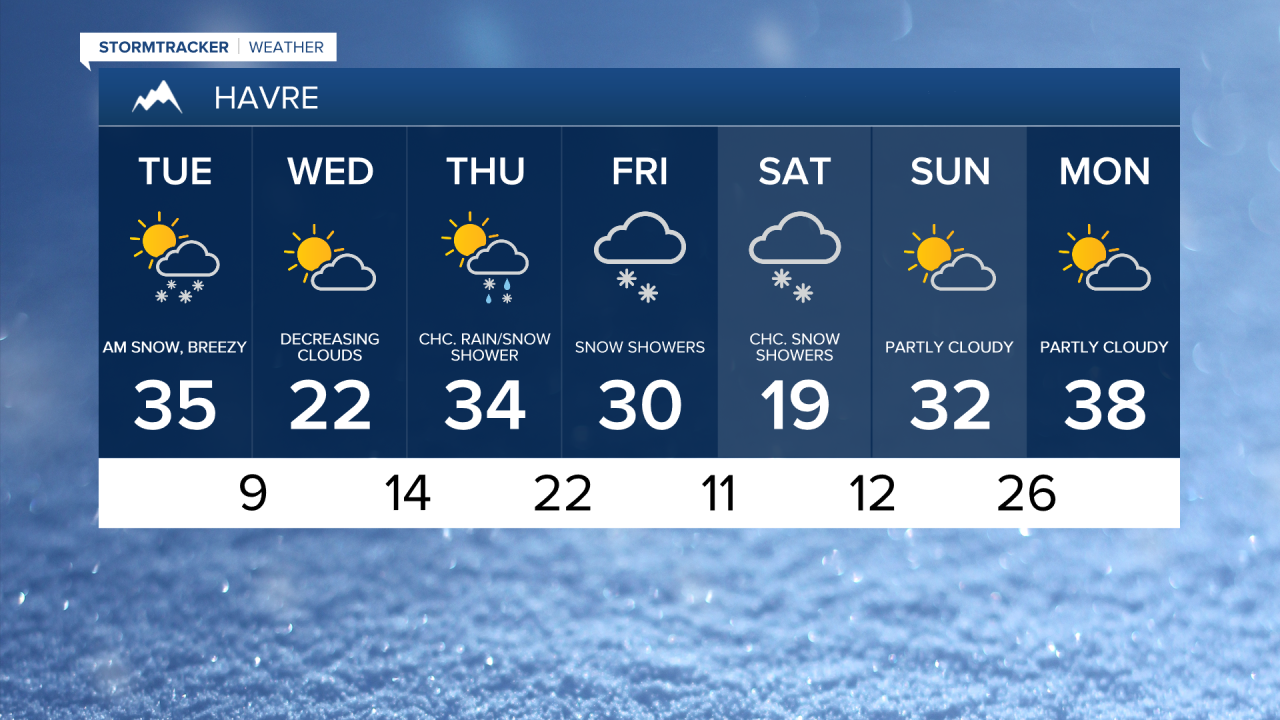
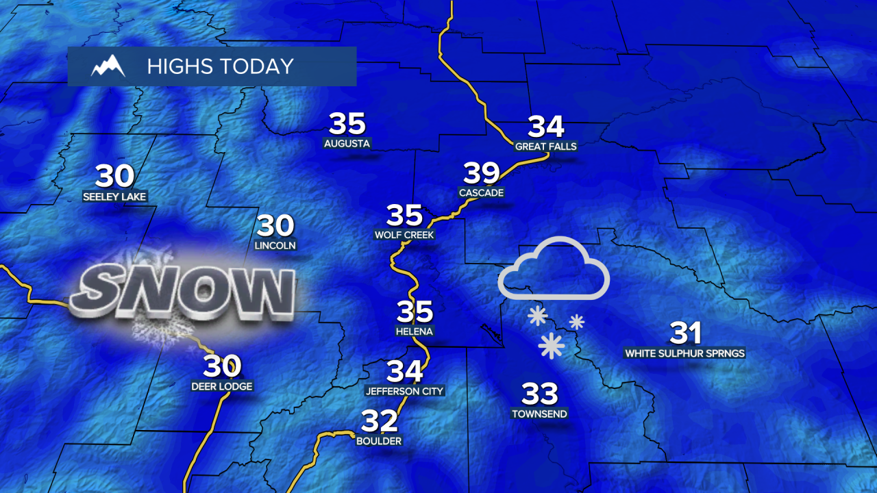
Highs will be in the upper 20s and low to mid 30s. A breezy west-southwest wind at 10-25 mph could lead to blowing snow and low visibility at times, especially between Great Falls and Lewistown on Highway 87.
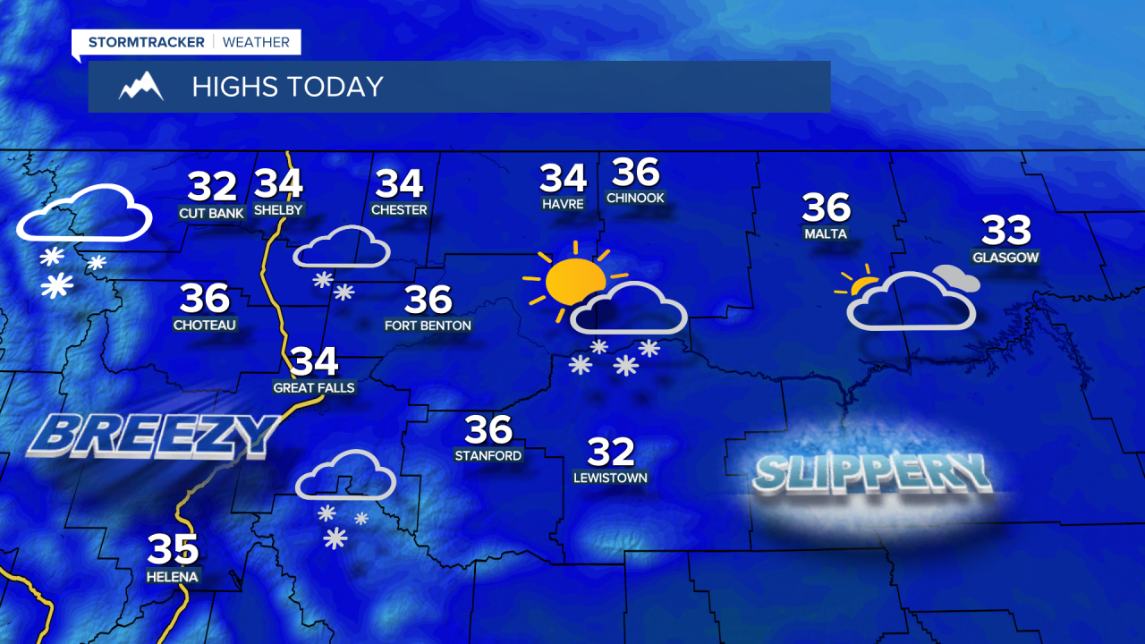
Intermittent snow showers throughout the day will gradually taper off. A chilly night ahead as temperatures fall back to the -0s and 0s for the Hi-Line east of Havre and 10s for north central Montana.

Skies gradually clear on Wednesday, with cold highs for the Hi-Line in the 10s and lower 20s and upper 20s and 30s across central Montana. Gusty winds start to develop for the Rocky Mountain Front and adjacent plains, and then those stronger winds push east across the plains by Thursday morning.
Another system will bring a mix of rain and snow to central Montana later Friday into Saturday. Precipitation begins Friday during the PM hours and gradually tapers off on Saturday.
Milder temperatures are expect Sunday into Monday, with high temperatures in the 20s for northeast Montana, 30s for the Hi-Line and low to mid 40s in central Montana.