


Tuesday felt more like the middle of summer than the middle of May. Poplar hit 102°, making it the hottest town in the entire nation. Temperatures surged into the 80s and 90s across much of Montana as well.
Wednesday Morning Forecast:
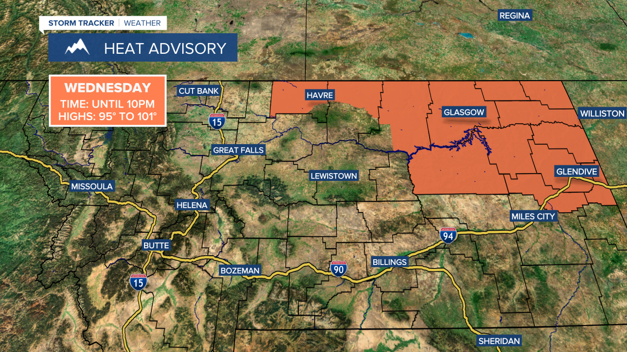
The heat continues for the Hi-Line and eastern Montana on Wednesday, where highs will climb back into the 90s to near 100. A Heat Advisory is in effect until 10pm for Hill, northern Blaine, Phillips, Valley and Daniels counties. Central Montana will be a touch cooler with highs mainly in the 80s. Most areas stay dry under partly to mostly cloudy skies, but a few isolated thunderstorms could develop during the afternoon and evening with gusty winds and brief downpours.


Isolated thunderstorms will pop up Thursday and Friday afternoons too, with gusty outflow winds, lightning and quick downpours the main threats. Temperatures stay very warm, with highs in the 80s and low 90s across central Montana and mid to upper 90s in eastern Montana Thursday. Friday will be similar, with 80s to near 90 in central Montana and 90s in eastern Montana.
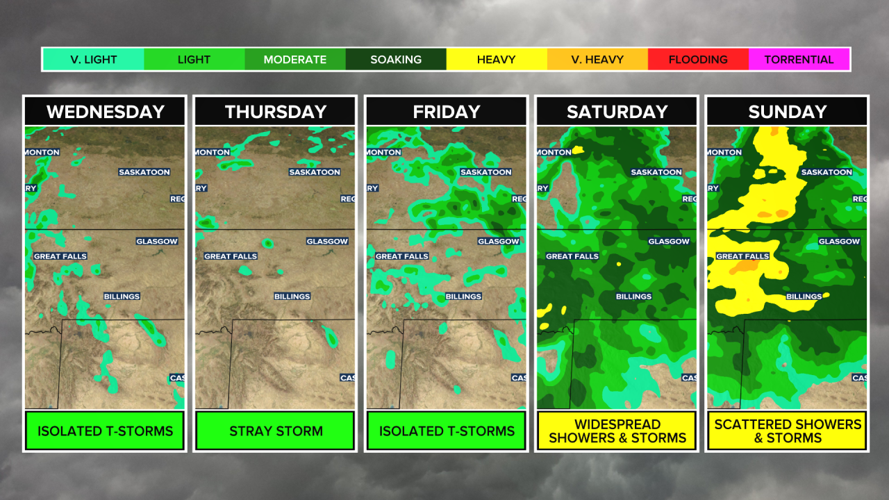
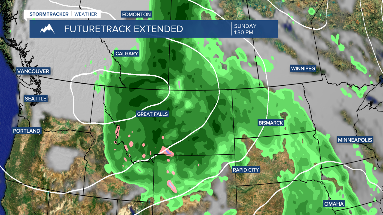
A cold front moves through late Friday night into Saturday, bringing more widespread showers and thunderstorms. Behind the front, much cooler weather and widespread showers continue through the rest of the weekend. Eastern Montana will still make it into the 70s and 80s ahead of the front Saturday, while central Montana cools into the 50s and 60s. By Sunday, highs will only reach the 50s in central Montana and the 60s to low 70s farther east.
This round of rain is looking increasingly promising for beneficial and much-needed moisture across much of the area. There’s a strong signal that a lot of central Montana could pick up at least 0.5" of rainfall, with some spots receiving over 1". There’s still a little more uncertainty with rainfall amounts farther east. Stay tuned.


