
WEATHER DISCUSSION: Sunday saw another warm day, with more active weather. Partly cloudy skies and high temperatures in the 70’s and 80’s were around for most of the day before shortwave troughing within a southwesterly flow interacted with moisture this afternoon to produce scattered showers and thunderstorms.
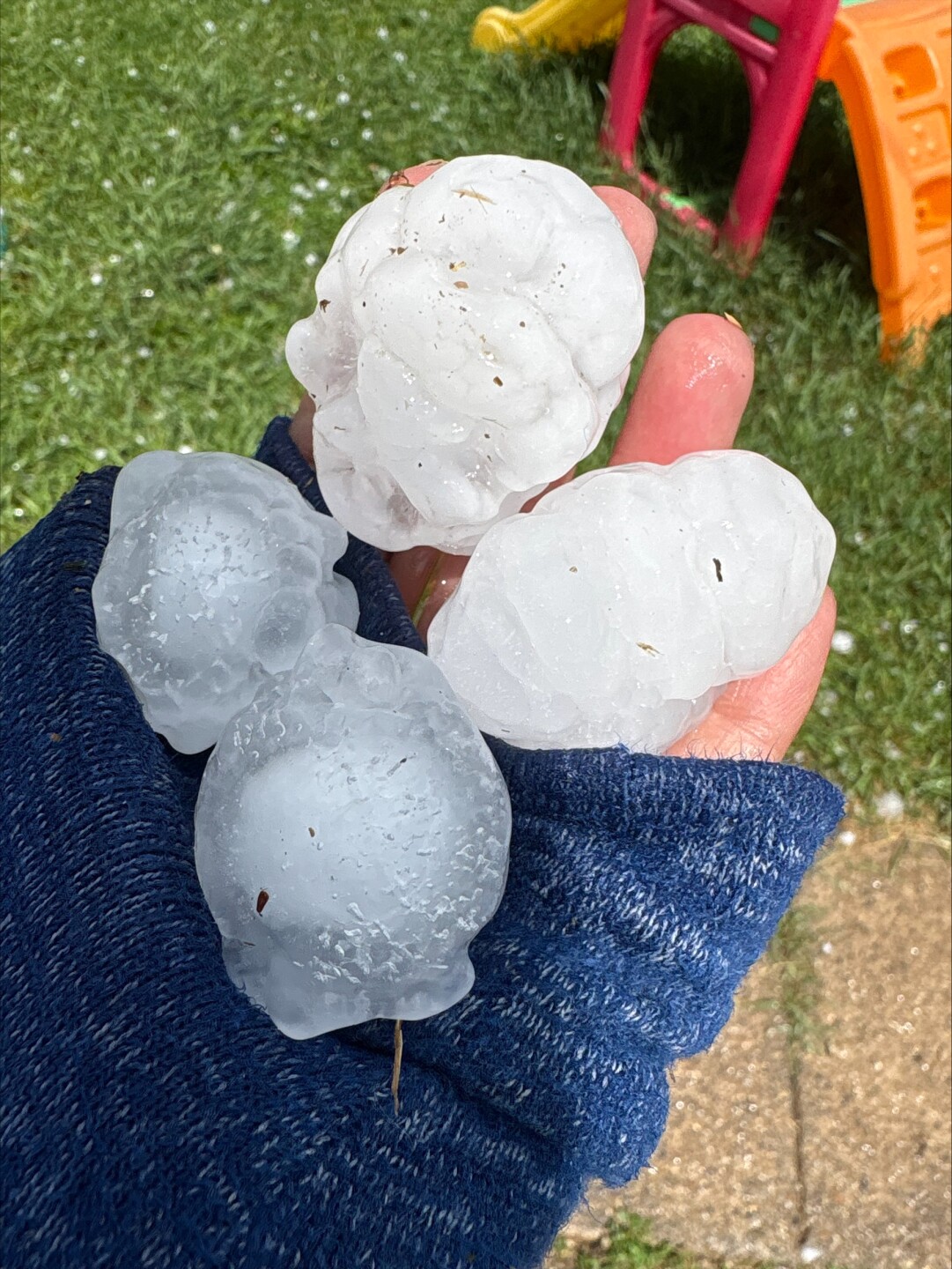
These storms were the talk of the region, with most of Central Montana getting hit with the most severe thunderstorms. Hail was the biggest threat, getting as big as 2 inches in Judith Basin and Fergus counties.

This activity moves eastward this evening, largely exiting by 9 PM or so. There does look to be some lingering support and instability for elevated showers and perhaps a thunderstorm or two tonight, mostly south of Great Falls and near Lewistown.
Otherwise, expect low temperatures in the 40’s and 50’s tonight with partly cloudy skies and 5 to 15 mph winds.

Monday and Tuesday, another wave within the southwesterly flow moves across the region tomorrow afternoon and evening. Although there looks to be at least low-end instability over the vast majority of the region, most severe thunderstorms look to stay around Southwest Montana, east of I-15. Both gusty winds and hail will be the concern with the thunderstorms that form. Expect high temperatures tomorrow to remain in the 70’s and 80’s with otherwise partly sunny skies and 5 to 15 mph winds.

Instability remains heading into Tuesday, though shear diminishes as weak shortwave ridging develops. Showers and thunderstorms are still likely, though look to be less organized in nature than this evening.
For the end of the upcoming week, a brief period of ridging develops Wednesday, yielding a brief period of dry weather. Daytime mixing Wednesday should yield marginally breezy conditions over the plains. More opportunities for showers and isolated thunderstorms will occur Thursday and Friday afternoon and evening but temperatures look to stay in the 70’s and 80’s for most of the area this period.


