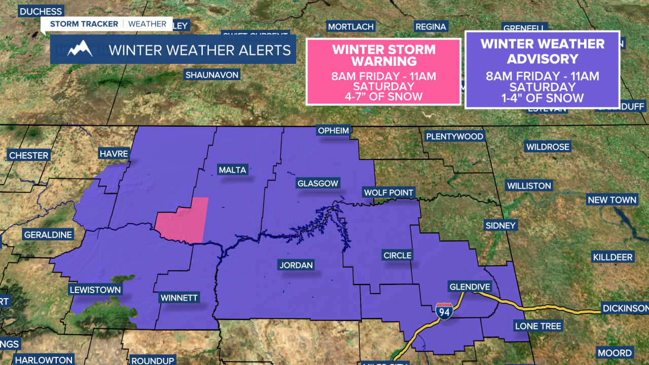
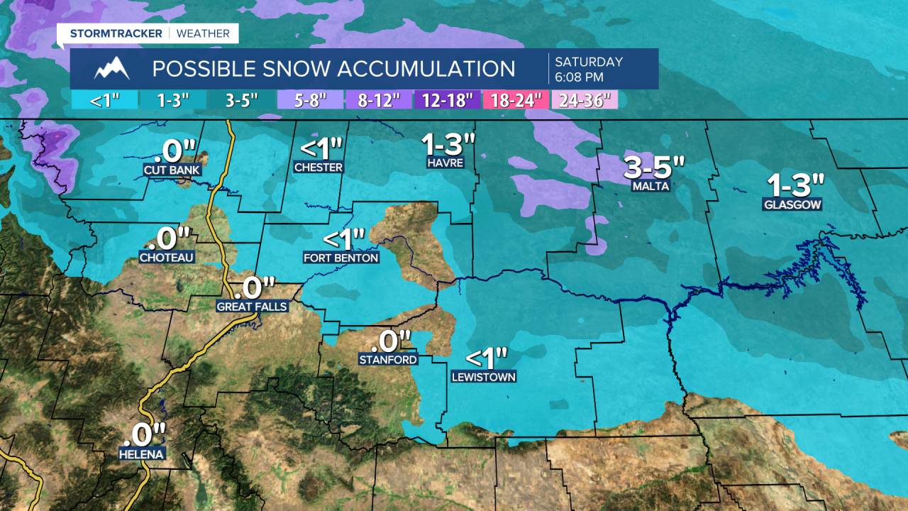
A clipper system moving along the Canadian border will bring snow and colder air to the Hi-Line and eastern Montana later today through early Saturday morning. Snow accumulation will range from a dusting to 3 inches in these areas, with heavier snowfall of 4-7 inches in the Bear Paws and the Little Rockies.
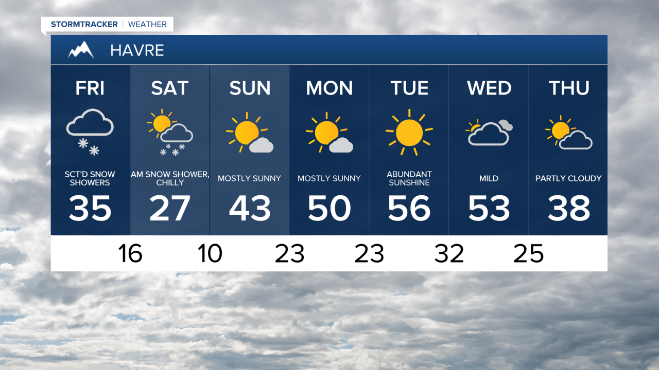
Today's Forecast:
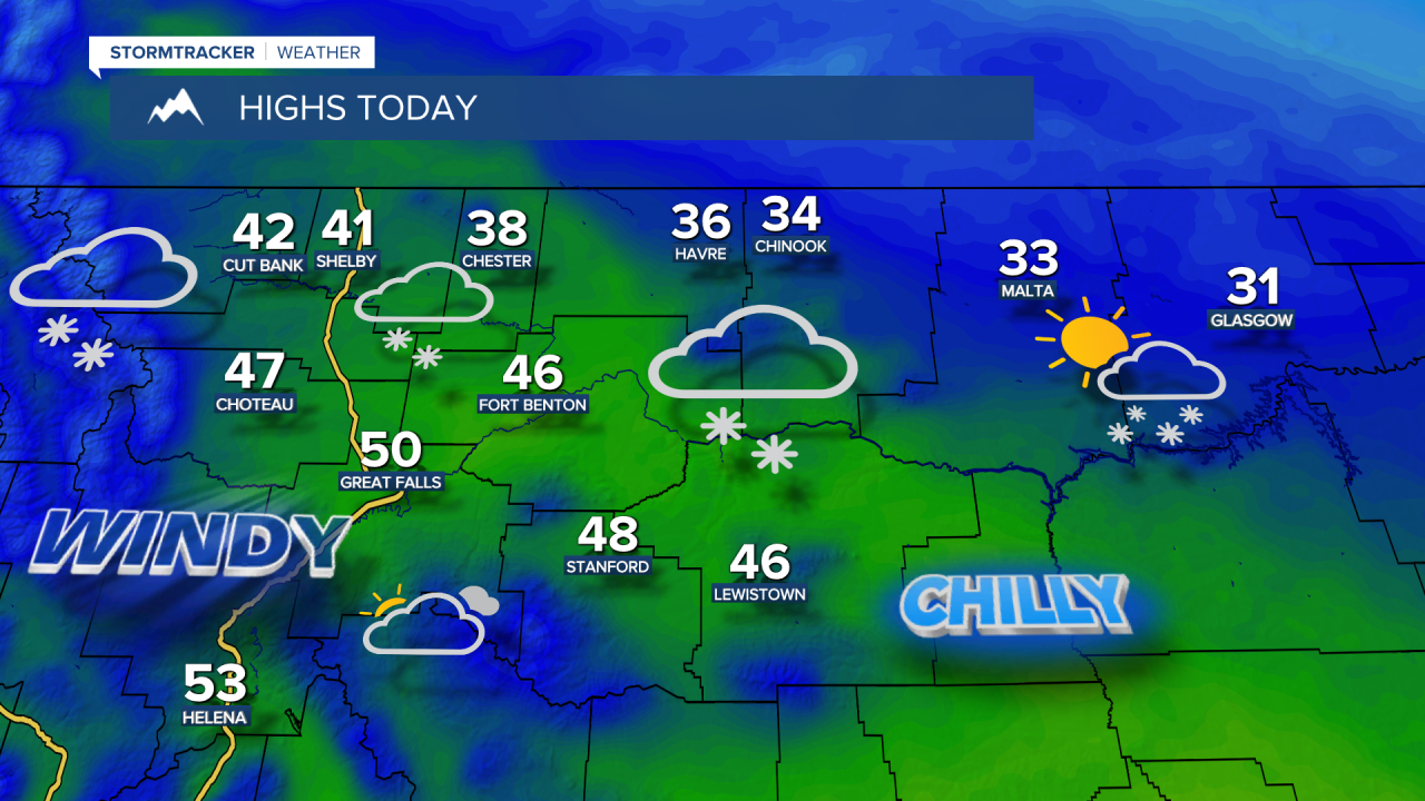
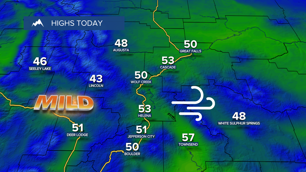
Outside of the Hi-Line, gusty winds continue but will gradually die down from north to south as a cold front moves down from Canada into northern Montana. Skies will be mostly sunny to partly cloudy south of the Hi-Line, with increasing clouds and scattered snow showers developing to the north. Daytime highs in the 30s and low 40s on the Hi-Line, and upper 40s to lower 50s south of the Hi-Line.
High temperatures turn much colder on Saturday, ranging from the 20s in northern Montana to the 40s around Helena, accompanied by a chilly northwesterly breeze. Skies will gradually clear from south to north throughout the day.
Sunday, March 1st, marks the start of Meteorological Spring. It will begin with a cold start, with temperatures in the 0s and 10s, but it should be pleasant in the afternoon with highs in the 40s and 50s and plenty of sunshine.
Monday and Tuesday stay mild and mostly sunny, with highs in the 50s. However, a storm system is expected to bring rain and snow showers next Wednesday, along with cooler weather for the second half of the week.
On Tuesday, March 3, there will be a chance to see a blood moon during the total lunar eclipse, which will turn the moon red for about an hour early that morning. The Earth moves between the sun and the moon, blocking most of the sunlight from reaching the lunar surface. During this event, the moon will be immersed in Earth's shadow, known as the "umbra." The eclipse will begin at 4:04 AM Mountain Time and last approximately 58 minutes.