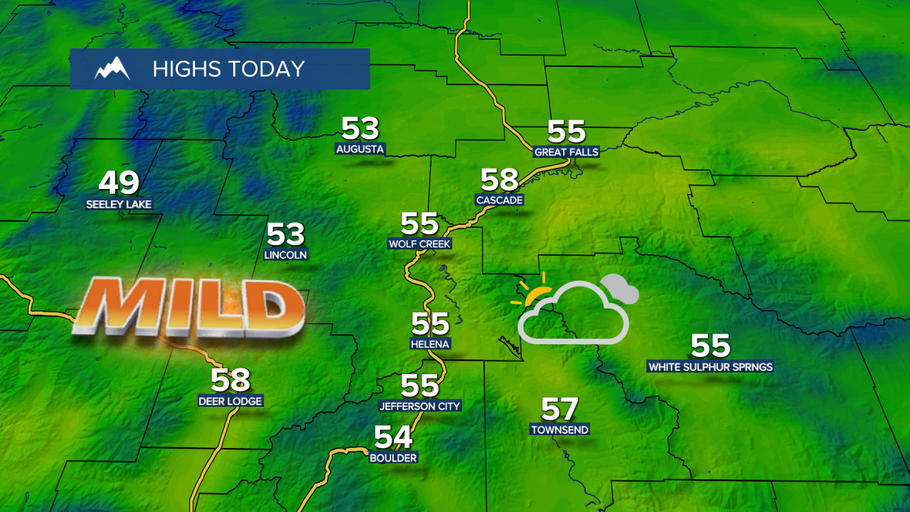
Following a cool and cloudy Tuesday, with highs in the low to mid 40s across central Montana, we will warm up today. Still, expect cloudy skies and some scattered rain and mountain snow showers, especially during the evening. Temperatures will climb into the upper 40s and 50s this afternoon.

Here's the detailed forecast:
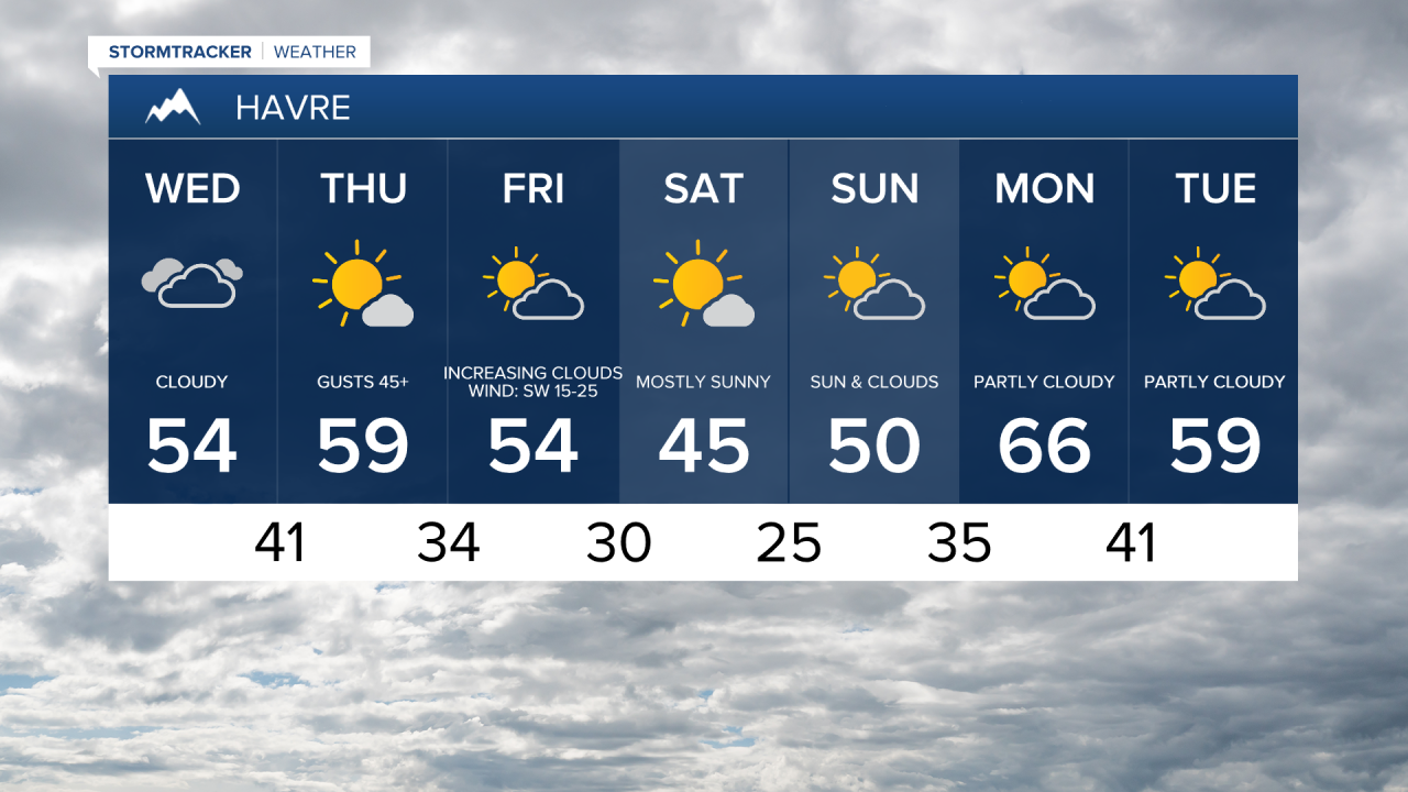
A High Wind Watch is in effect for the Hi-Line Wednesday night into Thursday. Gusts up to 60 mph are possible. Travel will be difficult for high-profile vehicles. The worst of the wind will be Thursday morning and afternoon.

Widespread gusty winds are expected for the rest of the area, with wind speeds between 15 and 35 mph and gusts of 40-50+ mph Wednesday night into Thursday. While there will be some sunshine on Thursday, it is still possible we'll have a few isolated rain and mountain snow showers throughout the day. Daytime highs will mid to upper 50s in central Montana and lower 60s in eastern Montana.
On Friday, scattered rain and mountain snow showers are likely, with the possibility of snow switching over to lower elevations Friday evening into Friday night. Little to no snow accumulation is expected. Temperatures will be slightly cooler, with highs in the upper 40s and low to mid 50s.
A weak system will impact northeast Montana on Saturday, bringing a few rain and snow showers. The rest of the area will remain dry and mostly sunny, with cooler temperatures. Highs will be in the mid to upper 40s in central Montana and in the 30s in eastern Montana.
On Sunday, more clouds are expected, but the area will stay dry. High temperatures will be in the low to mid 50s in central Montana and in the low to mid 40s in eastern Montana.