


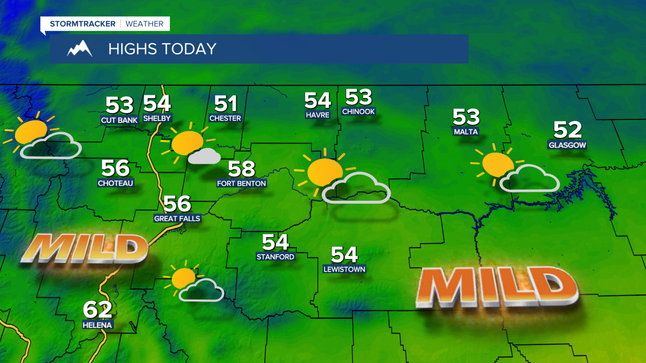
Following record warmth last Friday with highs in the 70s and 80s across Montana, the weekend brought a drastic change as temperatures fell into the 30s and 40s, with rain changing to snow. Highs on Monday are expected to reach the 50s in central Montana and the lower 60s near Helena under partly cloudy skies. It will be a nice break from the wind, with speeds generally staying below 10 mph.
Today's Forecast:

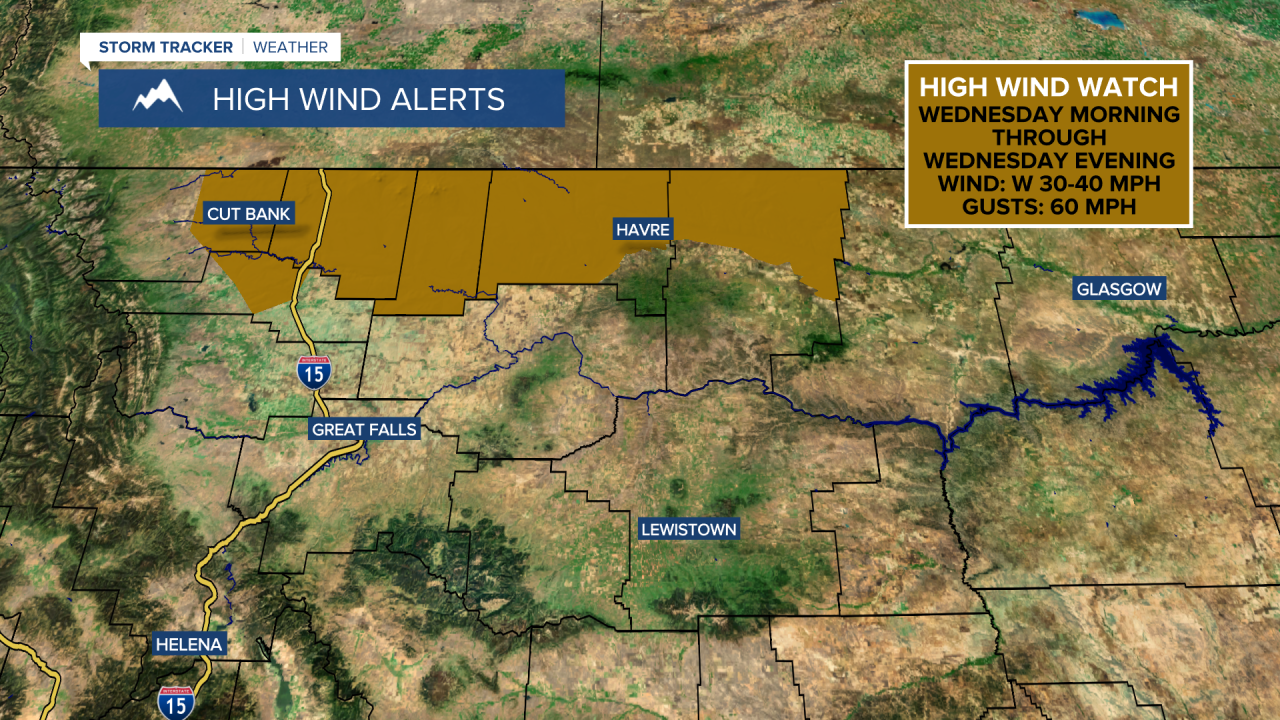
Rain and snow will develop along the Continental Divide as a Pacific system moves in on Tuesday. Scattered rain and mountain snow showers will then develop east of the Divide Wednesday night into Thursday as a cold front pushes across the state. High temperatures will reach the 50s and 60s.
Some lingering rain and snow showers may continue into early Thursday as the system slowly moves out, with mostly sunny to partly cloudy skies. It will be chilly, with high temperatures in the 30s and 40s.
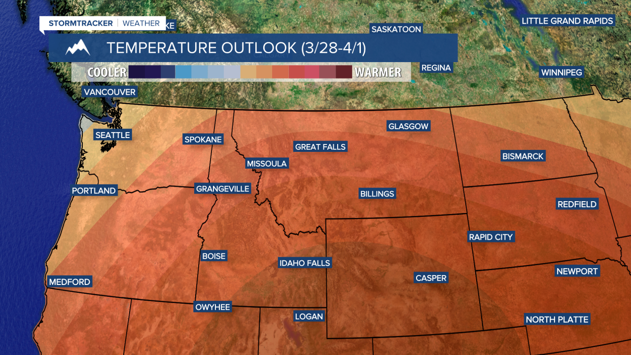
High pressure builds back in from Friday through the weekend, bringing mild temperatures and dry weather. Highs will reach the 50s and 60s.


