


Expect another mild day on Monday for Groundhog Day with mostly sunny skies. A gusty southwest breeze will make it feel a bit cooler, but high temperatures will reach the upper 30s to lower 40s in northeast Montana and the upper 40s to mid 50s in central Montana.
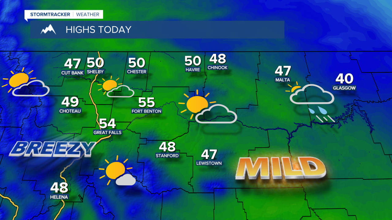
A northwest flow will trigger some light snow in the mountains tonight through Tuesday morning. Cooler temperatures will linger into Tuesday, with highs in the 40s and lower 50s, which is still well above average for the first week of February.
Today's Forecast:
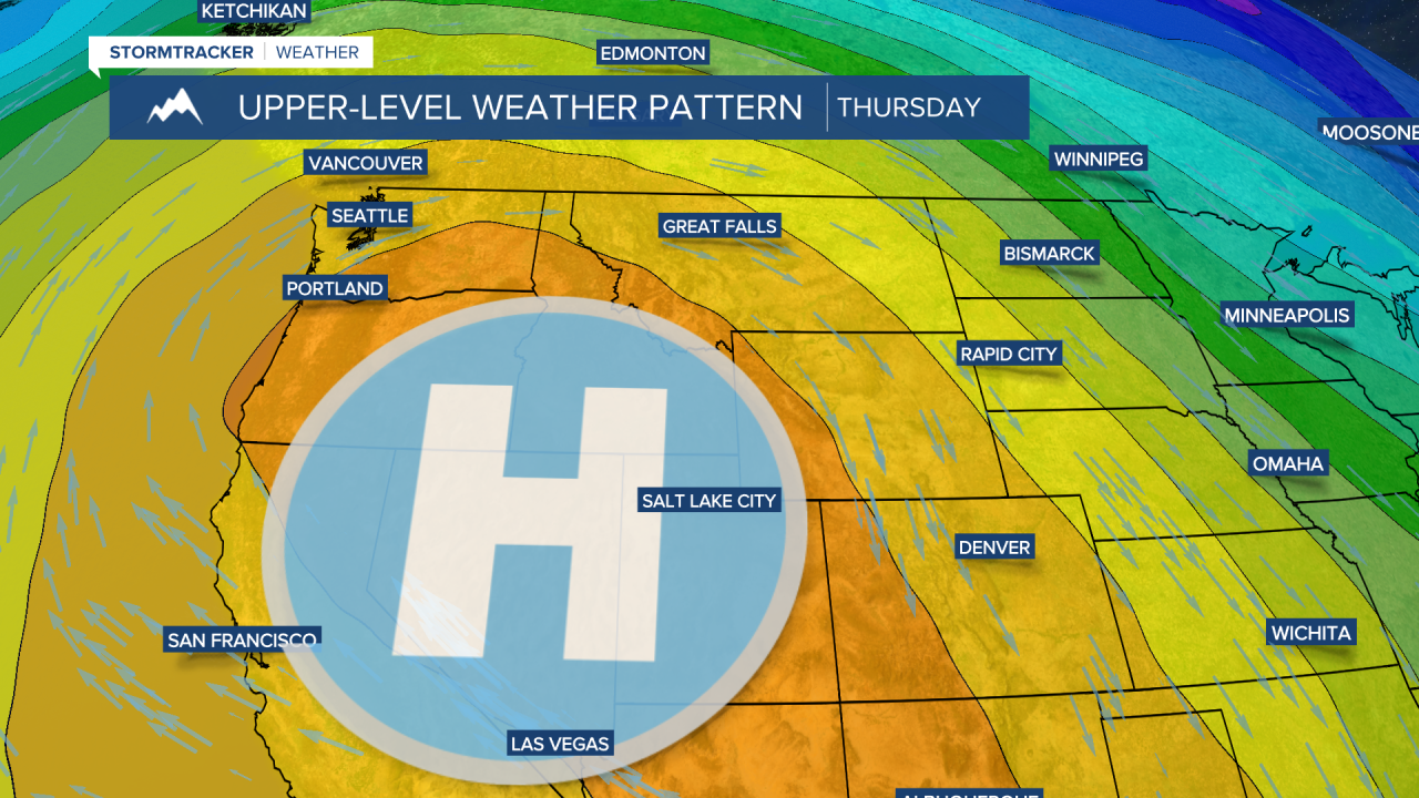
By Wednesday, a strong ridge of high pressure will amplify over the Pacific Northwest and remain parked there throughout the rest of the workweek. Daytime highs could soar into the 60s and lower 70s. It’s possible that Great Falls could see its warmest temperature on record for February, with the current record at 70°F, set in 1992.


