WEATHER DISCUSSION: There will be a very brief period of calmer winds overnight Saturday into Sunday morning. Strong winds develop for the Rocky Mountain Front on Sunday morning, extending further east across the plains throughout the afternoon and evening. Gusts up to 70 MPH expected for the Rocky Mountain Front, up to 50 MPH for the rest of central Montana.

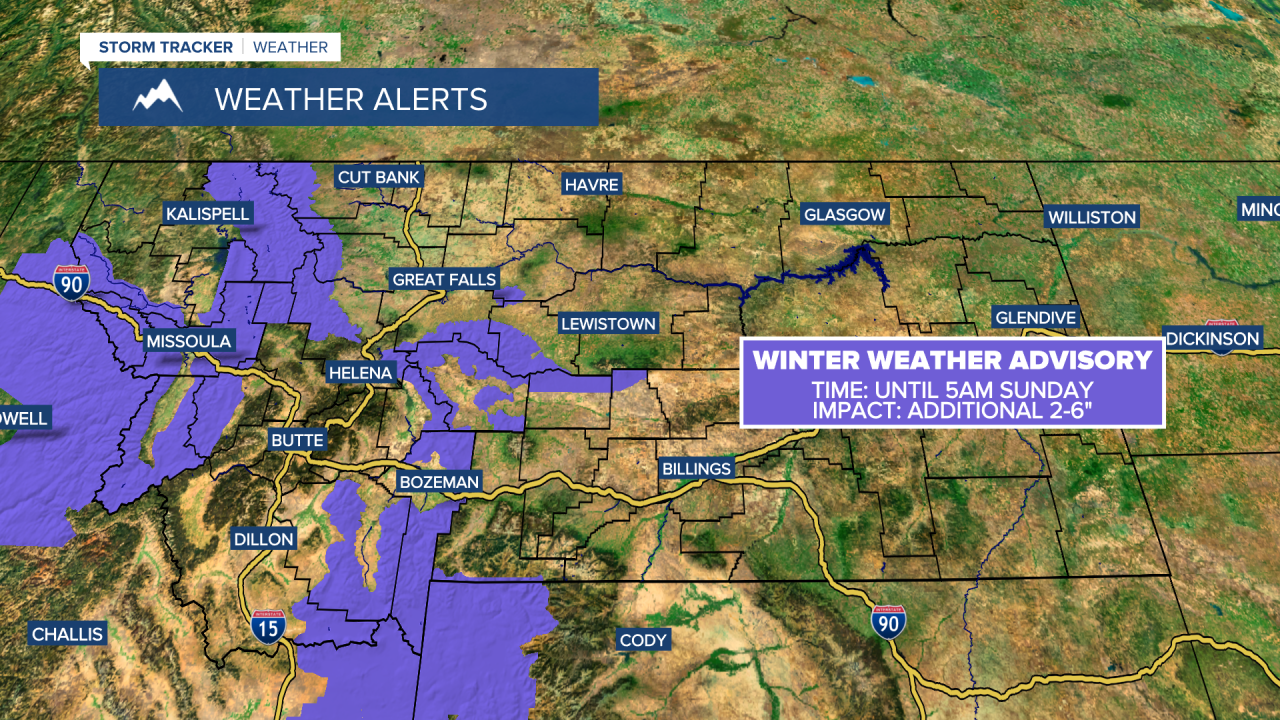
Snow showers will mostly wind down during the overnight timeframe on Sunday, however a few, scattered snow showers could persist over the Continental Divide. It will also be brief as steadier snow begins to develop over the mountains Sunday afternoon. Light to moderate snow develops in the Glasgow area on Sunday evening with minor accumulation anticipated.
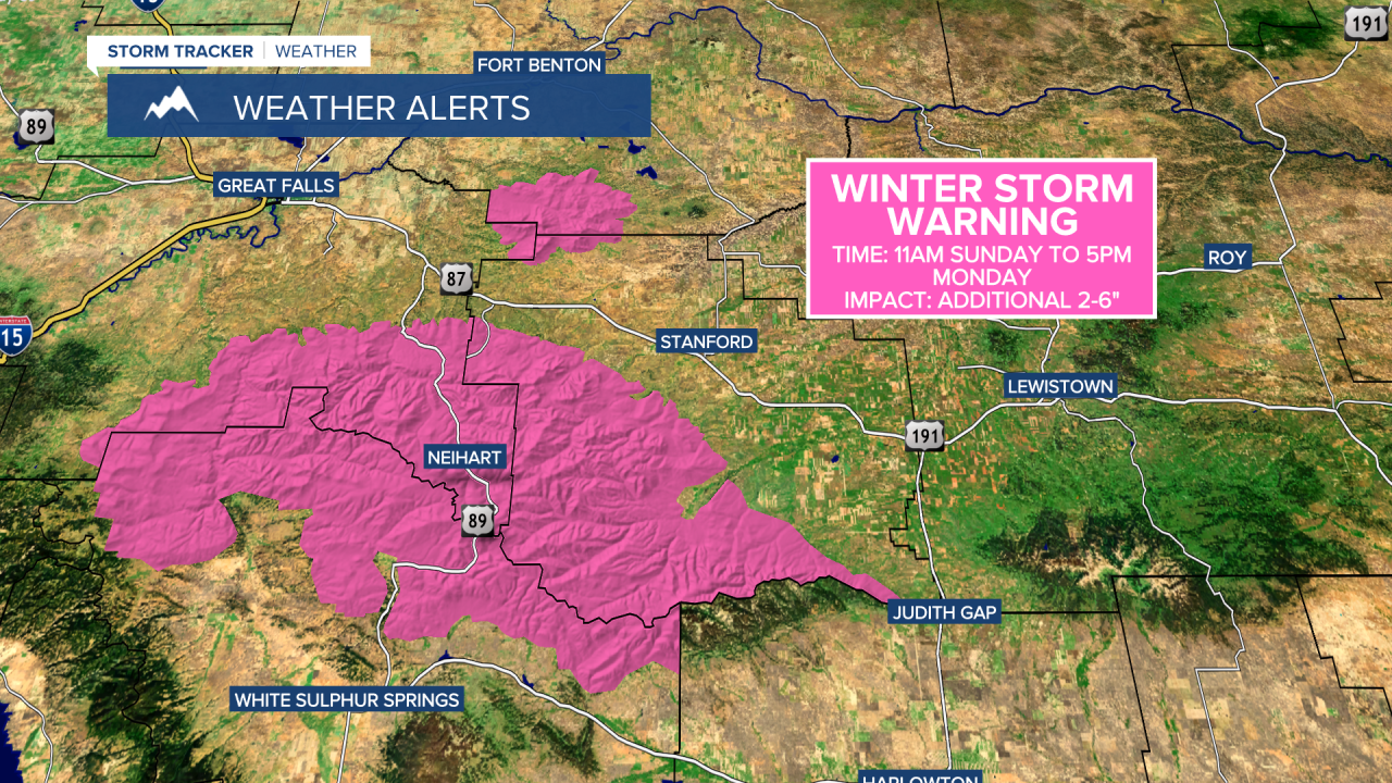
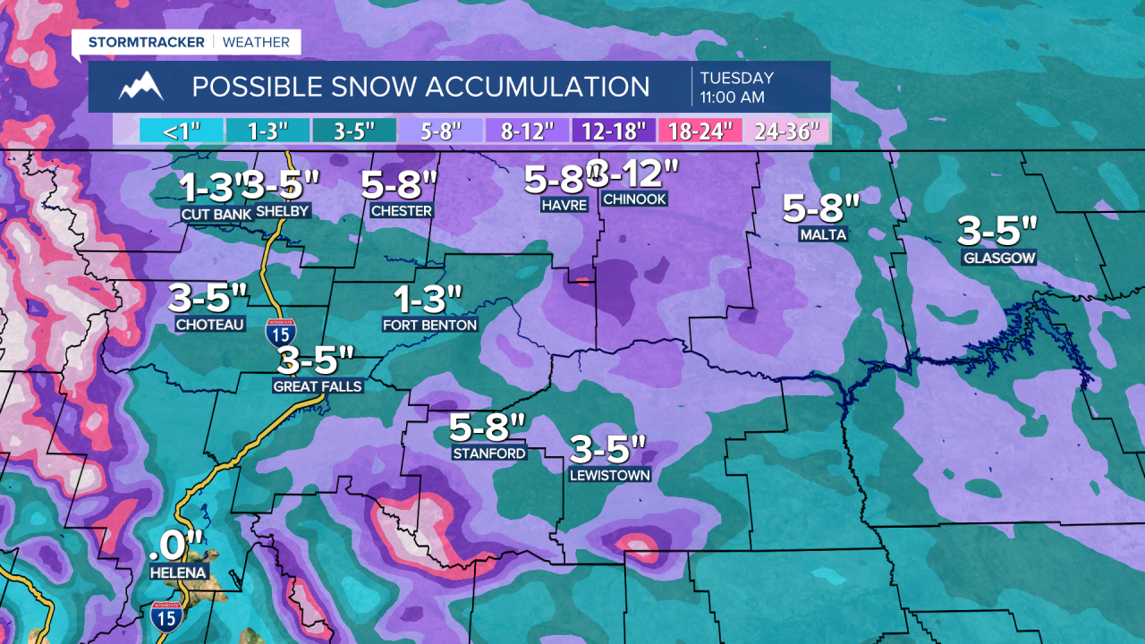
Light to moderate snow begins to overspread north central Montana during the overnight timeframe on Sunday. Bursts of snow will continue into Monday with slick travel likely for the Monday morning commute. A band of snow will push northeast and intensify over the Havre and Lewistown areas Monday night as a steadier snow gradually develops across central and eastern Montana.
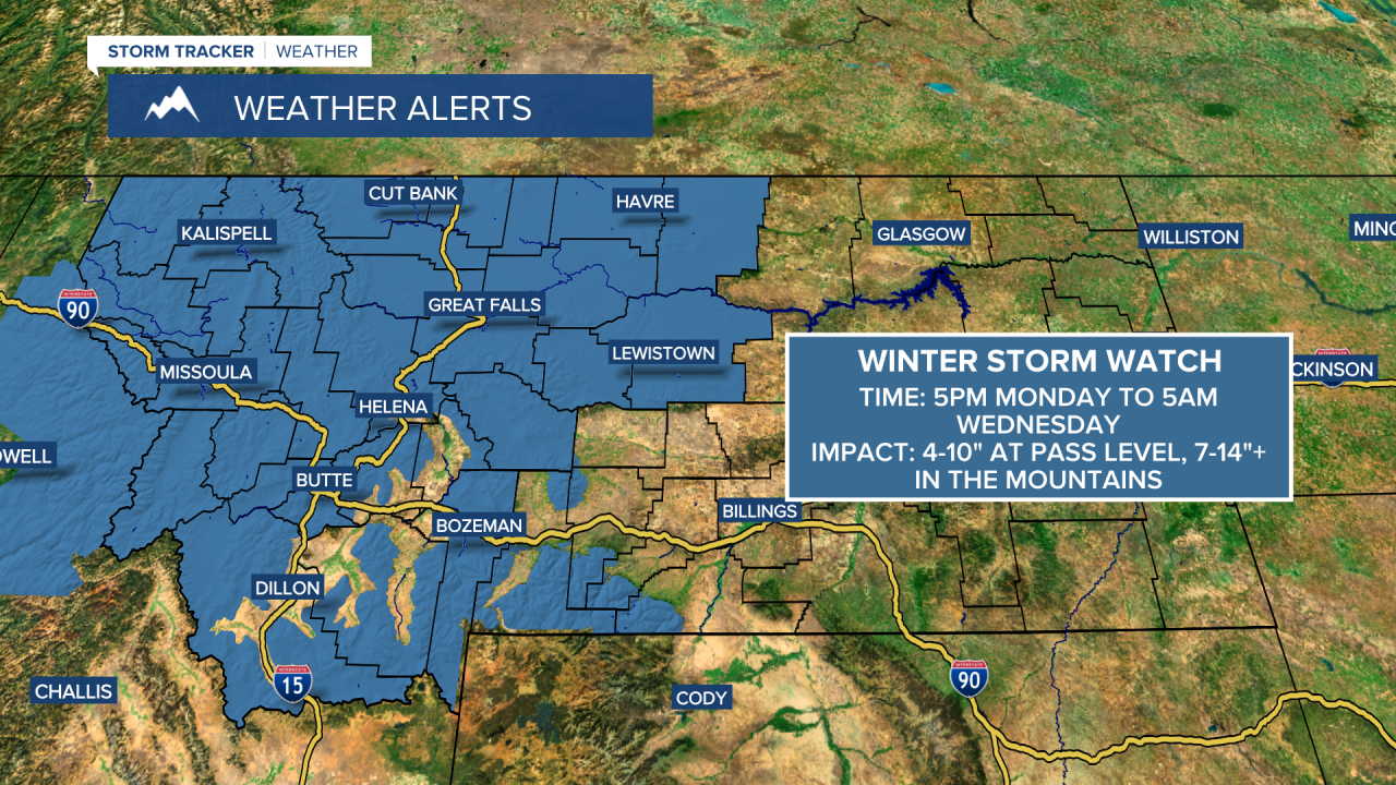
Several inches of snow accumulation (4-10") is likely across the plains as heavy snowfall (1-2 ft.+ is expected for higher terrain by Wednesday morning. The snow gradually tapers off on Wednesday as arctic air settles into the region. Temperatures will run around 20-35 degrees below normal towards the middle of next week.
A strong, chinook wind begins to strengthen along the Rocky Mountain Front towards Thursday. Blowing snow is going to cause major travel issues Thursday through Saturday morning across central and eastern Montana. Although, it will quickly warm temperatures across the plains by the weekend.
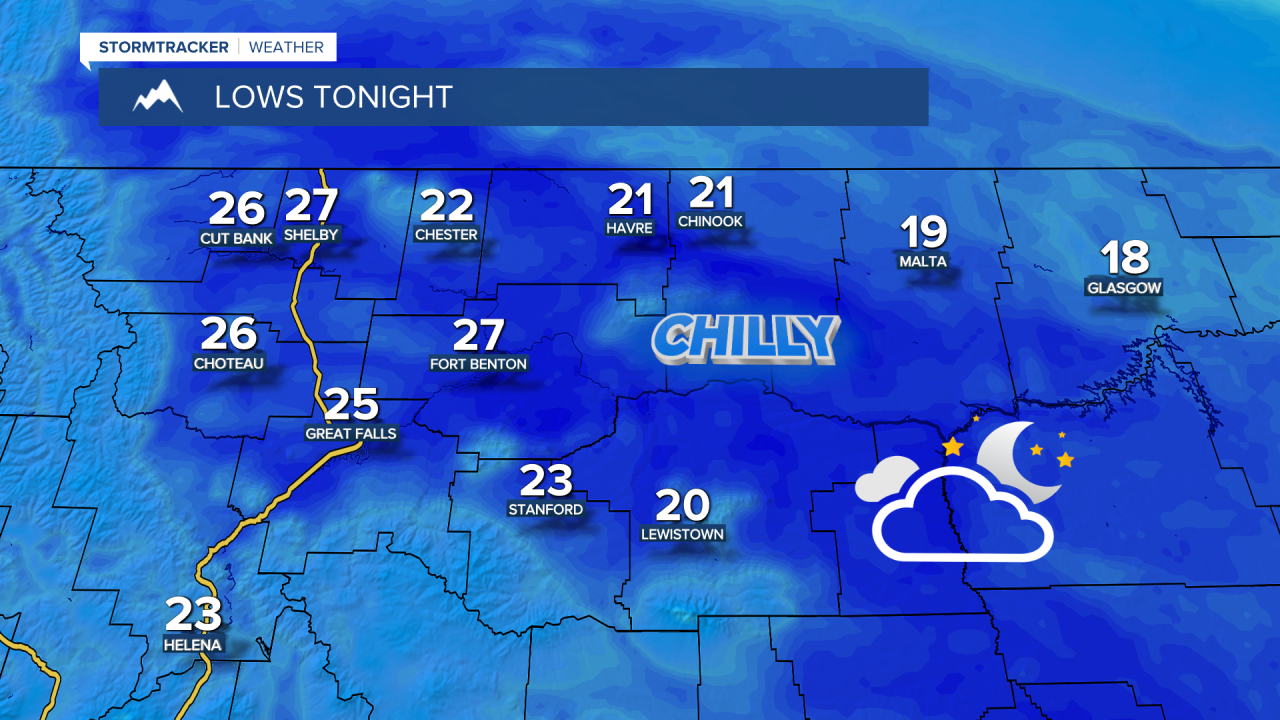
SATURDAY NIGHT: Wind and cloud cover gradually decreases. Isolated snow showers continuing in the mountains. Overnight lows in the upper 10s and lower 20s for the Hi-Line and the Helena Valley, mid to upper 20s for central Montana.
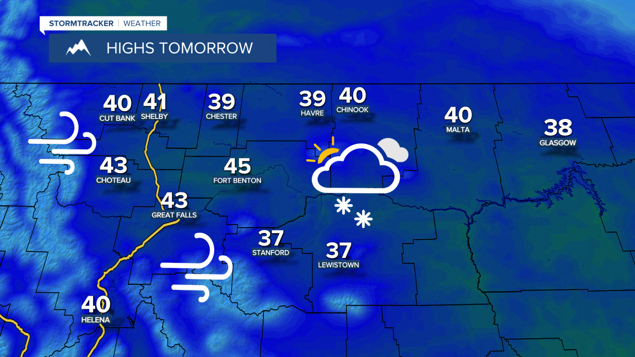
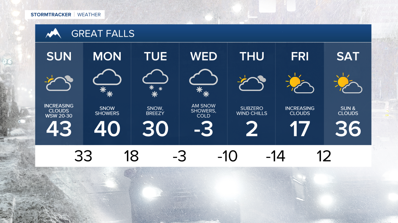
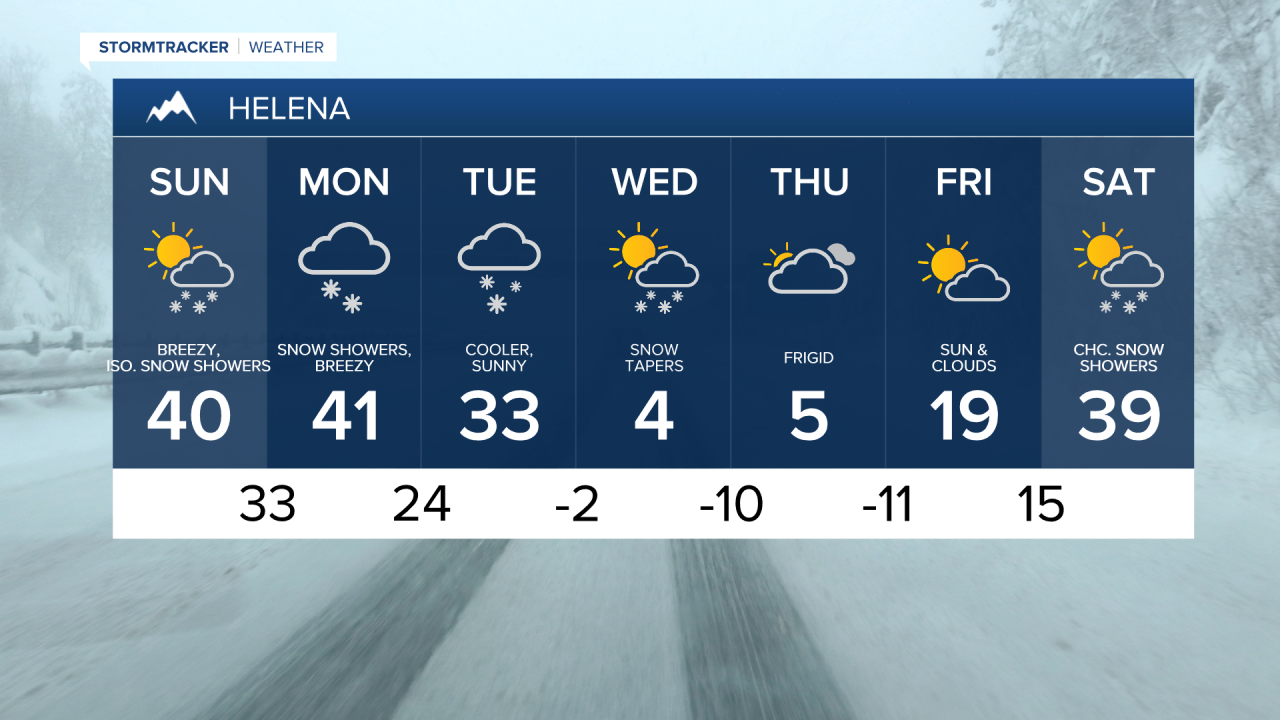
SUNDAY: Wind and clouds increase from west to east throughout the afternoon. Isolated rain or snow showers possible during the day. High temperatures in the upper 30s and lower 40s. Rain and snow showers becoming more numerous overnight. A coating to 2 inches possible by daybreak in the Glasgow area with several inches of snow piling up in the mountains. Overnight temperatures falling into the mid to upper 20s for the Hi-Line, upper 20s and lower 30s for central Montana.
MONDAY: Snow showers and breezy. Little/no snow for areas east of a line from Havre to Lewistown. High temperatures in the 10s in northeastern Montana, low to mid 20s for the Hi-Line, low to mid 30s for the Rocky Mountain Front, upper 30s and lower 40s for the Helena Valley and central Montana. Snow continues overnight, heavy at times in the mountains, and areas of blowing snow. Overnight temperatures falling into the upper 0s and lower 10s for the Hi-Line, upper 10s and lower 20s for central Montana, mid to upper 20s for the Helena Valley.
TUESDAY: Snow. Becoming breezy in the afternoon with areas of low visibility due to blowing snow. Several inches of snow accumulation (1-4") for the plains, heavy snow accumulation in the mountains (5-10"+). High temperatures in the upper 10s and lower 20s for the Hi-Line, mid to upper 20s for central Montana, mid to upper 30s for Helena. Temperatures will begin to fall during the afternoon and evening as an Arctic cold front moves through. Snow gradually tapering as wind remains blustery overnight. Poor visibility due to blowing snow. Temperatures falling into the -0s with wind chills as low as the -20s and -30s.
WEDNESDAY: Cloudy with scattered snow showers. A sustained NE breeze at 10-20 MPH gusting to 30 MPH at times creating blowing snow and reduced visibility. High temperatures ranging from -5 to 5 degrees. Wind chills as low as -25. Snow showers east of a line from Havre to Lewistown. Frigid with temperatures falling into the -0s and -10s. Wind chills as low as -35.
THURSDAY: Cloudy and frigid. Slight chance of a snow shower. High temperatures ranging from -5 to 10 degrees. Wind chills as low as -20.