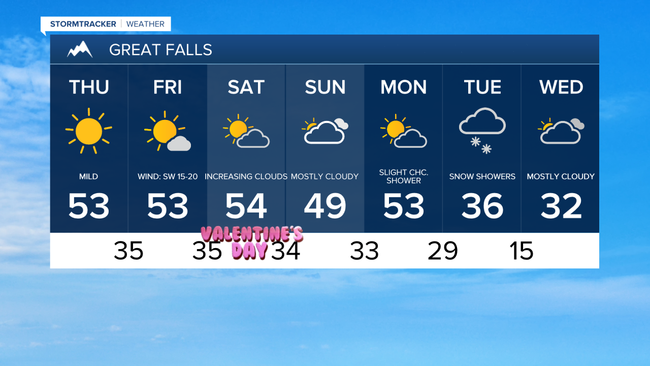
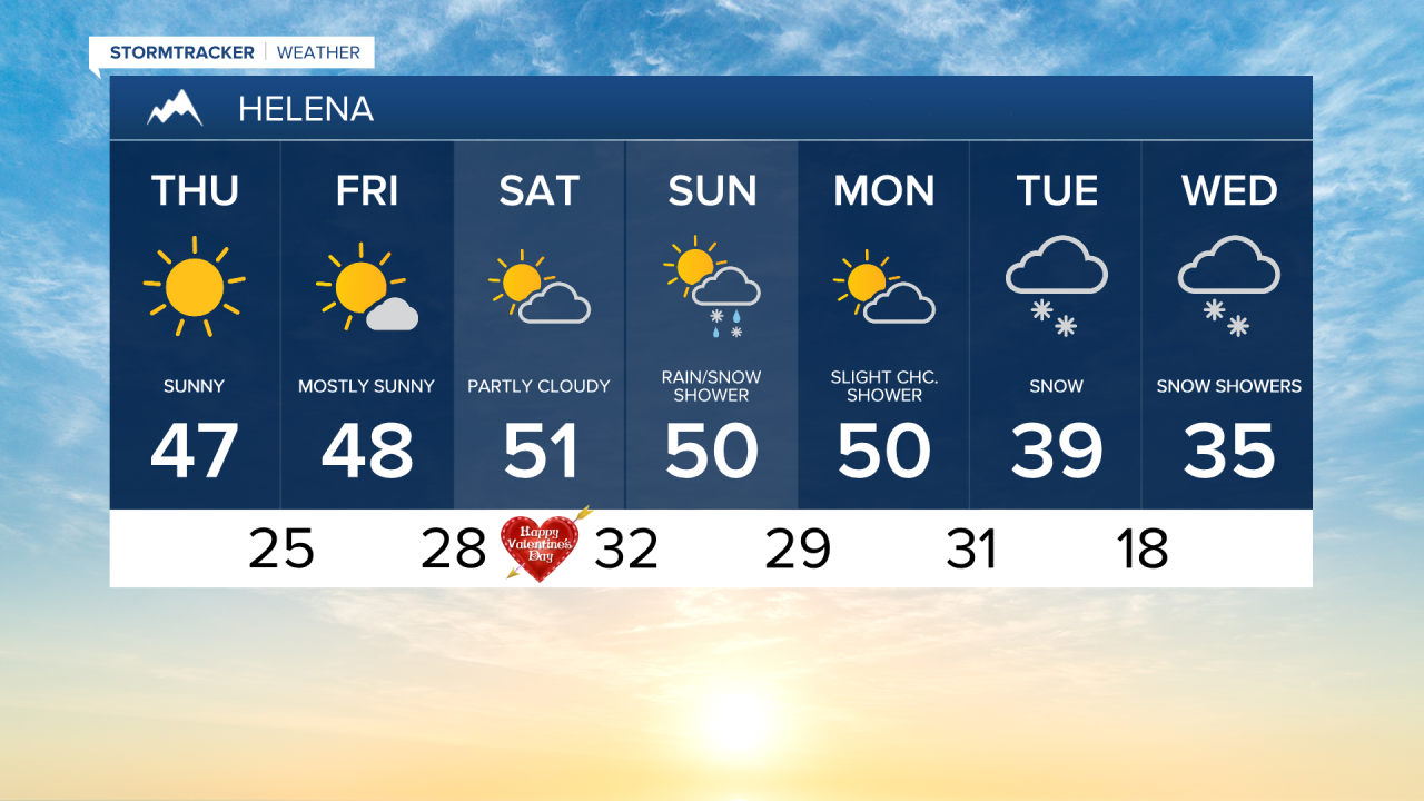
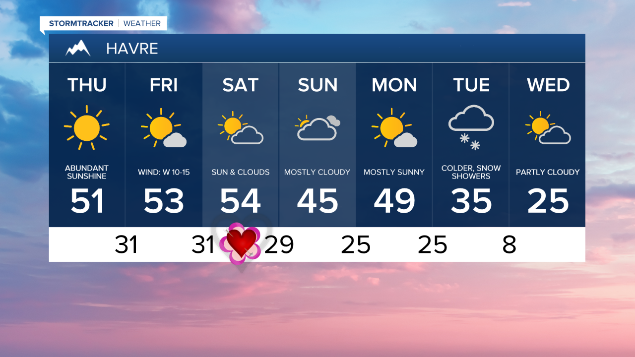
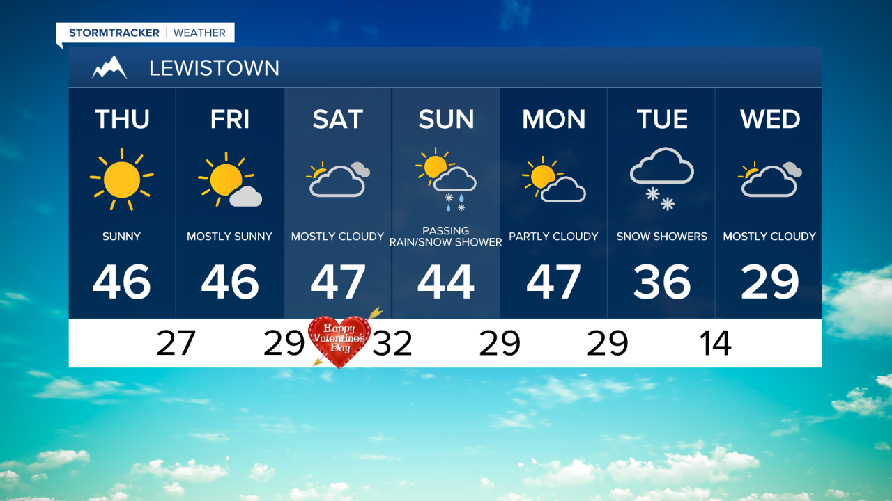
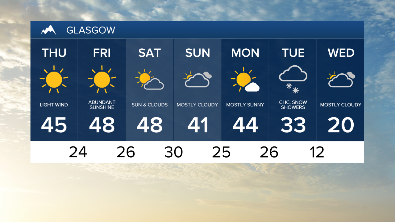
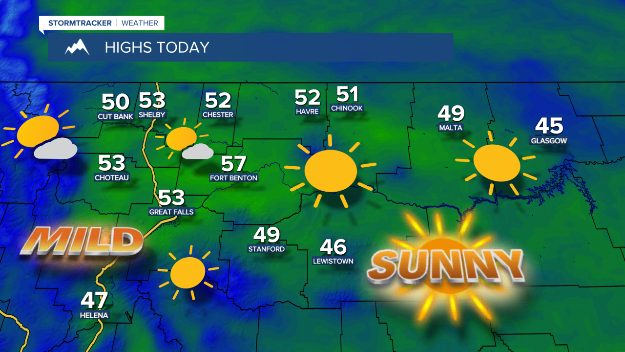
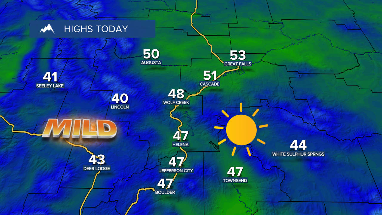
It is another colder start, with temperatures down in the 10s and 20s. Abundant sunshine today and Friday, with highs in the upper 40s and 50s. Along the Rocky Mountain Front, stronger winds between 15 and 30 mph, with gusts over 50 mph. Further east across the plains, wind speeds will also increase to 10-20 mph.
Over the weekend, clouds will increase, and a passing snow shower is possible in the mountains. Breezy conditions will continue, with wind gusts over 30 mph possible. Highs stay in the 40s and lower 50s.
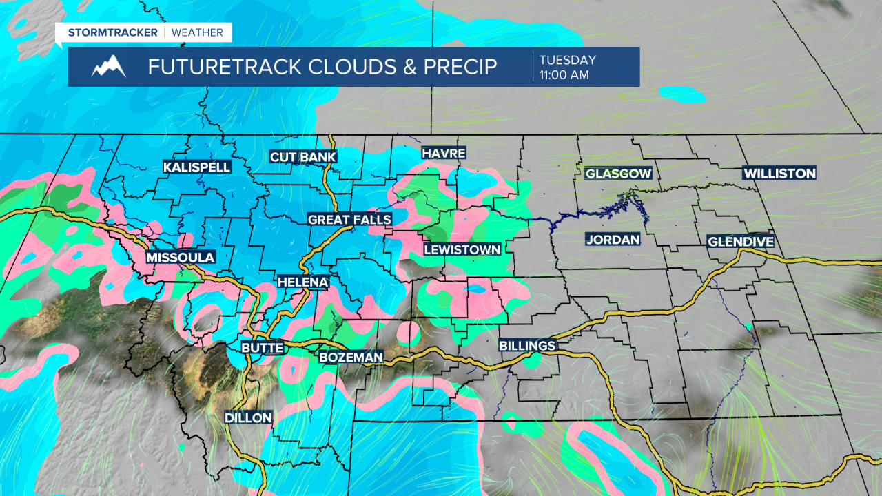
Next week will start mild and dry, with highs again in the 40s and lower 50s. However, starting Monday night into Tuesday, there is a chance of some snow. Temperatures fall into the 20s and 30s from Tuesday onward. Tuesday looks to be the most impactful weather day, with possible light accumulating snowfall in the lower elevations and heavier snowfall in the mountains.