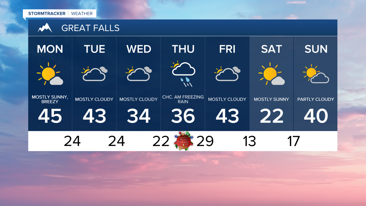
Welcome to winter! Temperatures will run mild to start the week, but it cools down closer to Christmas. Occasional snow showers will be around in the mountains, along with scattered mixed precipitation in the lower elevations throughout the week.
Today's Forecast:
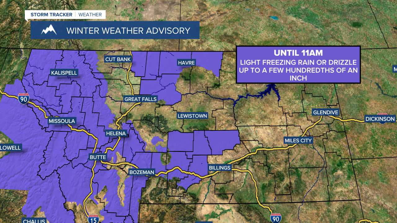
Light snow is falling along the Divide and over some mountain passes. There is also an area of rain and freezing rain over Fergus County and south toward I-90. Roads have been reported as coated in black ice south of Eddie's Corner, through Harlowton and Judith Gap on Highway 191. Be cautious of patchy freezing drizzle and rain during the morning commute, especially in the colder valleys.

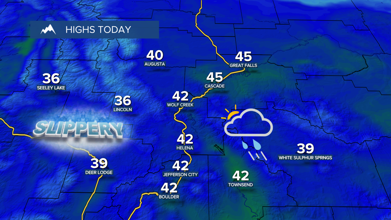
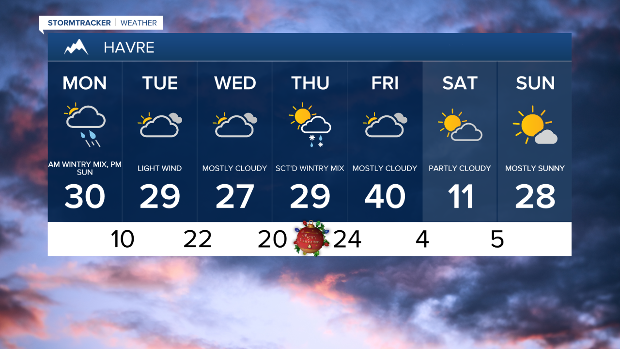
High temperatures in the 30s on the Hi-Line and 40s across central Montana.

An area of rain, freezing rain, and mountain snow is expected to develop near I-90 Tuesday morning and gradually drift north into the afternoon. This could bring a brief shower to Helena, but most of the area will remain dry into Tuesday. High temperatures will be in the 20s and 30s on the Hi-Line and lower 40s across central Montana.
A disturbance will then bring more light freezing rain or drizzle from Wednesday night into Christmas morning as temperatures fall into the teens and 20s. Keep a close watch on the forecast, as this could result in slick travel conditions on Christmas morning.
High temperatures will range from the 20s on the Hi-Line to the 30s and 40s across central Montana on Christmas Eve and Christmas Day.