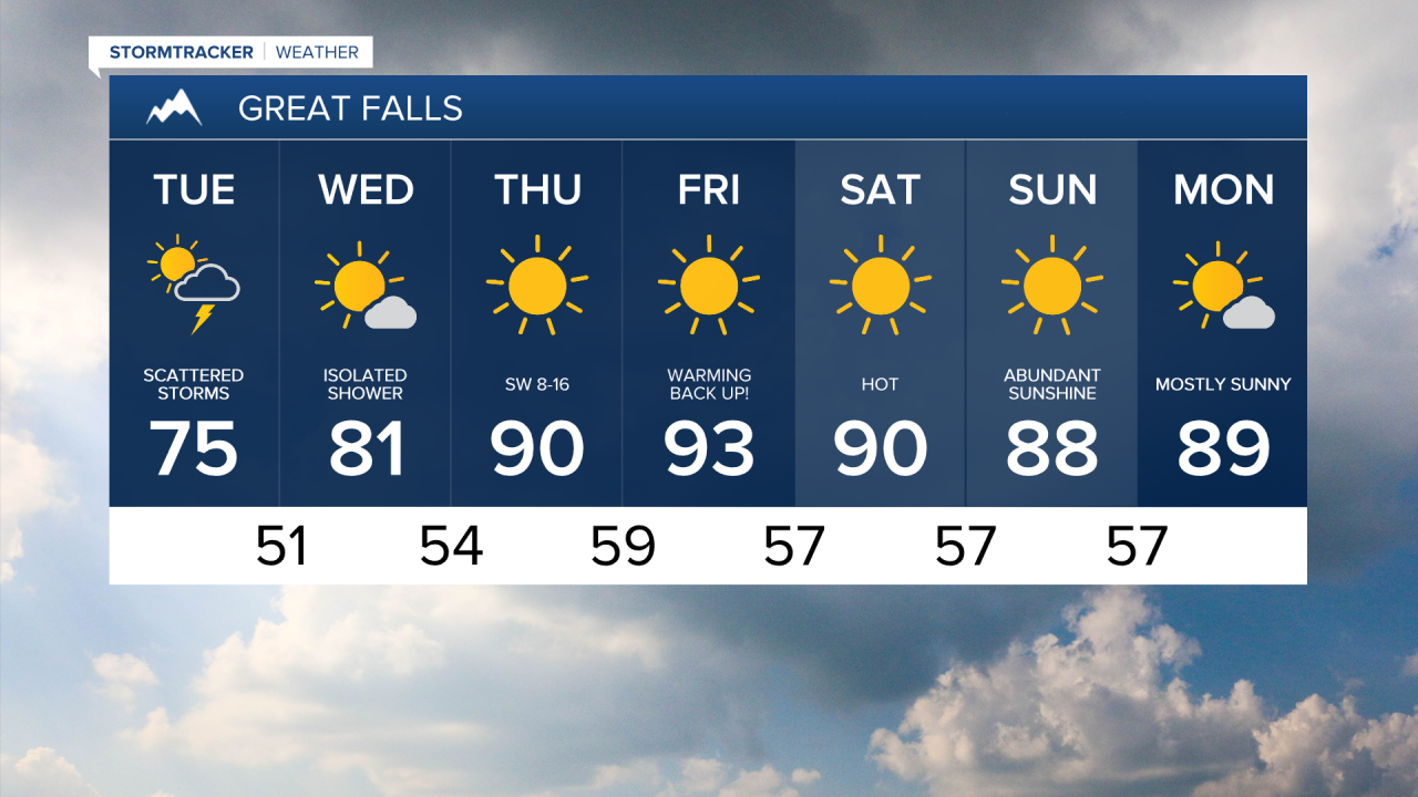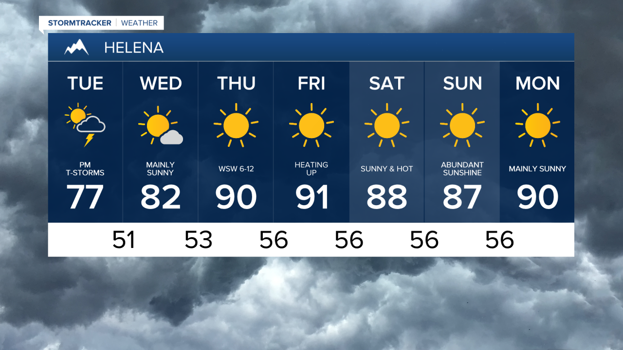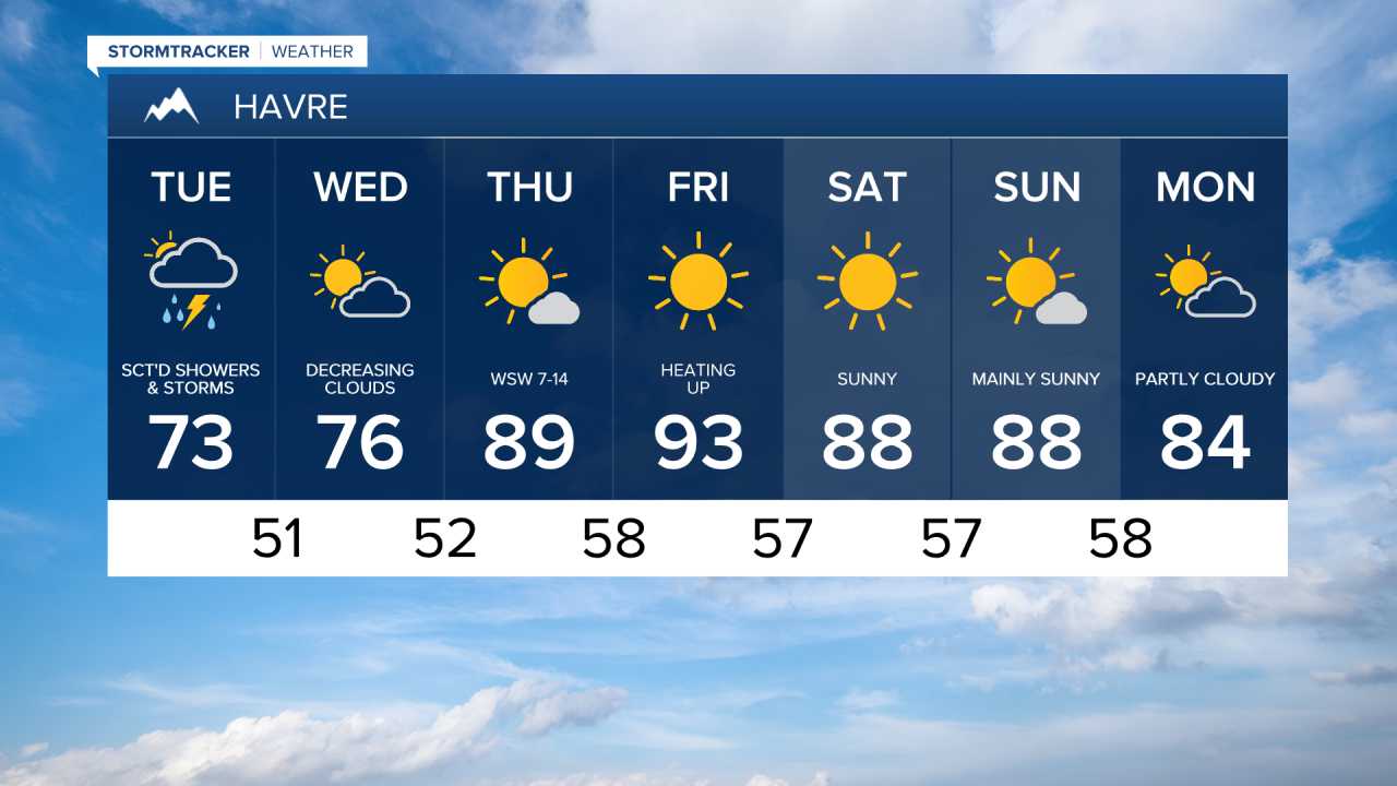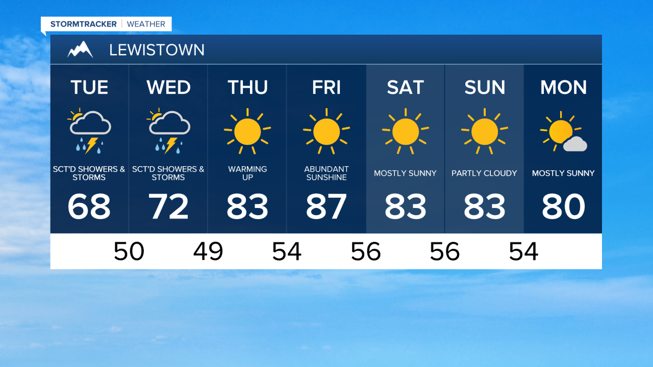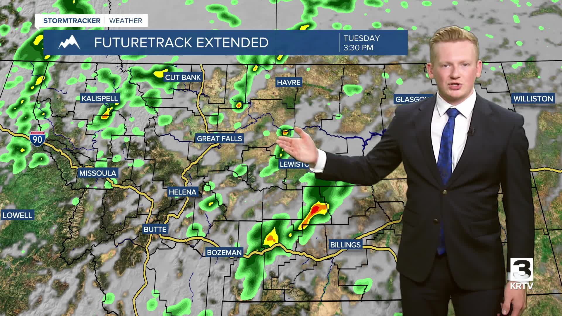


We'll stay on the cool side again today, along with another round of afternoon showers and thunderstorms. Severe weather is not expected other than an isolated stronger thunderstorm over Fergus county. There will be a decent breeze, with sustained winds between 10 and 20 mph, gusting over 30 mph at times.
A bit of wildfire smoke has drifted in from Canada into eastern Montana and the Hi-Line, mainly east of Havre. The smoke could continue to reduce air quality to unhealthy for sensitive groups or unhealthy for everyone. The haze and smoke are expected to decrease during the afternoon and evening.
Lingering showers and thunderstorms will continue on Wednesday, mainly east of a line from Havre to Lewistown. The storm system responsible for the cool and wet weather is departing the area, so clouds will clear from west to east. Once cleared, it should be a pleasant day with high temperatures in the 70s and low 80s.
Then, a ridge of high pressure begins to strengthen over most of the United States. This will lead to fairly widespread heat, including in Montana, where temperatures are going to reach the 90s on Thursday and Friday.
The summer warmth will persist into the upcoming weekend, with high temperatures in the upper 80s and 90s. There is a chance of isolated showers and thunderstorms each afternoon and evening on both days.