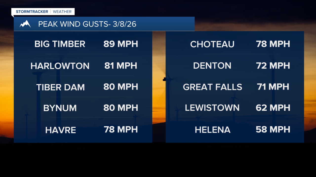
Yet another powerful windstorm hit Montana this weekend, with peak wind gusts of 60-90 mph east of the Continental Divide. In some areas, including Great Falls and Havre, the peak gusts exceeded those recorded during the December windstorm. High temperatures briefly climbed into the 60s before dropping to the 10s and 20s overnight behind a cold front.
Today's Forecast:
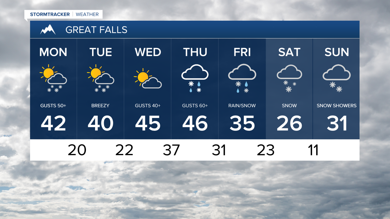
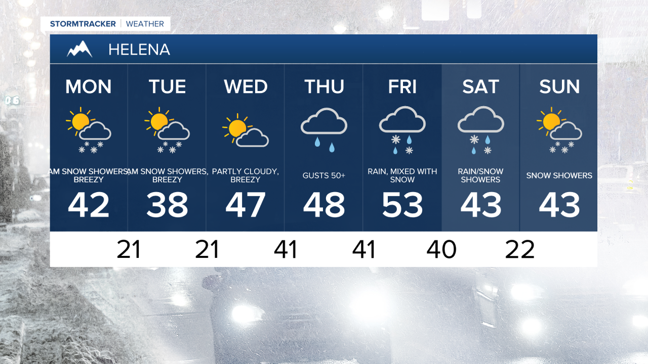
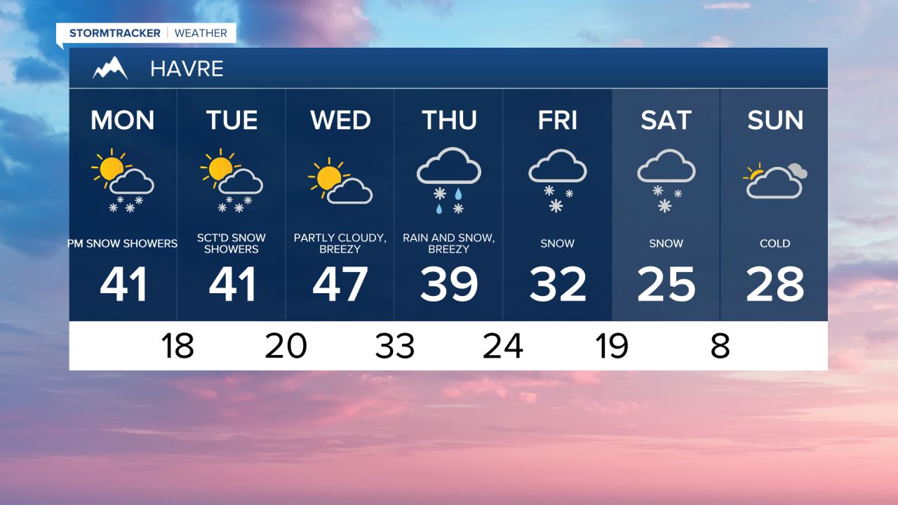
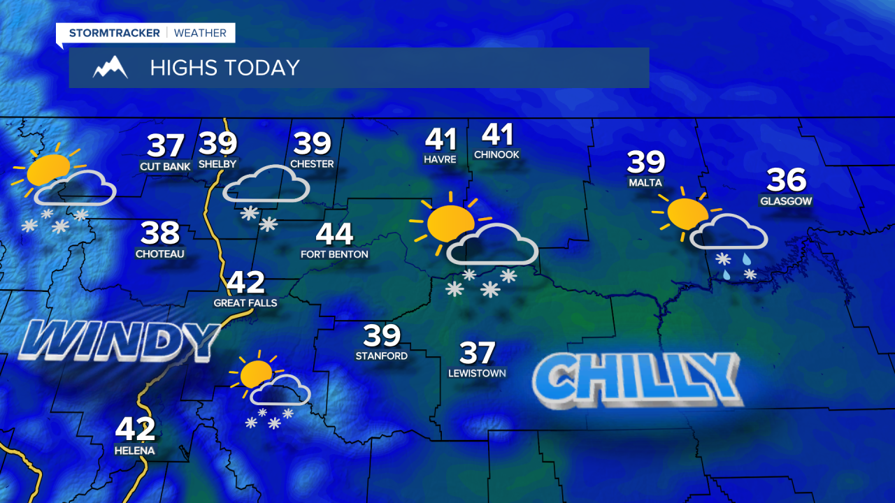
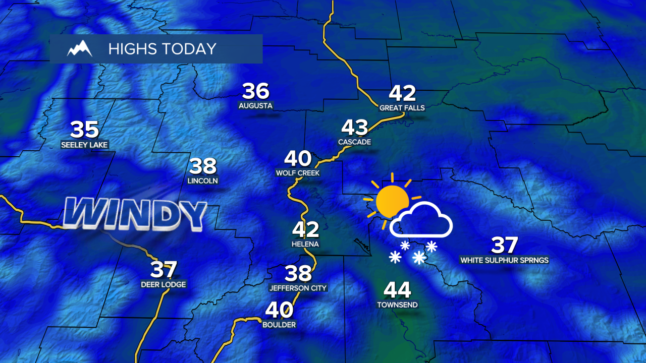
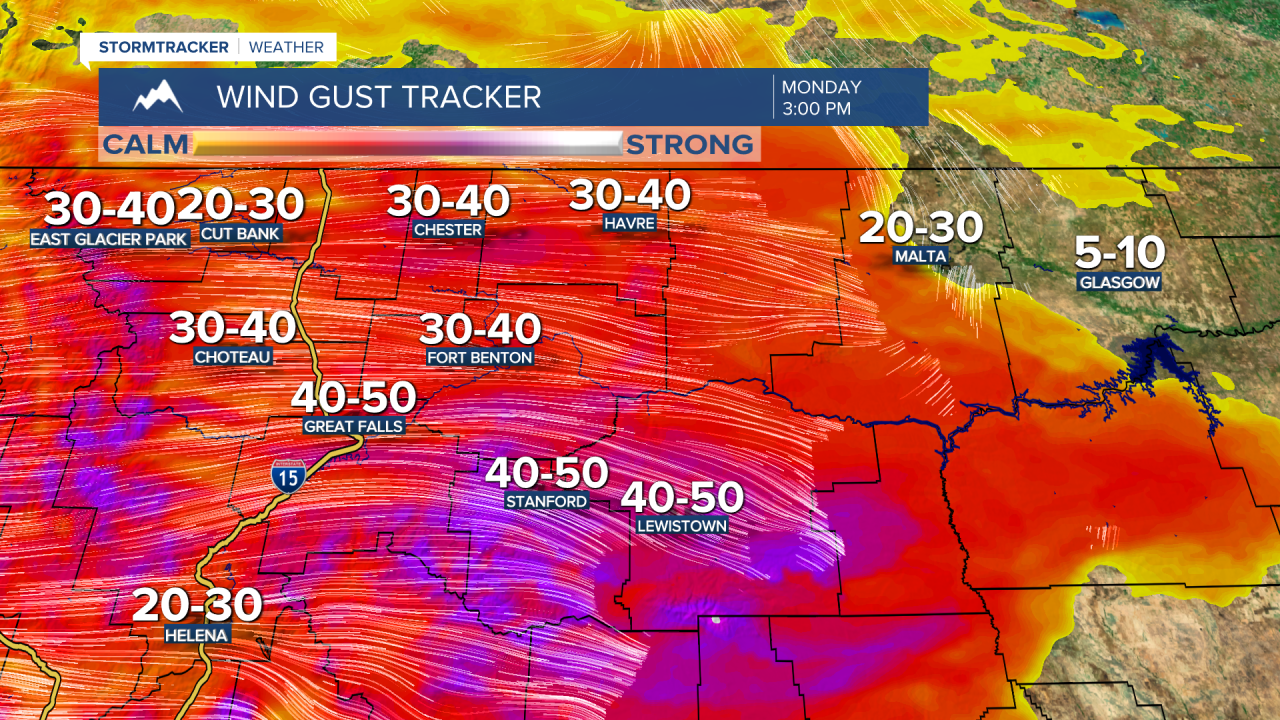
A Winter Weather Advisory is in effect through 9 a.m. A few bands of light to moderate snow will continue to trek across central Montana creating snowy, slick roads. Strong, gusty winds develop again later this morning into the afternoon, with peak gusts of 40-50+ mph coming from the west-southwest. Highs will be in the 30s and lower 40s.
Tuesday and Wednesday will be partly cloudy, breezy, and cool, with highs in the 30s and low 40s on Tuesday, and 40s to near 50 on Wednesday. Scattered flurries and light snow showers are possible on Tuesday, with heavier mountain snow moving into the Continental Divide on Wednesday.
Unfortunately, another strong and potentially damaging wind event is expected on Thursday, as an area of intense upper-level winds is expected to mix down to the surface. This could be very similar to the December windstorm as well as Sunday’s high winds. Given the strain on infrastructure, this event has the potential to be particularly damaging. Plan now for widespread wind gusts of 60-80+ mph late Wednesday night through Thursday.
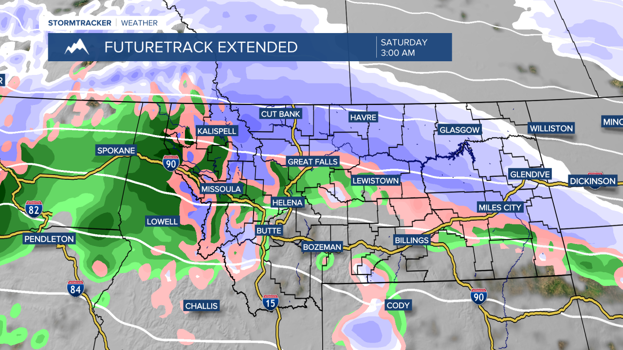
A cold front will drop south over the plains of central Montana Thursday night into Friday morning and stall near MT-200, ending the high winds. Deep Pacific moisture will stream over this front into the region, leading to rounds of heavy mountain snow and accumulating snowfall in the lower elevations. Depending on where the front stalls, this could be one of the heaviest snow events of the season in both the lower elevations and the mountains. Some models indicate several feet of snow could fall in the mountains.