A wide range of temperatures across central and eastern Montana this morning, as some arctic air has pushed south of the Hi-Line. Temperatures are in the 0s and 10s in some areas, while other areas are in the 30s and 40s.
Today's Forecast:
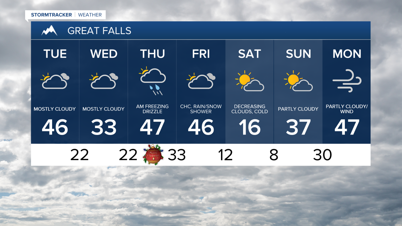
Tuesday will be mostly dry, but there could be a few isolated instances of light rain or freezing drizzle this evening in the Golden Triangle area. Colder air remains in place on the Hi-Line, with temperatures only reaching into the 20s, while south of the Hi-Line, highs will be in the upper 30s and 40s. Glacier County and the northern Rocky Mountain Front will have gusty winds this afternoon, with gusts over 30 mph at times.
Christmas Eve is expected to be quiet, dry, and cold, with high temperatures in the 20s and 30s.

Mild Pacific air continues to override a shallow layer of cold air over Montana. As some Pacific moisture arrives late Wednesday night into early Christmas morning, scattered snow, freezing rain, and rain showers are expected. Ice accumulation could pose a risk of slippery travel, with some areas possibly seeing up to a tenth of an inch of ice. Please use extra caution and check road conditions before heading out.

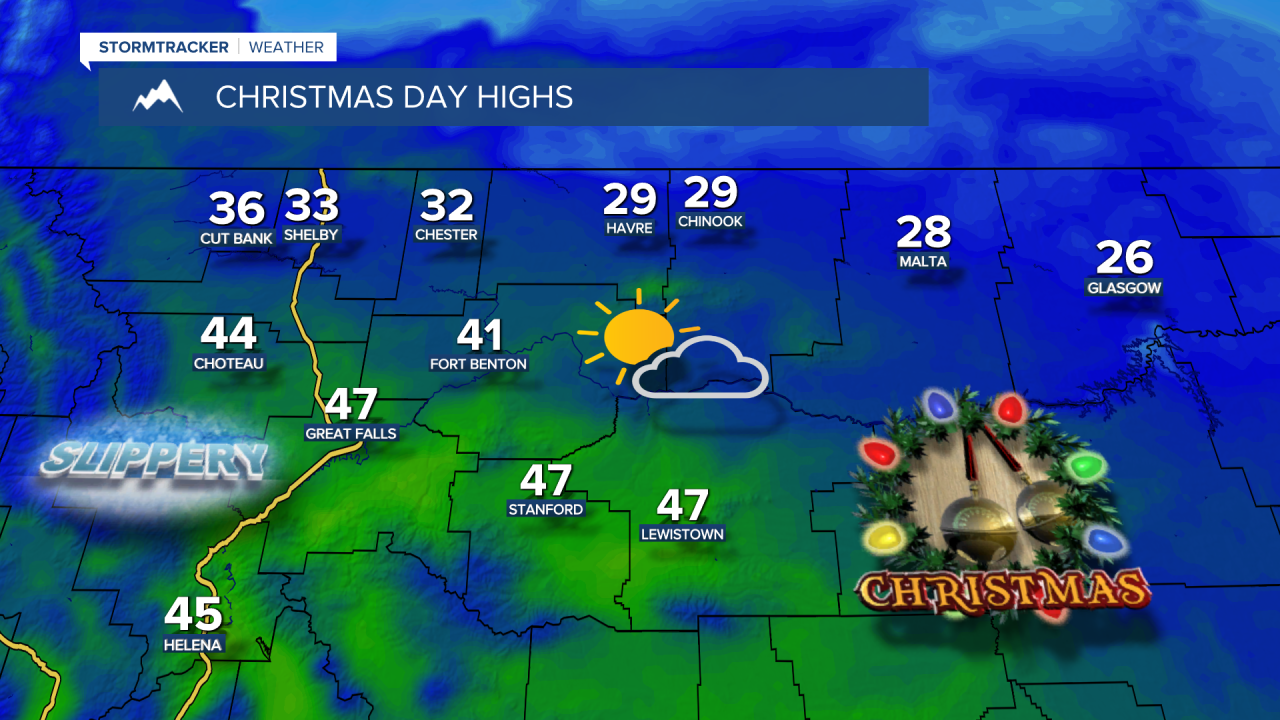
High temperatures won't be too bad for Christmas Day, in the 20s and lower 30s on the Hi-Line and 30s and 40s south of the Hi-Line.
Friday will be cloudy and unsettled, with high temperaturesstaying in the 30s and 40s. A brief blast of arctic air arrives Friday night into Saturday. High temperatures will struggle to reach above the 0s and 10s on Saturday, and there may be a light snowfall late Friday night into Saturday.