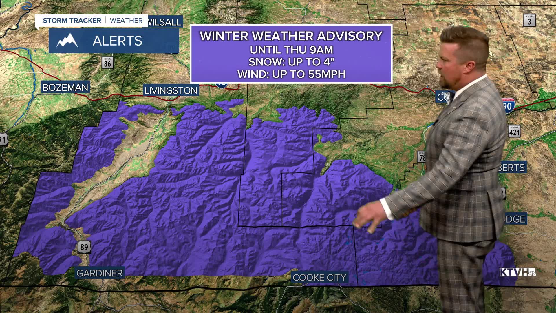


A WINTER WEATHER ADVISORY continues for the Beartooth and Absaroka Mountains into Thursday morning.
Another cold June storm is bringing rain, wind and mountain snow to Montana, so much snow that the Beartooth Highway had to close. Several inches of snow and wind up to 55mph have shut down the Beartooth Highway, and with more snow in the forecast this weekend, it may be a few days before crews can clear the new snow. Elsewhere, rain and mountain snow will continue Wednesday night. Thursday will start mostly cloudy with a few showers, but as the storm moves away, skies will become partly cloudy in the afternoon. There will be a few lingering showers and storms up on the Hi-Line and across eastern Montana. The wind will not be quite as strong but it will still be gusting up to about 30mph. Highs will warm into the 60s and 70s. Friday will be a great day with mostly sunny skies and warmer temperatures in the 70s, however, a few scattered showers and thunderstorms will impact the Cut Bank area down to Great Falls later in the afternoon and evening. This weekend will not be as wet as the last couple of weekends but it will not be completely dry. A cold front will move across the state friday night into Saturday with scattered light rain showers. Highs will be in the 50s and 60s. The Governor's Cup Race will have a few light rain showers and a north breeze through the event. The best chance for showers will be early on with clearing through the afternoon. Sunday will be partly cloudy with a few lingering showers across eastern Montana. Highs will warm into the 60s and 70s.
Have a great day,
Curtis Grevenitz
Chief Meteorologist
