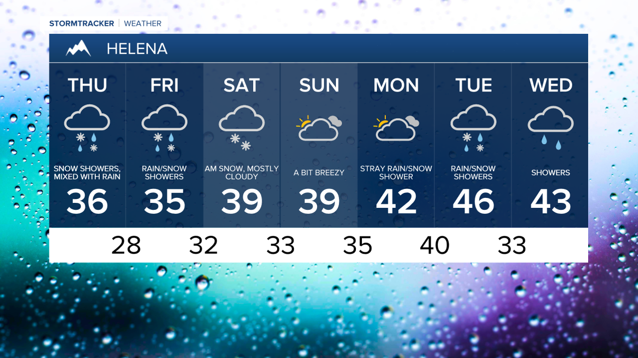
The first of two rounds of snow moves in today, primarily affecting travel over mountain passes and higher terrain in central and western Montana. Elsewhere, expect a cloudy, breezy day with a few passing snow showers. Daytime highs will reach the mid to upper 30s across central and eastern Montana.

Today's Forecast:
A Winter Storm Warning has been issued from this morning through early Saturday morning for the mountains of central and south-central Montana. Up to 4 to 8 inches of snow is possible today over Kings Hill, Bozeman Pass, and the higher terrain.
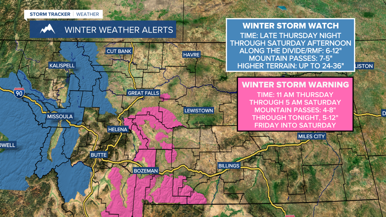
There will be a lull in snowfall Friday morning, but more widespread snow will move in Friday night into Saturday. Travel may become difficult or impossible at times due to heavy snow, gusty winds, and low visibility over mountain passes and higher terrain. Snowfall rates could reach 1 to 2 inches per hour.
Meanwhile, a broad area of light snow develops across north-central Montana overnight Friday into Saturday. While accumulations should remain fairly light (coating-2"), some spots, such as Geyser, Stanford, and Belt along US-87/MT-200, could see up to 4 inches. Rain may mix with snow in some areas, limiting snow amounts.
This will be a significant snowstorm for the mountains west of the Divide, with some of the peaks receiving up to 2 to 3 feet of snow. Travel over mountain passes could become treacherous from Friday night into Saturday.


A few lingering snow showers continue into Sunday in the mountains, but temperatures warm from the 10s and 20s on Saturday to the 30s and 40s on Sunday. In Helena, high temperatures will remain mild at around 40 degrees both days.
Gusty winds return Sunday and Monday, with speeds between 10 and 25 mph, gusting to 30-40 mph at times. Monday will be pleasant, with partly to mostly cloudy skies, mostly dry conditions, and highs in the 30s to low/mid 40s.
The active weather pattern continues into next week, with another storm system impacting the area Tuesday into Wednesday. This will be a milder storm, mainly bringing mountain snow. High temperatures in the 40s and lower 50s on Tuesday, then cooling to the 20s and 30s on Wednesday. Very windy conditions are likely on Tuesday.