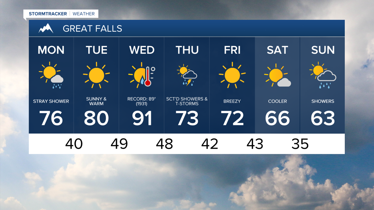
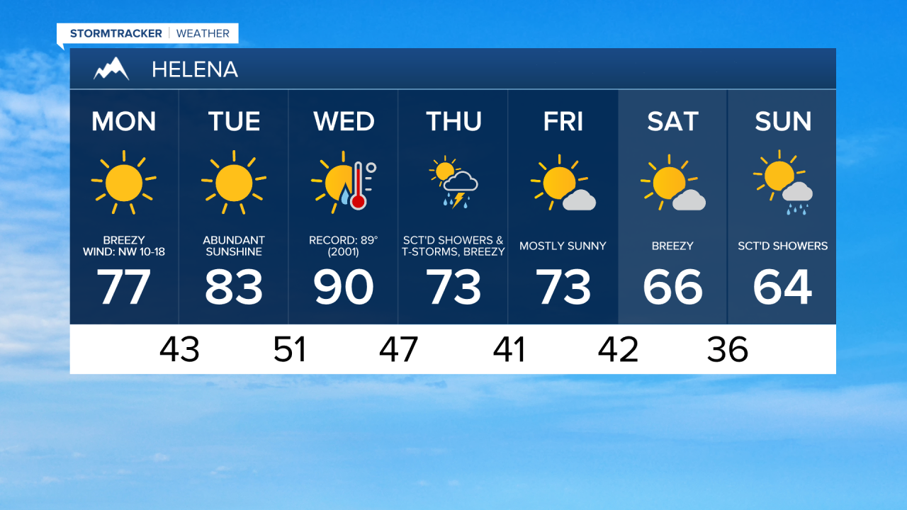
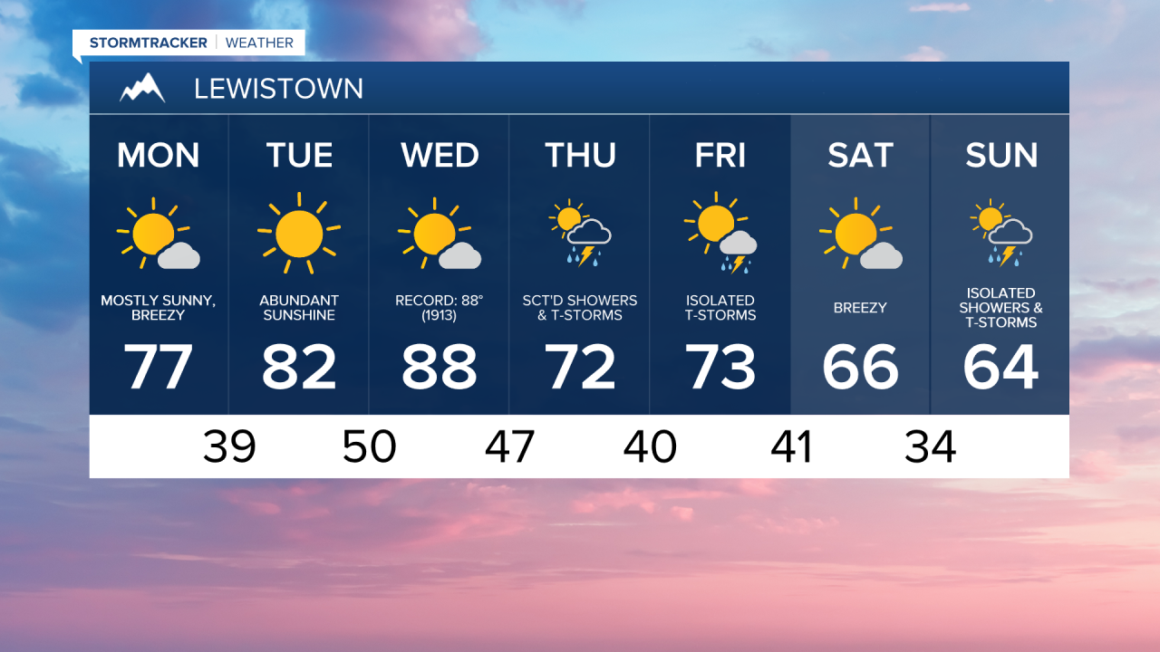
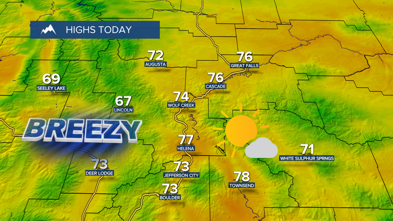
We’re kicking off the week with a weak, dry cool front knocking temperatures down by a few degrees along with gustier winds and elevated fire danger. Daytime highs will reach the upper 60s and 70s on Monday.
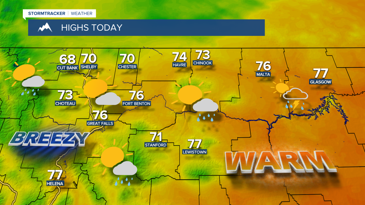
Monday Morning Forecast:
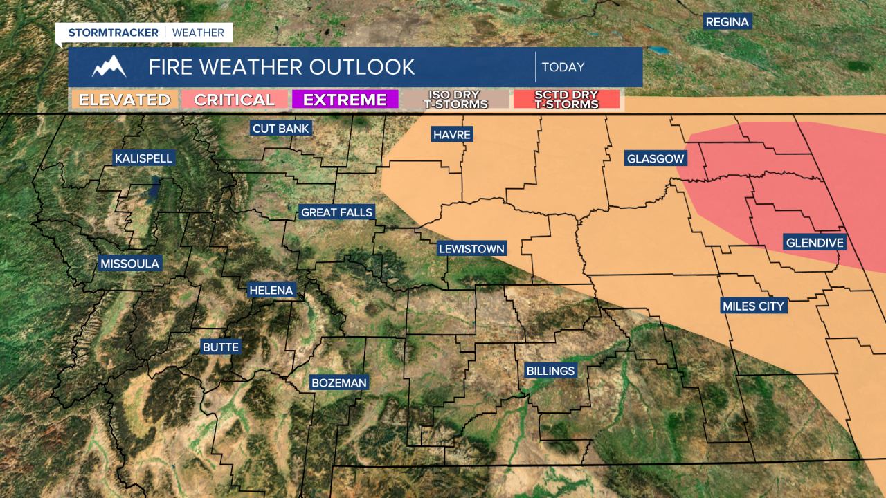
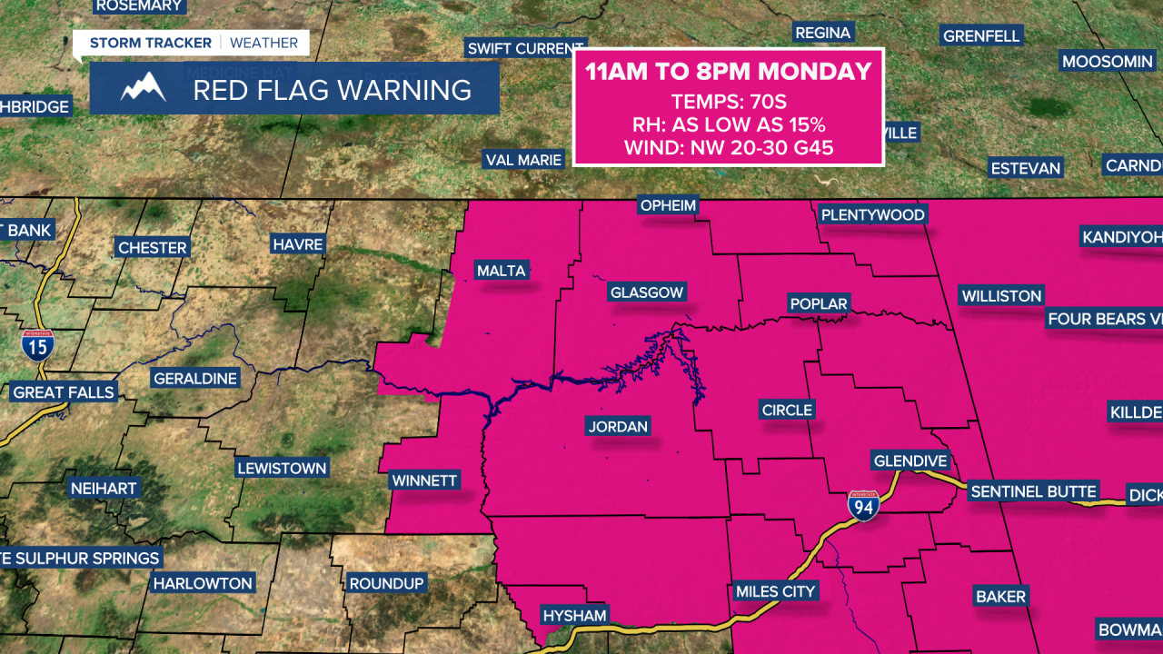
It will be very dry and windy at times this week with an early preview of summer and the potential for record highs. A Red Flag Warning is in effect from 11 a.m. to 8 p.m. for Phillips and Valley counties and much of eastern Montana.
High temperatures warm into the 70s and lower 80s on Tuesday, then surge into the 80s and lower 90s by Wednesday. Record highs are generally in the upper 80s and lower 90s, so some records could be challenged. Fire danger will remain high again on Wednesday.
A southwest flow will strengthen ahead of an approaching system, leading to isolated to scattered afternoon showers and thunderstorms Wednesday and Thursday. Some storms could produce hail and strong wind gusts.
Thursday and Friday will turn much cooler with highs back in the 60s and 70s. Showers will linger into the weekend as temperatures cool even further, with highs mainly in the 50s and 60s.