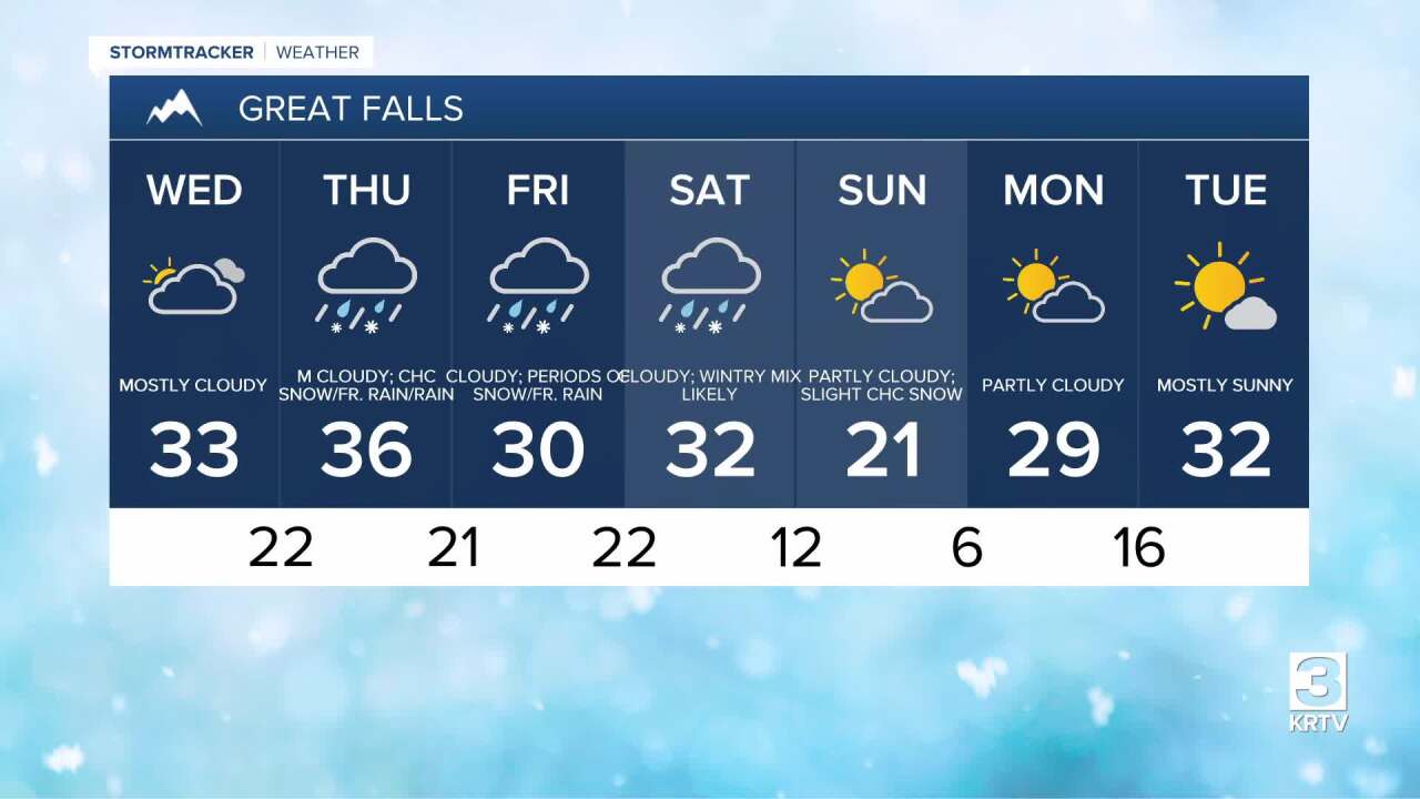
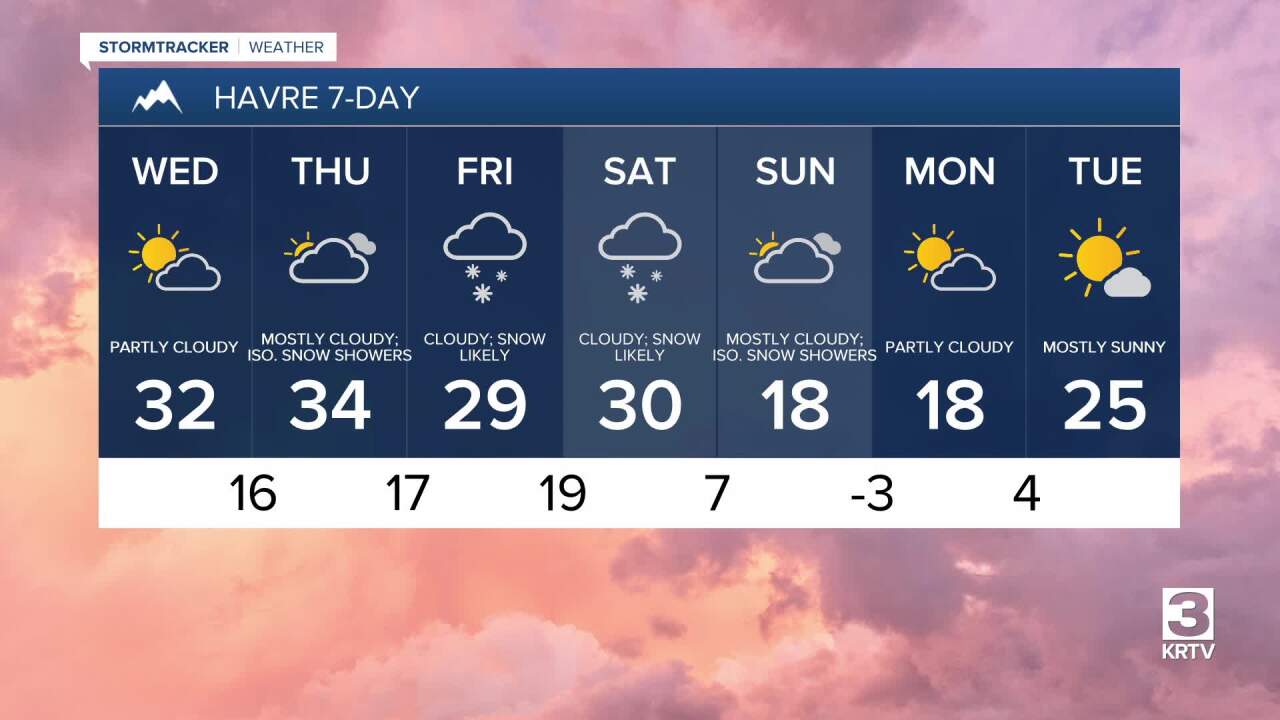
Happy Wednesday! It was a frigid start as clear skies and light winds overnight allowed temperatures to plummet.
𝐌𝐈𝐍𝐈𝐌𝐔𝐌 𝐓𝐄𝐌𝐏𝐄𝐑𝐀𝐓𝐔𝐑𝐄𝐒
- Rocky Boy: -1°
- Bozeman Airport: 1°
- Cascade: 2°
- Butte: 3°
- Valier: 4°
- Chester: 6°
- Moccasin: 7°
- Harlem: 7°
- Great Falls Airport: 7°
- Lewistown Airport: 9°
A weak area of high pressure is passing through, which will continue to provide quiet weather throughout the day. This also allowed some areas of dense fog to form in the Golden Triangle region, and the fog is beginning to dissipate as of 11:00 AM. Sunshine will peek through for a bit this afternoon, before more clouds overspread the area this evening ahead of the next storm system.
The first of several rounds of moisture is hitting western Montana. Snowfall is expected to impact areas along and west of the Continental Divide through tomorrow morning, with accumulations of 2-6 inches in mountain passes and up to a foot in higher terrain.

Warmer air will attempt to surge north on Thursday, with most areas into the mid 30s to low 40s. Scattered areas of freezing drizzle or light rain/snow throughout the day, especially in southwest Montana.
A widespread batch of mixed precipitation (rain/freezing rain/snow) moves through central Montana early to mid-morning on Friday. In the Golden Triangle region, temperatures are expected to hover around or below freezing, leading to a light glaze of ice (up to 0.1"). Even a small coating of ice can create hazardous road conditions, so be sure to use extreme caution as Friday morning and afternoon could have particularly treacherous travel.
A strong Canadian cold front will push from northwest to southeast across Montana Saturday afternoon and evening. Expect a heavy burst of snow accompanied by gusty winds as the front passes. Most areas at lower elevations will receive 1-3 inches of snow accumulation, while the mountains receive 4-8 inches.
Following this storm, a chilly air mass will settle in for Sunday and into early next week. Temperatures will plunge below zero on the Hi-Line during the morning, with high temperatures struggling to get out of the 10s across much of north-central Montana.


