


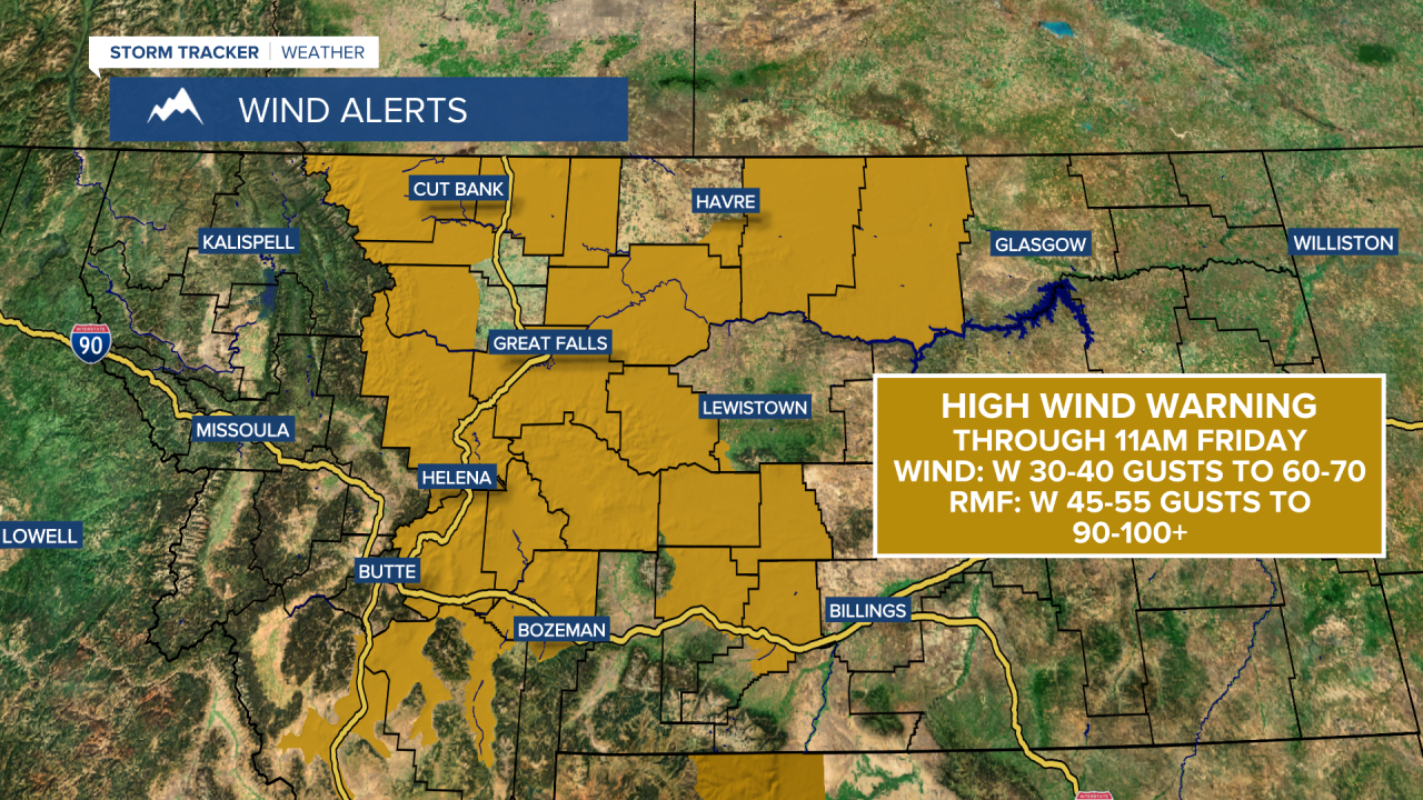
Batten down the hatches! Powerful winds will sweep across Montana over the next few days, with gusts reaching up to 100 mph along the Rocky Mountain Front. Elsewhere, peak wind gusts could hit 60-70 mph. These winds will make travel extremely difficult for high-profile vehicles, especially on those north-south roads and highways. While this wind event will not be as intense as the one in December, there is still potential for isolated power outages and tree damage.
Today's Forecast:

The wind will pick up throughout Wednesday morning, intensifying into the afternoon and evening. The Rocky Mountain Front could see wind gusts over 80 mph and 50-60 mph gusts elsewhere. High temperatures reach the 40s and low 50s.

The strongest gusts arrive Thursday afternoon and evening, with some reaching 100 mph or more on the eastern slopes of the Rockies. Gusts of 90 mph or higher are possible along the Rocky Mountain Front. East of the Rocky Mountain Front, peak gusts will be in the 50-70 mph range. High temperatures will be in the 40s and low 50s under mostly sunny skies.
Gusty winds will continue Thursday night into Friday. A cold front drops south into north central Montana on Friday, putting an end to the high winds. Some light snow accumulation is possible for the Hi-Line, with a few snow showers in central Montana Friday night into Saturday morning. Highs will fall into the 10s and 20s along the Hi-Line, and into the 30s and 40s in central Montana.

Meteorological spring begins on Sunday as we head into March. High pressure brings in milder temperatures and sunshine. Highs will be in the 40s and low 50s on Sunday, warming into the 50s and lower 60s early next week.


