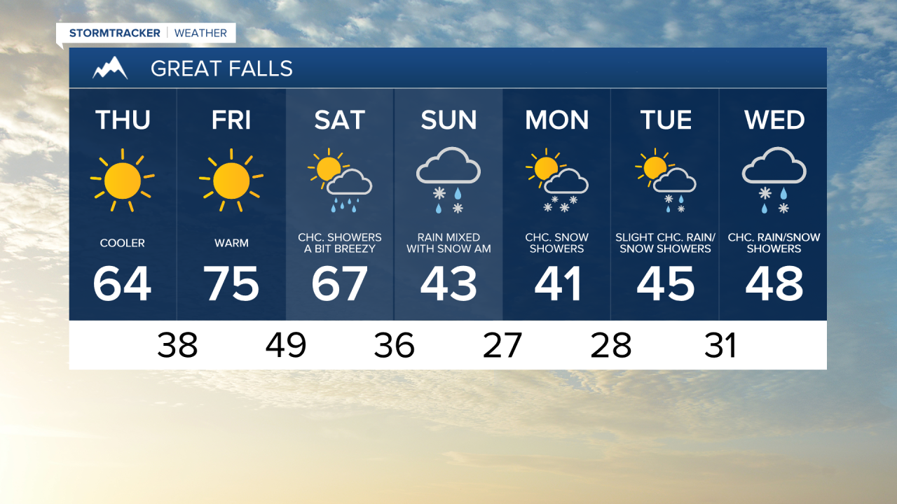
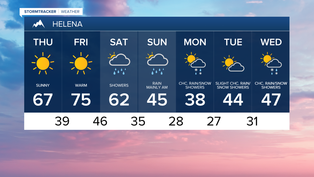
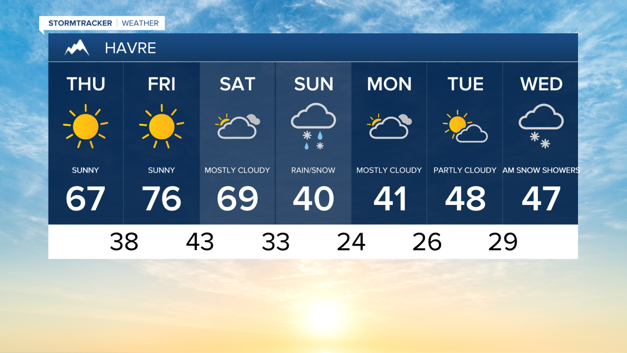
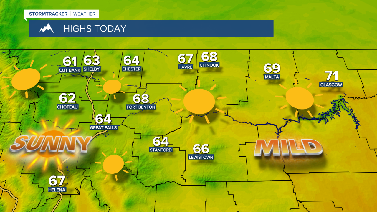
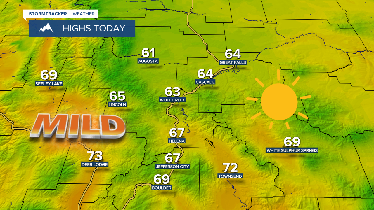
A weak cold front is passing through early this morning setting the stage for a cooler afternoon, with highs in the 60s across central and eastern Montana. We'll continue to have light wind across the area.
Check out the forecast:
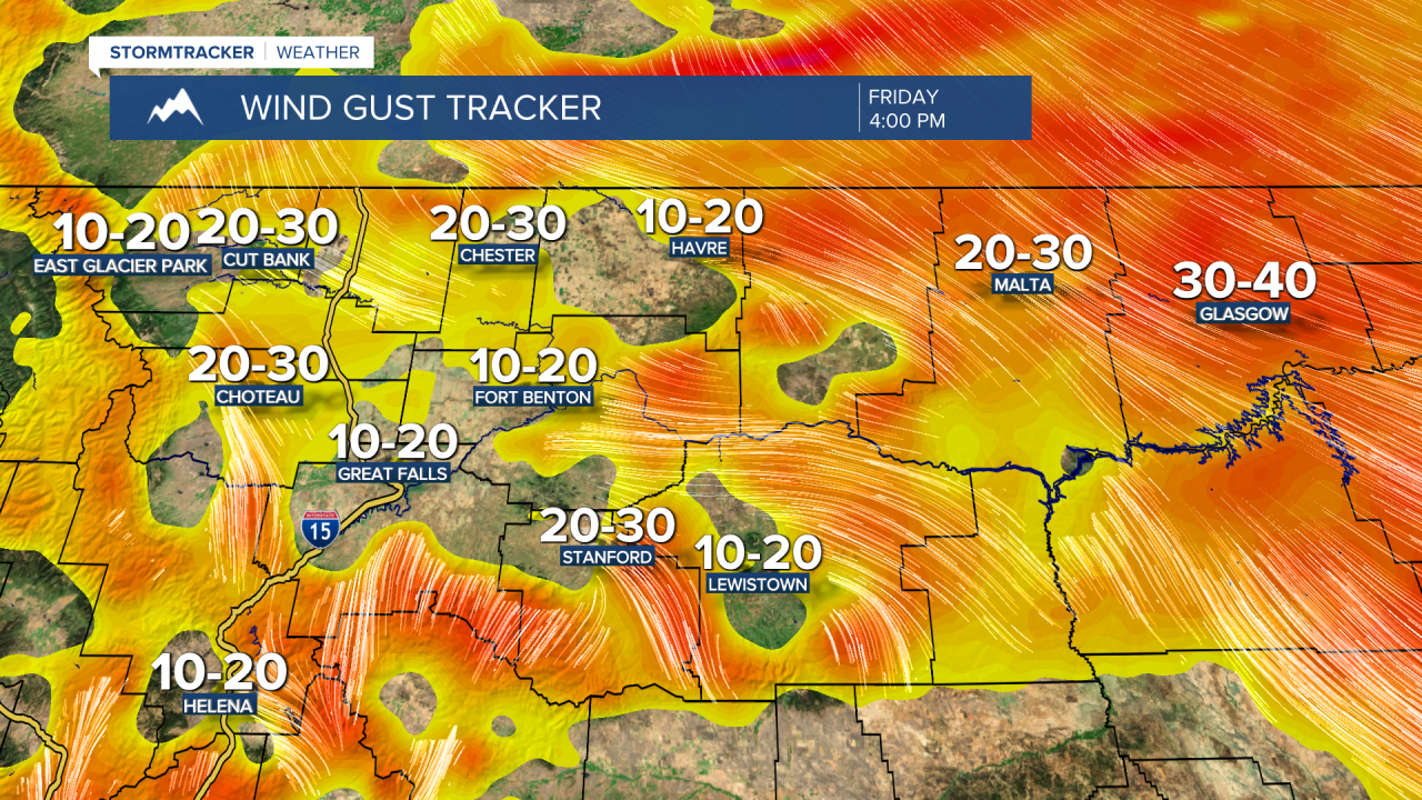
As the peak of the high pressure moves overhead on Friday, we'll continue to have sunshine and temperatures will spike into the 70s. Winds will also strengthen, especially for the eastern half of the Hi-Line, where gusts could reach up to 30 mph.
A Pacific cold front starts to move across the state Saturday morning, bringing breezy conditions and scattered showers. Precipitation will become more widespread Saturday night as a secondary cold front drops south from Canada, leading to lowering snow levels. Snow levels are expected to drop to around 4000 feet, but could get even lower in some areas. Rain showers and mountain snow will continue through Sunday, gradually becoming less widespread by Sunday evening. Temperatures will fall from the 60s in central Montana and the 70s in eastern Montana into the 30s and 40s on Sunday.
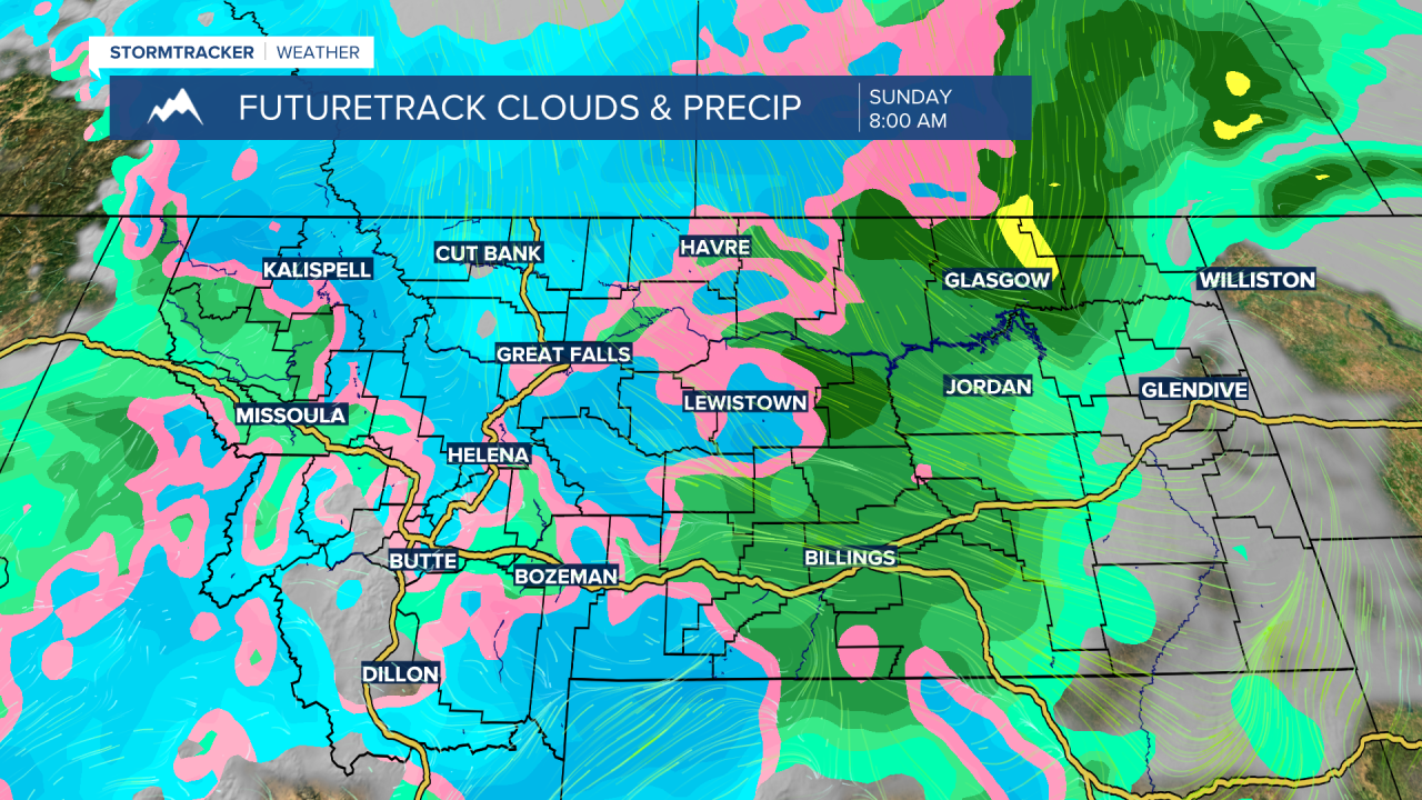
Accumulating snow is expected in the mountains, with the heaviest snowfall in the Glacier National Park area. Some lower elevations, particularly those near mountains, may also see light snow accumulations this weekend. Travel could be slippery at and above mountain pass levels from Saturday night into Sunday.
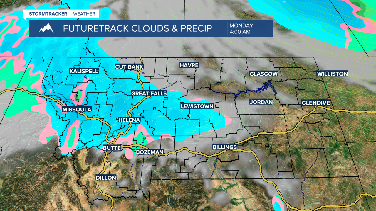
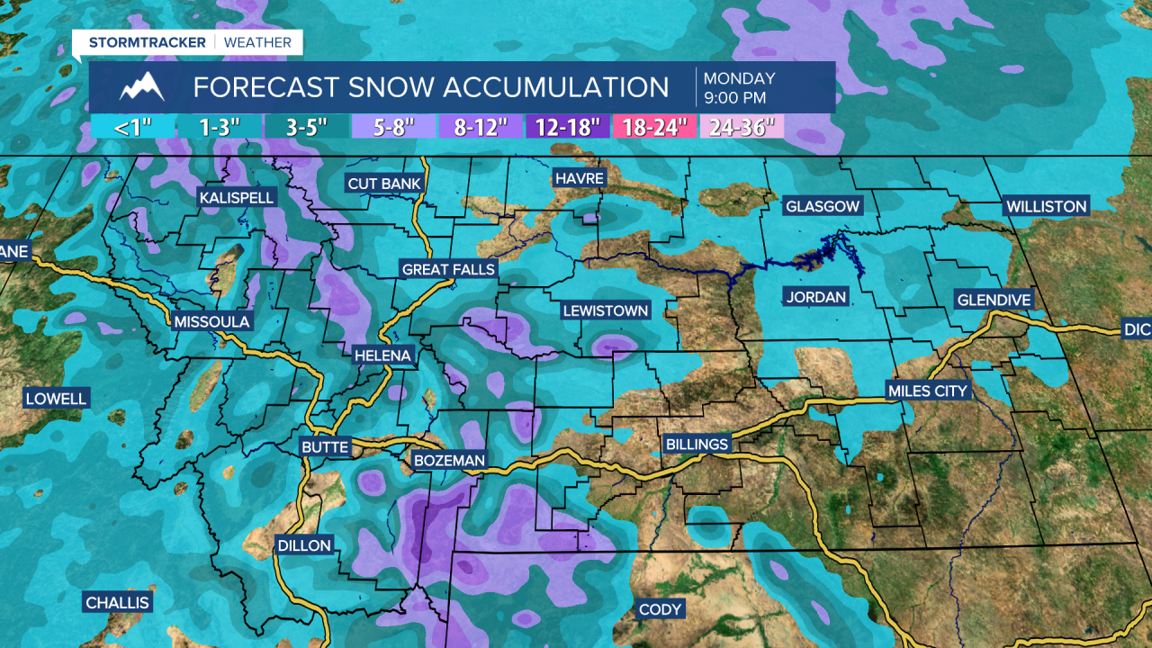
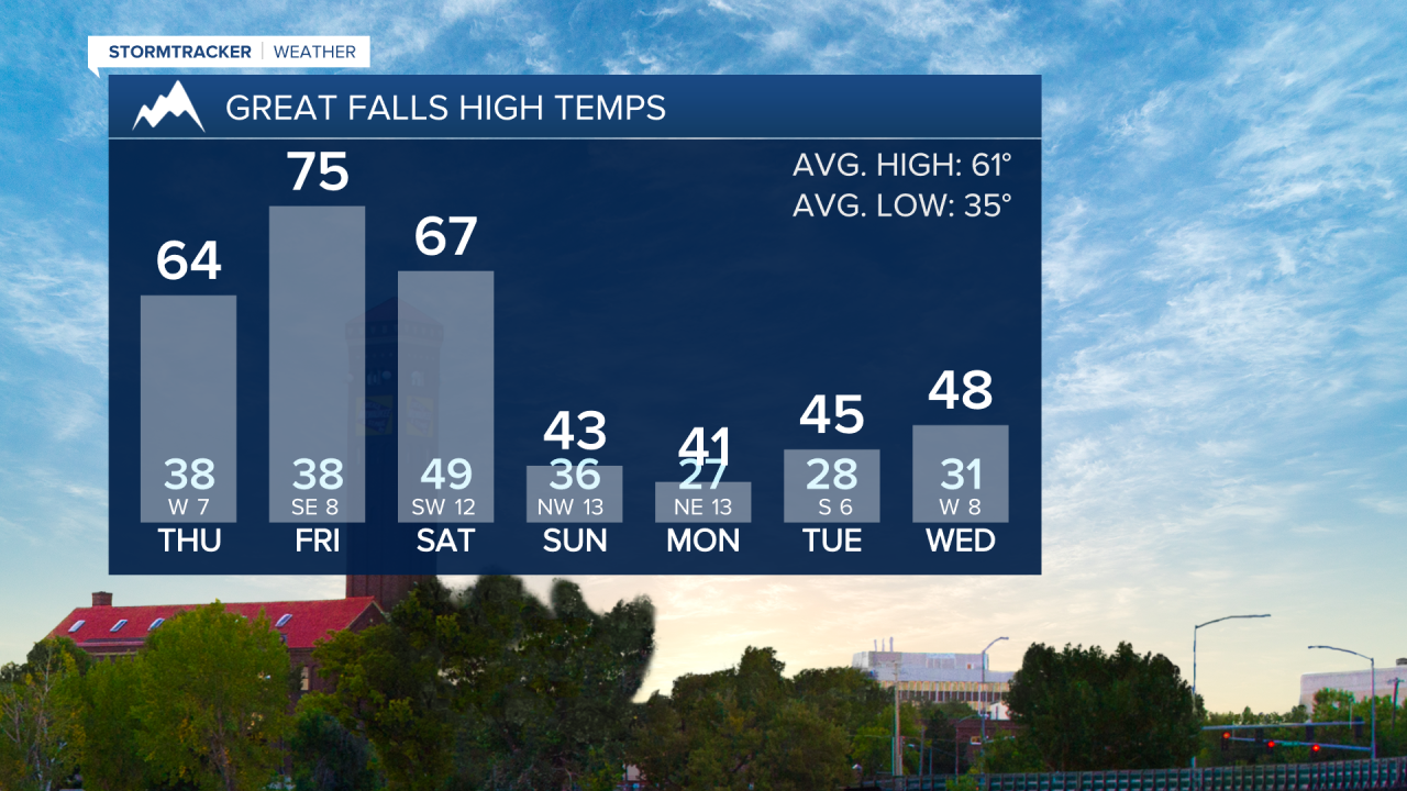
The system responsible for this unsettled weather will move slowly through the area and remain for the first half of next week. This will keep conditions cool and unsettled, with high temperatures in the 30s and 40s on Monday and Tuesday. Rain and snow showers will be around at all elevations, with some light accumulation possible in lower areas. In the mountains, all precipitation will fall as snow, with more accumulation expected.