Highs climbed into the 60s and 70s ahead of yesterday's cold front, but colder temperatures settled in quickly. It's down to the teens and 20s as we kick off our Wednesday.
Wednesday Morning Forecast:
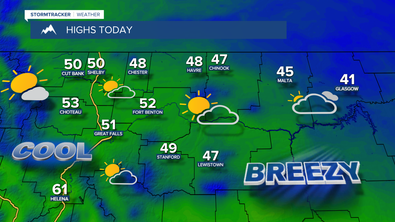

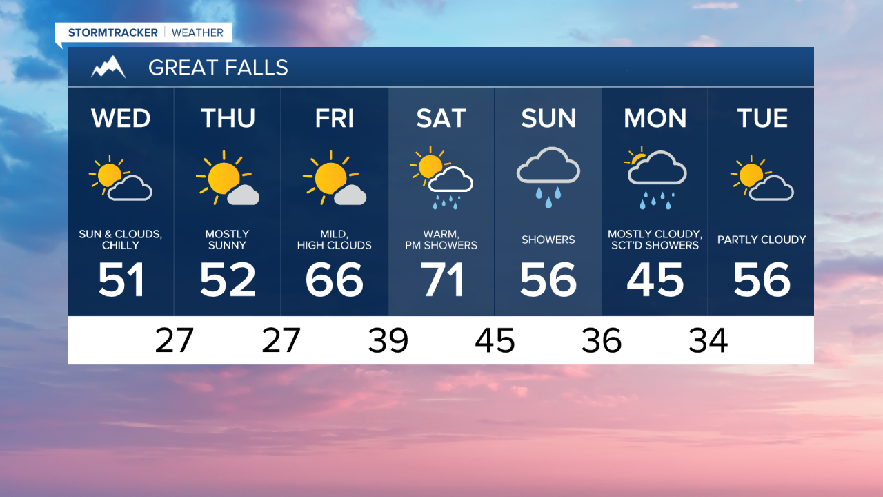
Northeast Montana is seeing some light snowfall as yesterday's system departs. Gusty winds continued overnight in Fergus County and along the Hi-Line east of Havre, but winds are much lighter across central Montana. It will be cooler today with decreasing clouds and highs in the 40s and 50s.
Another weak front could trigger a few widely scattered rain and snow showers early Thursday morning, but we clear out by the afternoon. High temperatures stay on the cool side once again in the 40s and 50s.
Friday will be gorgeous as high pressure brings mild and dry weather with highs in the 60s and lower 70s. The weekend starts out beautiful as temperatures climb into the 60s and 70s under mostly sunny skies on Saturday, but clouds will build during the afternoon and some areas could see their first thunderstorms of the season. Severe weather is not expected, but some spots could hear the first clap of thunder of the year. These storms will be very isolated in nature and primarily focused over southwest Montana.

A more widespread batch of showers will develop Saturday night into Sunday as snow levels gradually lower. Highs cool back to the 40s and 50s. Some snow may mix in at the tail end of the storm on Monday.